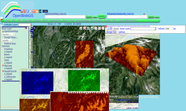
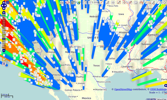
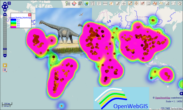
OpenWebGIS - OpenWebGIS is created for everyone who wishes to see and use a new free&open Geographic Information System(GIS). Please make your comments and suggestions. In this GIS you can use the extensive mathematical functionality to calculate and analyze your data. Using OpenWebGIS you will get a GIS at your disposal, it may be similar in functionality to some desktop GIS. Please support this project. The OpenWebGIS for Android has online and local version. In local version, you can use OpenWebGIS without having to connect to the server of OpenWebGIS and even without Internet connection. In local version, some functions do not work, but in future there will be the modification of these functions for the local version. The OpenWebGIS blog (http://openwebgisystem.blogspot.com/) provide a lot of information about possibilities for users' data operating. Full list of articles about OpenWebGIS: http://openwebgisystem.blogspot.com/2015/08/list-of-articles-about-openwebgis-in.html
Like it? Share with your friends!
Supported operating systems:
Google Android 10.x, Google Android 3.0, Google Android 3.1, Google Android 3.2, Google Android 4.0, Google Android 4.1, Google Android 4.2, Google Android 4.3, Google Android 4.4, Google Android 5.x, Google Android 6.x, Google Android 7.x, Google Android 8.x, Google Android 9.x
Similar Software:
TabWidget TabWidget Custom implementation of Android tabs, that overcomes some of the shortcoming of built-in tabs.
The widget allows us to add custom background and use custom icons, tabs can be Top/Bottom aligned
What RGB? Simple application to check RGB values of an image
JADE Android JADE Android is a software package that allows developing agent-oriented applications based on JADE for the ANDROID platform.
The programming language of ANDROID applications is JAVA and the completely new Dalvik VM, allows accessing all core functionality of the mobile device
Common Language Extension for Android Common Language Extension for Android - CLE is a common extension platform, which presents a general method for mixed language calls. It supports distributed object technique, which objects as medium to implement the mixed call between languages. Object is presented as a structured memory with a list of function pointers
Quick Server Info Quick server info is a simple tool to check your server's http response and details
Learn Selenium Learn Selenium - This tutorial is designed for software testing professionals who would like to learn the basics of Selenium through practical examples. The tutorial contains enough ingredients to get you started with Selenium from where you can take yourself to higher levels of expertise
Add-on Compatibility Reporter Add-on Compatibility Reporter - Help Mozilla make sure your favorite add-ons get updated for upcoming Firefox releases by using this extension to report whether they still work or are having some issues with alpha and beta releases
JavaScript Tutorial JavaScript Tutorial - JavaScript is a simple programming language that can be written directly into HTML documents to allow for increased interactivity with the user.
This App will learn you the very basic of JavaScript
Add-on Compatibility Reporter Add-on Compatibility Reporter - Help Mozilla make sure your favorite add-ons get updated for upcoming Firefox releases by using this extension to report whether they still work or are having some issues with alpha and beta releases
ActionScript3 Reference The ActionScript 3.0 Language Reference is a reference manual for the application programming interfaces (APIs) for Adobe Flash Professional, Flash Player and Adobe AIR.
This version includes ActionScript classes, methods, and properties that support the Adobe AIR runtime environment
Comments on OpenWebGIS:
Comments not found
If you noted an error or download link is broken, please, report it via this page or use comments.
OpenWebGIS is compatible with your device InFocus Snap 4 Dual SIM TD-LTE IF9003