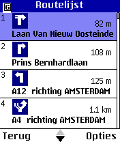
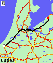
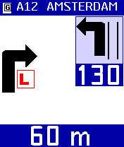
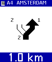
With Nav4All you can navigate worldwide on your own mobile phone.
You will never lose your way again and you will always know where you and your friends are located.
You get access to over 1 billion addresses on MyWorld, including Yellow Pages, phonebooks, etc.
While you're on the road you can easily save an interesting location by pressing one button. Or you can take a picture which will be instantly visible on a map on the Myworld website. Your pictures are visible to you or also to your friends, that's up to you.
Like it? Share with your friends!
Supported operating systems:
Google Android 1.0, Google Android 1.5, Google Android 1.6, Google Android 10.x, Google Android 2.0, Google Android 2.1, Google Android 2.2, Google Android 2.3, Google Android 3.0, Google Android 3.1, Google Android 3.2, Google Android 4.0, Google Android 4.1, Google Android 4.2, Google Android 4.3, Google Android 4.4, Google Android 5.x, Google Android 6.x, Google Android 7.x, Google Android 8.x, Google Android 9.x
Similar Software:
TomTom Benelux for Android TomTom Benelux for Android - TomTom Benelux is a turn-by-turn GPS navigator for Android devices. The app includes accurate offline maps, so you can find your way anywhere, even without an internet connection
Trip Journal Lite Trip Journal Lite is the ultimate trip tracking, recording, documenting and sharing solution that is currently available for Android phones
My Fleet Geofence My Fleet Geofence - Why do you need My Fleet Geofence application?
1. With My Fleet Geofence, you can create a specific "safe zone" or "unauthorized zone" on a map and get an E-mail Alert if the phone leaves the area.
2. Receive an instant alert in case of breach of specific zone.
How to start?
1. Install the application on your Android phone.
2
GPS Speedometer: white version GPS Speedometer: white version - GPS speed application is a free software for Android devices with built-in GPS antena. It acts as a normal speed gauge, which you may find in any car, showing the velocity of the vehicle you are in
AlpineQuest AlpineQuest - AlpineQuest turns your Android device into an off-road GPS using offline topo maps. It is a complete solution for all outdoor activities and sports, including hiking, running, trailing, hunting, sailing, geocaching and much more
AndNav2 (Android) AndNav2 is a navigation system for Android-powered phones. AndNav2 is based on free mapdata by OpenStreetMap.org. AndNav2 will provide full audible turn-by-turn realtime route-guidance. AndNav2 has unique features, like Text-2-Speech, an accessibility-study (aka 'Where can I get in 30 minutes') or avoiding customizable areas, i.e
Date Me Date Me uses GPS to determine your exact location and instantly connect you with fun friends in your immediate vicinity
LAS MobileTracker LT LAS MobileTracker LT - The LAS MobileTracker LT is an easily configured app to read GPS coordinates from an Android OS phone or tablet. Every five minutes, the coordinates and user ID are uploaded to our website from anywhere on the planet that has internet access. A GeoTag button also takes a ''snapshot'' of your location
MapMyRun+ for Android MapMyRun+ for Android - MapMyRun is a fitness assistant designed to allow runners, joggers and walkers to track their workouts using their phone's built-in GPS.
With the app you can view your route on a map and record your workout details, including duration, distance, pace, speed, elevation and calories burned
Other Software by developer «Nav4All»:
Nav4All (Java) Nav4All (Java) - With Nav4All you can navigate worldwide on your own mobile phone.
You will never lose your way again and you will always know where you and your friends are located.
You get access to over 1 billion addresses on myworld, including Yellow Pages, phonebooks, etc
Nav4All (BlackBerry) Nav4All (BlackBerry) - With Nav4All you can navigate worldwide on your own mobile phone.
You will never lose your way again and you will always know where you and your friends are located.
You get access to over 1 billion addresses on MyWorld, including Yellow Pages, phonebooks, etc


")
")


")
")


")
")