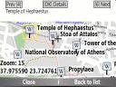
Bluemapia Mobile - View Maps, Search places and geotagged Wikipedia articles, GPS. Mobile Application for bluemapia, the new Web & Mobile Social Mapping for Boaters
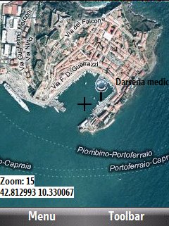
- View Maps (OpenStreetMap and other web map servers)
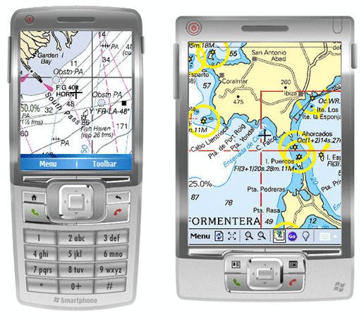
- Support BSB/NOAA Charts and raster, calibrated charts
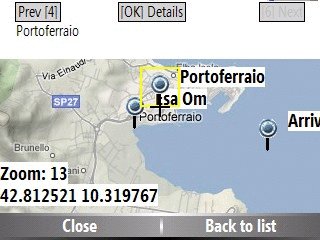
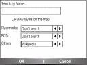
- Search places by name and bluemapia content from the web site
- View geotagged Wikipedia articles on the map
- Use a GPS to display your position on the map and set a terget destination
- Create tracks (gpx file)
- Shoot and upload photos and text to bluemapia for community sharing
Like it? Share with your friends!
If you got an error while installing Themes, Software or Games, please, read FAQ.
Supported operating systems:
Windows Mobile 2003, Windows Mobile 5.0, Windows Mobile 6 Classic, Windows Mobile 6 Professional, Windows Mobile 6.1 Classic, Windows Mobile 6.1 Professional, Windows Mobile 6.5 Professional
Similar Software:
Nav4All Nav4All-search and find millions of interesting places like restaurants, bars, gas stations, shops and much more. You can use the places you like as destination, save them as favorite, or share them with your friends by sms or email.
* Voice-instructions and clear arrows on your screen will guide you to your destination
FOLLOW ME [GPS EDITION] FOLLOW ME [GPS EDITION] - This program allows you
to use Pocket PC and GPS Rx
in the situation where you
have no map image.
And you can still check your actual position, track your moving, calculate distances and directions
Navio Navio is the perfect companion for your GPS receiver!
Navio gives you access to all the information from your GPS receiver on your Pocket PC 2002/2003/WM5/WM6 device or Windows computer (95/98/NT4/Me/2000/XP)
The Weather Channel Weather can make or break your plans, whether it be business travel or a round of golf. With The Weather Channel for Windows Mobile, you'll have the latest weather information at your fingertips so you can plan more efficiently
FON Access Points for Kuwait FON Access Points for Kuwait - FON offers you a new Points of Interest service (POIs). This allows you to download FONspots directly to your navigation device.
What does that mean? You can download a Points of Interest file directly to your navigation device
Google Maps Mobile WM Street View on your phone, as well as business reviews and walking directions
Take the power of Google Maps with you on your mobile phone.
Real-time traffic — See where the congestion is, and estimate delays in over 30 major US metropolitan areas
Danger! App for notification of danger on the road
myRadar myRadar is a location aware radar application that makes use of Wunderground and Accuweather US web services to show real-time, animated Radar Images of your local area regardless of where in the US you might be. This application requires myLocation services to function automatically.
The program will install to /Program Files/myRadar
FON Access Points for Trinidad and Tobago FON Access Points for Trinidad and Tobago - FON offers you a new Points of Interest service (POIs). This allows you to download FONspots directly to your navigation device.
What does that mean? You can download a Points of Interest file directly to your navigation device
Other Software by developer «Bluemapia»:
not found
Comments on Bluemapia Mobile:
Comments not found
If you noted an error or download link is broken, please, report it via this page or use comments.
Bluemapia Mobile is compatible with your device iPAQ hx2410/hx2415


![FOLLOW ME [GPS EDITION]](https://static.mobyware.org/data/programs/images/reduced/gps_followme_preview_76522small.jpg "FOLLOW ME [GPS EDITION]")


