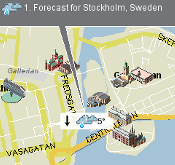
Locago delivers - map/local search app with directions and gps support. Browse business listings and traffic info, Wikipedia articles, geotagged images, weather forecasts, touristic webcams on a map in your phone. And you can create new layers with your content, just like making map mashups on the web but for mobile phones. Map layers include Booli, Eniro, Foreca, Google, MarineTraffic, Nestoria, Panoramio, Qype, Riksantikvarieämbetet, Tele Atlas, Twitter, Västtrafik, WCities and Yahoo and more. Stream or downloads maps with the MapLoader.
Locago let's you browse detailed maps covering North America and Europe, search for addresses and create directions for car or pedestrians. Locago supports both internal and bluetooth GPS. The map engine is using highly compressed vector data and is much more efficient than alternatives using images for maps. Locago runs on most phones with Java, for a full list visit our list of http://www.locago.com/site/SupportedPhones/ supported phones.
Many exciting layers are already available in Locago. Here's a selection, go and pick your favorites! Browse Wikipedia articles, geotagged images from Flickr and Panaramio, travel guides from WCities, houses for sale from Nestoria, business listing from Yahoo! and Eniro, weather forecasts from Foreca, keep track on friends with Yahoo Fire Eagle, prominent buildings from Tele Atlas, and much more!
Not enough layers? Why not use Locago to build your own custom map service? Sign in and publish your favorite geographic data using the open API of Locago, documentation and examples are available at www.locago.com
Like it? Share with your friends!
Requirements:MIDP 2.0, CLDC 1.1
Supported operating systems:
Java ME, Java Nokia 240x320, Java SE 240x320
Similar Software:
amAze GPS amAze GPS - light edition provides access to worldwide street maps, full topographic map coverage of the USA and satellite imagery for 200 major cities around the world. It allows you to search in a worldwide rich POI database and you can upgrade to the full version that includes turn-by-turn voice guided navigation from within the application, or via www.amazegps.com
Suruk Suruk Do you commute by auto rickshaw or taxi often? Suruk is for you. Suruk is your handheld digital meter that lets you know midway whether the fare meter is tampered with. If it's way off, just get down and take another one. You'll also be able to know the past conduct of the driver from other Suruk users. Suruk gives you a routefinder and a map
Amsterdam DK Eyewitness Top 10 Travel Guide & Map (Java) From sailing along the Amsterdam's canals to enjoying the most comprehensive Van Gogh's collection in the Van Gogh Museum - the 10 best of everything to see, buy, do, taste and avoid in Amsterdam, plus maps and transport maps
GpsMid Portugal GpsMid is a free, fully offline, vector based map application for your mobile phone. It displays your current position on a zoomable map and can be used to search for and navigate to roads or points of interest of your liking. As all data is stored in a compact binary format on your mobile phone you will incur no charges for extra data downloads
GpsMid Australia, Victoria GpsMid Australia (Victoria) is a free, fully offline, vector based map application for your mobile phone. It displays your current position on a zoomable map and can be used to search for and navigate to roads or points of interest of your liking. As all data is stored in a compact binary format on your mobile phone you will incur no charges for extra data downloads
Locify Locify - Maps, navigation, places, route recording and GPS - all ready to use. Also extendable by third party web services: show geocaches around you, post your location to Twitter or Fire Eagle, read nearby Wikipedia articles, send a friend your location via SMS and more
GpsMid Moldova GpsMid is a free, fully offline, vector based map application for your mobile phone. It displays your current position on a zoomable map and can be used to search for and navigate to roads or points of interest of your liking. As all data is stored in a compact binary format on your mobile phone you will incur no charges for extra data downloads
Google Maps Help Google Maps Help - Google Maps is a mobile web mapping service application and technology provided by Google, offering satellite imagery, street maps, and Street View perspectives, as well as functions such as a route planner for traveling by foot, car, bicycle (beta test), or with public transportation
Other Software by developer «Idevio»:
Locago Locago is a map/local search app that gives you directions, gps support and lots of content. Browse Wikipedia, Flickr images, weather forecasts, city guides and worldwide webcams. Or use the open API to create new cool layers


_programView.jpg)
_programView.png)


")


