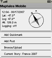
Maptales Mobile is a Java-based application for mobile devices that allows you to track your routes, add posts and tags and directly upload everything to Maptales.
Maptales Mobile has been created with ease of use in mind and provides a simple, straightforward interface for mobile storytelling. It is the optimal companion to the Maptales web application, where uploaded stories can be edited, published and exported to other formats.
If you do not have a Maptales account yet, you can always create on for free. Maptales allows you to edit your tracked routes and locations and share them with your friends. Content uploaded to Maptales can be published to your personal website or blog or exported in various data formats including KML (for viewing in Google Earth) and RSS/Atom.
What's New in This Release:
· Timestamps of the GPS signal are stored for placing images automatically on Maptales.com
· Altitudes of the GPS signal are stored for being displayed on an altitude map on Maptales.com
· Speed of the GPS signal are stored to detect how fast one was moving.
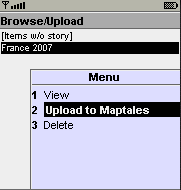
· The Browsing and Uploading screens have been improved.
Like it? Share with your friends!
Requirements:MIDP 2.0, CLDC 1.1;
Bluetooth GPS device
Supported operating systems:
Java ME, Java Nokia 240x320, Java SE 240x320
Similar Software:
FON Access Points for Colombia FON Access Points for Colombia - FON offers you a new Points of Interest service (POIs). This allows you to download FONspots directly to your navigation device.
What does that mean? You can download a Points of Interest file directly to your navigation device
Vicinity Match - Location Based - GPS Vicinity Match - Location Based - GPS - Vicinity Match - Location Based (LBS)
Want to find your match using location based service (GPS)?
Use the new and improved Vicinity Match to find a new friend, a penpal or your ideal dating partner
GpsMid Brunai GpsMid is a free, fully offline, vector based map application for your mobile phone. It displays your current position on a zoomable map and can be used to search for and navigate to roads or points of interest of your liking. As all data is stored in a compact binary format on your mobile phone you will incur no charges for extra data downloads
GpsMid Czech Republic GpsMid is a free, fully offline, vector based map application for your mobile phone. It displays your current position on a zoomable map and can be used to search for and navigate to roads or points of interest of your liking. As all data is stored in a compact binary format on your mobile phone you will incur no charges for extra data downloads
FON Access Points for Cyprus FON Access Points for Cyprus - FON offers you a new Points of Interest service (POIs). This allows you to download FONspots directly to your navigation device.
What does that mean? You can download a Points of Interest file directly to your navigation device
FON Access Points for Tunisia FON Access Points for Tunisia - FON offers you a new Points of Interest service (POIs). This allows you to download FONspots directly to your navigation device.
What does that mean? You can download a Points of Interest file directly to your navigation device
Place Finder West USA Place Finder West USA - A tool for finding places of interest in the vicinity of a location keyword. Once downloaded and installed on your mobile phone you can search (using location keywords or parts of words) to find corresponding Wikipedia Keyword place entries and also nearby entries in the proximity (with the approximate distances indicated in units of 0
GpsMid Midlands and Northern England GpsMid Midlands and Northern England is a free, fully offline, vector based map application for your mobile phone. It displays your current position on a zoomable map and can be used to search for and navigate to roads or points of interest of your liking
GpsMid Slovenia GpsMid is a free, fully offline, vector based map application for your mobile phone. It displays your current position on a zoomable map and can be used to search for and navigate to roads or points of interest of your liking. As all data is stored in a compact binary format on your mobile phone you will incur no charges for extra data downloads
Other Software by developer «Maptales»:
not found
Comments on Maptales Mobile:
Comments not found
If you noted an error or download link is broken, please, report it via this page or use comments.
Please, select device to check if Maptales Mobile supports it