Free Java Trackut Software Download
|
|
|
|
|
| |
|
|
|
|
My Device
|
 |
|
| |
|
|

|
|
|
| |
Trackut

|
Version: 0.10
Platforms: JavaCategories: Travel & NavigationUpload date: 2 Jun 11Developer: License: Freeware
Downloads: 1850
File Size: 325 Kb
|
Trackut
| |
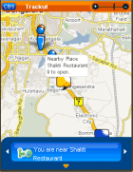
Trackut has unveiled its new face !! and its more fun than before !! Visit www.trackut.com to claim your presence on Trackut.
|
|
|
Like it? Share with your friends! |
|
|
| |
Supported operating systems:
Java ME, Java Nokia 240x320, Java SE 240x320
| | |
Similar Software:
|
 | bliin
bliin - On bliin, users can locate and follow friends on a map in real-time, upload media: "Shares" - photos, videos, audio and text to Google Maps or other mapping services. Shares are geo-tagged to the location of capture |  | Nulaz (Siemens)
Nulaz is a simple application for mobile devices and the Internet that enables you to see each others' location:
Know where you are, where your friends are and send them messages for free!
With Nulaz, friends can find each other in a crowded place, a mother can keep an eye on her kids, and you can see where all your friends are when you go clubbing |  | GpsMid England (South West)
GpsMid England (South West) is a free, fully offline, vector based map application for your mobile phone. It displays your current position on a zoomable map and can be used to search for and navigate to roads or points of interest of your liking. As all data is stored in a compact binary format on your mobile phone you will incur no charges for extra data downloads |  | GpsMid Torino
GpsMid is a free, fully offline, vector based map application for your mobile phone. It displays your current position on a zoomable map and can be used to search for and navigate to roads or points of interest of your liking. As all data is stored in a compact binary format on your mobile phone you will incur no charges for extra data downloads |  | GpsMid Madrid
GpsMid is a free, fully offline, vector based map application for your mobile phone. It displays your current position on a zoomable map and can be used to search for and navigate to roads or points of interest of your liking. As all data is stored in a compact binary format on your mobile phone you will incur no charges for extra data downloads |
|
 | GpsMid Australia, Victoria
GpsMid Australia (Victoria) is a free, fully offline, vector based map application for your mobile phone. It displays your current position on a zoomable map and can be used to search for and navigate to roads or points of interest of your liking. As all data is stored in a compact binary format on your mobile phone you will incur no charges for extra data downloads |  | GpsMid Australia, Western Australia
GpsMid Australia (Western Australia) is a free, fully offline, vector based map application for your mobile phone. It displays your current position on a zoomable map and can be used to search for and navigate to roads or points of interest of your liking |  | baliza
baliza - Baliza Java is the app you should use to send your GPS position to sekvi.com servers. This will enable you to share your location with your social network friends (currently on bebo.com) Your friends could see it inside the bebo.com network or while on move at m.sekvi.com Try it now |  | FON Access Points for Ukraine
FON Access Points for Ukraine - FON offers you a new Points of Interest service (POIs). This allows you to download FONspots directly to your navigation device.
What does that mean? You can download a Points of Interest file directly to your navigation device |  | TrackMeTweet
TrackMeTweet - uses the built-in GPS, or a Bluetooth GPS (recommended for cellphone battery life) to send regular tweets of your location to Twitter.
The Tweet info contains your identifier, distance from take-off in km, coordinates in degrees and decimal minutes, altitude in meters above sea level, speed in km/h, direction you are heading at that specific moment |
|
|
| |
Comments on Trackut:
Comments not found
|
|
| |
If you noted an error or download link is broken, please, report it via this page or use comments. |
| |
Please, select device to check if Trackut supports it |
|
|
|
|
|
|
|
| Home | Contacts | Sitemap | Terms of Use | Privacy Policy |
| © Pantich 2009 - 2025 All rights reserved. |
