Categories: Business & Profession, Travel & Navigation
Upload date: 8 Mar 11
Developer: Ulf Arndt
License: Freeware
Downloads: 9626 File Size: 82 Kb
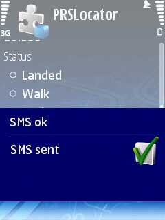
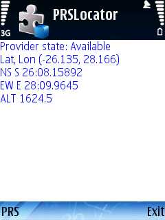
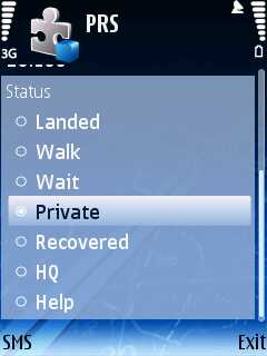
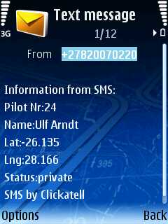
PRS GPS - Uses a built-in GPS of a Nokia Phone and JAVA J2ME based Location based service to SMS your Pilot Status to the Pilot Recovery System. Can be used for the Winelands Paragliding comp. The JAVA J2ME Midlet feeds via SMS the Pilot Recovery status webpage.
Like it? Share with your friends!
Supported operating systems:
Java ME, Java Nokia 240x320, Java SE 240x320
Similar Software:
FON Access Points for Guadaloupe FON Access Points for Guadaloupe - FON offers you a new Points of Interest service (POIs). This allows you to download FONspots directly to your navigation device.
What does that mean? You can download a Points of Interest file directly to your navigation device
FON Access Points for Italy FON Access Points for Italy - FON offers you a new Points of Interest service (POIs). This allows you to download FONspots directly to your navigation device.
What does that mean? You can download a Points of Interest file directly to your navigation device
GpsMid Ruhr Gebiet GpsMid Ruhr Gebiet is a free, fully offline, vector based map application for your mobile phone. It displays your current position on a zoomable map and can be used to search for and navigate to roads or points of interest of your liking. As all data is stored in a compact binary format on your mobile phone you will incur no charges for extra data downloads
CloudGPS CloudGPS is Java ME mapping application using OpenStreetMap data and CloudMade services to provide
FON Access Points for North Korea FON Access Points for North Korea - FON offers you a new Points of Interest service (POIs). This allows you to download FONspots directly to your navigation device.
What does that mean? You can download a Points of Interest file directly to your navigation device
GpsMid British Columbia GpsMid British Columbia is a free, fully offline, vector based map application for your mobile phone. It displays your current position on a zoomable map and can be used to search for and navigate to roads or points of interest of your liking. As all data is stored in a compact binary format on your mobile phone you will incur no charges for extra data downloads
FON Access Points for Morocco FON Access Points for Morocco - FON offers you a new Points of Interest service (POIs). This allows you to download FONspots directly to your navigation device.
What does that mean? You can download a Points of Interest file directly to your navigation device
GpsMid India, South GpsMid India (South) is a free, fully offline, vector based map application for your mobile phone. It displays your current position on a zoomable map and can be used to search for and navigate to roads or points of interest of your liking. As all data is stored in a compact binary format on your mobile phone you will incur no charges for extra data downloads
GpsMid Bulgaria GpsMid is a free, fully offline, vector based map application for your mobile phone. It displays your current position on a zoomable map and can be used to search for and navigate to roads or points of interest of your liking. As all data is stored in a compact binary format on your mobile phone you will incur no charges for extra data downloads
GpsMid USA, Bay Area GpsMid USA, Bay Area is a free, fully offline, vector based map application for your mobile phone. It displays your current position on a zoomable map and can be used to search for and navigate to roads or points of interest of your liking. As all data is stored in a compact binary format on your mobile phone you will incur no charges for extra data downloads
Other Software by developer «Ulf Arndt»:
RTMS RTMS - This JAVA Midlet sends a SMS to a mobile phone that runs the TrackMe code.
It sends an SMS to TrackMe, TrackMe then sends a SMS with the location data to the predefined number.
The predefined number gets set by the enduser when TrackMe gets started.
The code needs a trackmesms.txt file in the Images folder of the cellphone
Pilot Recovery System Pilot Recovery System - A simple J2ME JAVA Midlet that can be used with the Pilot Recovery System. Can be used for the Winelands Paragliding comp. The JAVA J2ME Midlet feeds via SMS the Pilot Recovery status webpage
TrackMeTweet TrackMeTweet - uses the built-in GPS, or a Bluetooth GPS (recommended for cellphone battery life) to send regular tweets of your location to Twitter.
The Tweet info contains your identifier, distance from take-off in km, coordinates in degrees and decimal minutes, altitude in meters above sea level, speed in km/h, direction you are heading at that specific moment
TrackMe (S60) TrackMe (S60)-An application that sends your location at a regular interval via SMS to another cellphone. If it receives a SMS query in a certain format (e.g. from RTMS), will send your location to the predefined number


")