Platforms: Symbian OS, Series 60, Series 80, UIQ, Java
Categories: Travel & Navigation
Upload date: 18 Apr 11
Developer: Symarctic Solutions
License: Freeware
Downloads: 9217 File Size: 14 Kb
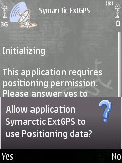
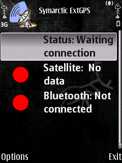
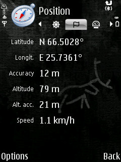
Symarctic ExtGPS allows you to use your phone's built-in GPS module externally on laptop via Bluetooth. It is mainly targeted for Nokia N95, E90, 6110 Navigator handsets, allowing you to use existing, more sophisticated GIS applications.
Like it? Share with your friends!
If you got an error while installing Themes, Software or Games, please, read FAQ.
j2me PhotoGeoTag j2me PhotoGeoTag - Take pictures with your mobile phone and incorporate the data of the geographical location. The application allows you to include in the photographs, data from the GPS receiver, along with a brief note. If you know the coordinates, not having the GPS receiver, you can also handwrite geographic data
FON Access Points for Slovakia (Slovak Republic) FON Access Points for Slovakia (Slovak Republic) - FON offers you a new Points of Interest service (POIs). This allows you to download FONspots directly to your navigation device.
What does that mean? You can download a Points of Interest file directly to your navigation device
GpsMid Jordan GpsMid is a free, fully offline, vector based map application for your mobile phone. It displays your current position on a zoomable map and can be used to search for and navigate to roads or points of interest of your liking. As all data is stored in a compact binary format on your mobile phone you will incur no charges for extra data downloads
FON Access Points for Poland FON Access Points for Poland - FON offers you a new Points of Interest service (POIs). This allows you to download FONspots directly to your navigation device.
What does that mean? You can download a Points of Interest file directly to your navigation device
FON Access Points for United Kingdom FON Access Points for United Kingdom - FON offers you a new Points of Interest service (POIs). This allows you to download FONspots directly to your navigation device.
What does that mean? You can download a Points of Interest file directly to your navigation device
Map Mobile Navigator (MapNav) Map Mobile Navigator (MapNav) is a powerful navigation tool for mobile phones with GPS-receivers (Bluetooth or embedded)
GpsMid Estonia GpsMid is a free, fully offline, vector based map application for your mobile phone. It displays your current position on a zoomable map and can be used to search for and navigate to roads or points of interest of your liking. As all data is stored in a compact binary format on your mobile phone you will incur no charges for extra data downloads
GpsMid Italy Central GpsMid Italy Central is a free, fully offline, vector based map application for your mobile phone. It displays your current position on a zoomable map and can be used to search for and navigate to roads or points of interest of your liking. As all data is stored in a compact binary format on your mobile phone you will incur no charges for extra data downloads
GpsMid Australia, Western Australia GpsMid Australia (Western Australia) is a free, fully offline, vector based map application for your mobile phone. It displays your current position on a zoomable map and can be used to search for and navigate to roads or points of interest of your liking
Other Software by developer «Symarctic Solutions»:
not found
Comments on Symarctic ExtGPS:
Comments not found
If you noted an error or download link is broken, please, report it via this page or use comments.
Please, select device to check if Symarctic ExtGPS supports it


")


")


