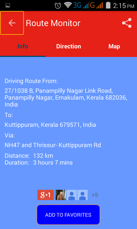
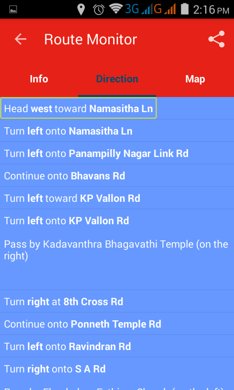
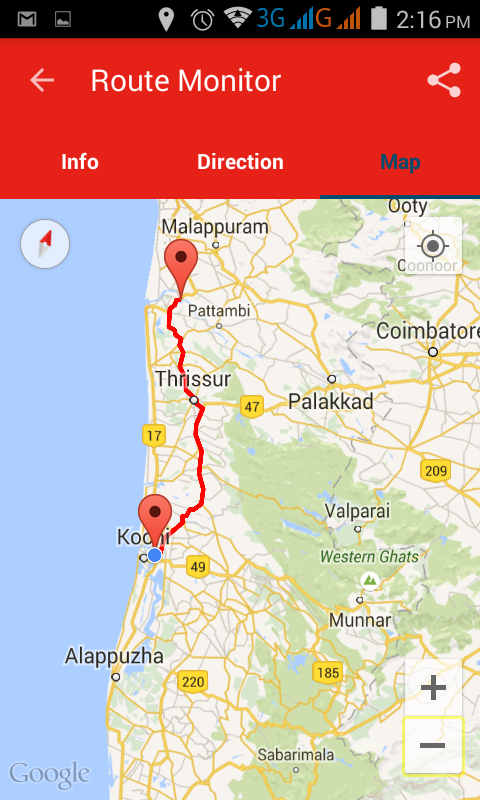
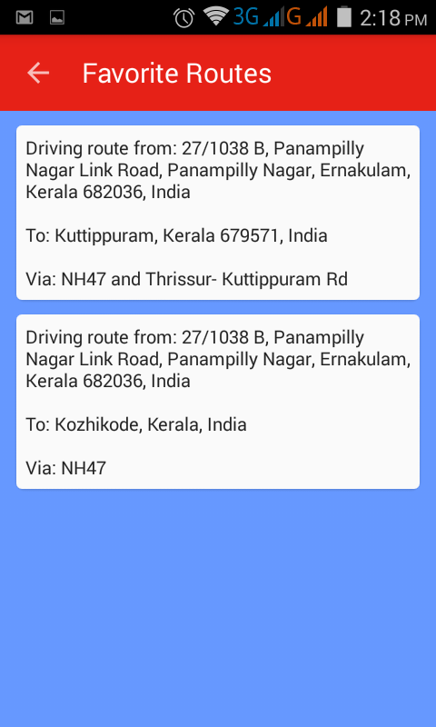
Route Monitor - This application helps you to find the driving route between any start and end location which would have been set by you. It is very simple to use. Just search/select your source / destination location and press the submit button! The route between those two locations will be shown on the map. You can view the route in text format too. In addition to the route, you can view your traveling duration and travel distance. You can save the route to favorites list and show anytime without internet connection. Also share the route with friends and family! Features: * Travel Modes: Shows the route for driving mode and for walking mode. * Duration and Distance: It gives very accurate driving/walking duration and distance. * Alternative Route: you will get alternative routes if available. * Route on the map: you can see the route on the map. * Route in text format: you will get the route in text format, useful for our visually challenged community.
Like it? Share with your friends!
Supported operating systems:
Google Android 3.0, Google Android 3.1, Google Android 3.2, Google Android 4.0, Google Android 4.1, Google Android 4.2, Google Android 4.3, Google Android 4.4
Similar Software:
MapMe MapMe allows mobile users to locate their position via GPS. If the users move beyond specific range or distance, the application will automatically display the location on a map
Android Photo GeoTag Android Photo GeoTag - Take pictures with your mobile phone and incorporate the data of the geographical location. The application allows you to include in the photographs, data from the GPS receiver, along with a brief note. If you know the coordinates, not having the GPS receiver, you can also handwrite geographic data
GPS Coordinates Converter GPS Coordinates Converter - With this app you can convert GPS coordinates from "degrees, minutes, decimal seconds" to "decimal degrees".
What's New in This Release:
· Locate your phone and show the coordinates
What's New in 2
Current Location Finder Current Location Finder - Current Location finder which can be used to locate your location with the aid of a live satellite map you can dynamically (real time) determine ... Use the live satellite maps
wheredroid wheredroid is a simple application to display your coordinates from the GPS receiver: latitude, longitude, heading, speed, number of satellites used and (it's its peculiarity) altitude and accuracy. It is quite usable as an altimeter and a compass.
What's New in This Release:
· fixes a bug inverting East with West on some displays
What's New in 1.4
GPSbySMS (Android) GPSbySMS is an application that reads navigation data from GPS and sends it to any user via SMS or email.
Purpose:
1) Read navigation data from GPS and send it to any user via SMS or email.
2) View current position on Maps (need Internet connection).
3) Save navigation data in database using data transfer via GPRS Internet.
4) Alarm Function
Waze Waze is a free, 100% user-generated, social navigation application that allows drivers to build and use live maps & real-time traffic updates to improve their daily commute
TeleNav GPS Navigator Get voice-guided GPS, maps, business listings and real-time traffic updates now!
GPS Info GPS Info - GPS Info **PRO VERSION AVAILABLE (NO ADS) is an simple to use and functional gps application. for beginner and advanced users. All needed gps data is bundled in one screen with perfectly designed layout.with usability in mind
Comments on Route Monitor:
Comments not found
If you noted an error or download link is broken, please, report it via this page or use comments.
Route Monitor is compatible with your device Karbonn Platinum P9 Dual SIM


")


