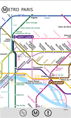
Metro Paris - Simple et efficace, le plan de metro de Paris toujours dans votre poche grace a cette application
Like it? Share with your friends!
If you got an error while installing Themes, Software or Games, please, read FAQ.
Supported operating systems:
Windows 10 Mobile, Windows Phone 7, Windows Phone 8
Similar Software:
SketchMaps Free! SketchMaps Free! - SketchMaps is the very first drawable live map which can also be saved to pictures. It's an unique idea and it's first of its kind. It's that simple. Please, view screenshots!
SketchMaps Free is full-featured, but will show ads. You can buy the full version of SketchMaps at any time to remove the ads
Prague Maps Prague Maps - This app contains offline (no data plan/reception necessary) public transportation maps for the Prague area, including tourist maps, metro/tram maps, and the Airport Express, which takes you from Prague Airport to popular the main train station, Hlavni Nadrazi
Free World Explorer Free World Explorer - So, you think you are good at geography? Let's see how good you are :)
Pan the map to fly the plane to the destination place and click on land button when you find the green airport symbol. You need to be connected to internet for this. Difficulty mode to challenge you with a lot more countries
GMapPro GMapPro - Features:
1. Use Google Maps which is the most complete mapping solution available in the world
2. Download the maps of desired area, and use them while you are offline
3. Provide a list of downloads so you can delete them in future (if you don't wish to keep them anymore)
4. Use the phones internal GPS, to find you on the map
5. Markers:
5
XMaps XMaps - With xMaps you have the possibility to use the worldwide map data from openstreetmaps.org on your phone. xMaps comes without any map data, you can download any maps in different zoom levels for free. You can zoom in / out and rotate and tilt the map.
Use xMaps to search a point by coordinate or to plan a travel route by car or by foot
Find My Car Find My Car Have you every parked your car and then went about your day, only to realize at the end of the day that you don't recall where you parked it? Then "Find My Car" is for you.
What's New in This Release:
· Updated to support copy and paste functionality and update Bing maps
Bing Get Me There Bing Get Me There - Bing Get Me There is a London travel app that gets you from where you are right now to wherever you want to be. True door-to-door directions using Bing maps and live tube updates to ensure you get the best route for you
Chicago Maps Chicago Maps - Offline (no data connection necessary!) public transportation maps for the Chicago area. Click on the thumbnails and zoom in for a detailed look.
Includes:
1. an overview of the Chicago Transit Authority system with the ability to zoom into different sections using a map and/or a list
2. Night Owl bus map
Can be used in portrait or landscape view
Bingle Maps Bingle Maps is a full featured map application. Other than the commonly desired features like Search, Routing and Itineraries, it allows you to drop unlimited personal pins and synchronize them with your DropBox account, not to mention that it also integrates with Google Maps.
Highlights:
- You can choose to use either Bing Maps or Google Maps
Other Software by developer «pAppaSoft»:
not found
Comments on Metro Paris:
Comments not found
If you noted an error or download link is broken, please, report it via this page or use comments.
Metro Paris is compatible with your device LANIX Ilium W250 LTE