GPS Essentials - Turn your phone into a fully-featured GPS receiver!
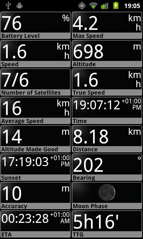
★★★ Dashboard ★★★
Shows navigation values such as: Accuracy, Altitude, Speed, Battery, Bearing, Climb, Course, Date, Declination, Distance, ETA, Latitude, Longitude, Max Speed, Min Speed, Actual Speed, True Speed, Sunrise, Sunset, Moonset, Moonrise, Moon Phase, Target, Time, TTG, Turn.
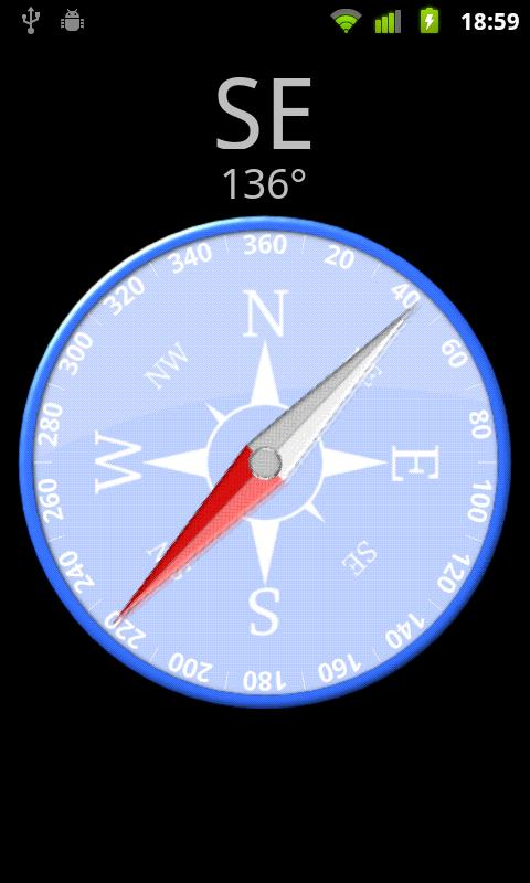
★★★ Compass ★★★
Show the orientation of the earth's magnetic field, shows an arbitrary tracking angle and the current target.
★★★ Camera ★★★
A camera HUD (heads-up display) view to show your waypoints.
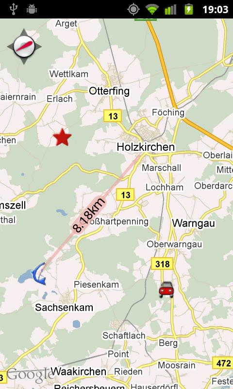
★★★ Map ★★★
A map to show your waypoints. Convert mail addresses of your contacts to waypoint so that they can be used within the app.
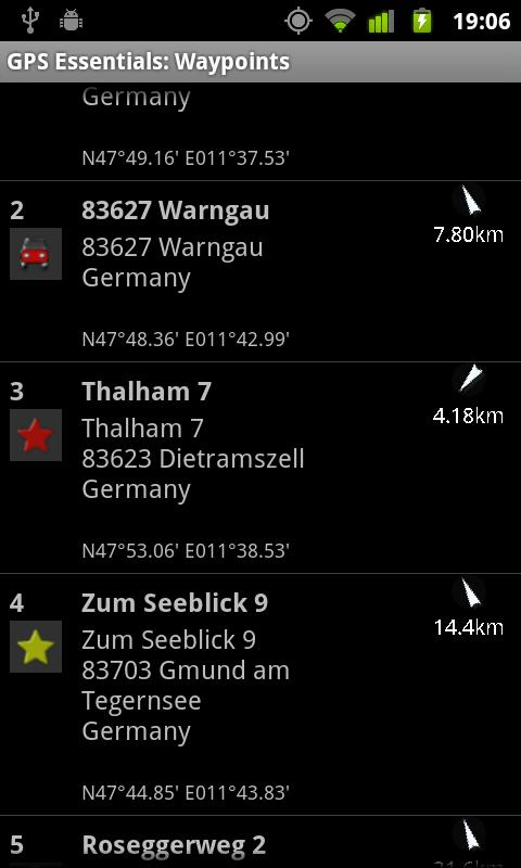
★★★ Waypoints ★★★
A list of all your waypoints with export and import (KML-format).
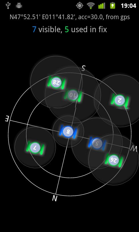
★★★ Satellites ★★★
A sky view of the current positions that shows satellites in view.
Please open the web page below for more info, send me emails for support. I CANNOT HELP IF YOU SIMPLY PLACE A COMMENT HERE.
Purchase the "GPS Essentials Donation Plugin" on Android Market if you want to support development.
Like it? Share with your friends!
Supported operating systems:
Google Android 1.5, Google Android 1.6, Google Android 10.x, Google Android 2.0, Google Android 2.1, Google Android 2.2, Google Android 2.3, Google Android 3.0, Google Android 3.1, Google Android 3.2, Google Android 4.0, Google Android 4.1, Google Android 4.2, Google Android 4.3, Google Android 4.4, Google Android 5.x, Google Android 6.x, Google Android 7.x, Google Android 8.x, Google Android 9.x
Similar Software:
runtastic GPS Coach Your personal GPS sports assistant for running, cycling, walking, hiking, ... runtastic GPS is your personal running and fitness application for all outdoor (running, nordic walking, hiking, skating,..) and indoor sports (treadmill, cardio, yoga, bodybuilding)
Phone Location Tracker SOS Nearby Places and GPS Phone Location Tracker SOS Nearby Places and GPS - What this app can do for you? SOS Emergency Alert Safety if the most important and paramount requirement for all today. You are worried about your children, spouse, parents and friends. If this app is installed on their mobile phones, your worries are gone for good
wheredroid wheredroid is a simple application to display your coordinates from the GPS receiver: latitude, longitude, heading, speed, number of satellites used and (it's its peculiarity) altitude and accuracy. It is quite usable as an altimeter and a compass.
What's New in This Release:
· fixes a bug inverting East with West on some displays
What's New in 1.4
Modern Compass Modern Compass this compass does what the compass always was intended to do, it helps you locate the destination of your choice.
Using GPS technology and Google maps, this application lets you mark a destination of choice and then shows in what direction that destination lies, as well as how far away it is from your current location
Metosphere (Android) Metosphere Explore and create virtual objects around your physical location like messages, emergency alerts, events, news, reviews, games. View geospatial data from Wikipedia, Eventful, and Upcoming. Start a GeoBlog on your GPS-enabled phone.
This is the core Metosphere Android app
TapIn Places TapIn Places is all about your daily check-in places by tap.
· View nearby places around your location.
· Shared Facebook wall posting.
· Search your favorite places with or without categories simply.
· Manage recent and favorite places.
· Bookmarks your favorite places simply.
· Long click item list to view action detail
Track My Mobile Track My Mobile - Your mobile phone can be Tracked by this applicatio after it get lost
Redpin The aim of the Redpin project is to create an open source system that allows indoor positioning up to room-level description using mobile phones
Location Barcoder Location Barcoder is a tool for creating geocoded barcodes based on your location. Barcodes are stored on the SDCard in a folder named LocationBarcodes
GPS Map Camera use GoogleMap GPS Map Camera use GoogleMap - The main feature of the 'GPS Map Camera':
When you take a piture with GPS enabled, it will paste the google map, address and weather to picture. (GPS latitue/longitude also include in the information)
Please enable your network and GPS function before using this application
Other Software by developer «mictale»:
not found
Comments on GPS Essentials:
Anton:
Free download gps essentials how?
Date: 30 Mar 13
If you noted an error or download link is broken, please, report it via this page or use comments.
GPS Essentials is compatible with your device Lava Z10 TD-LTE Dual SIM


")


