NaviPOWM is a car navigation system capable of running on a variety of operating systems. Only OSM based map data is supported. Realtime routing engine is planned in a later version. Geocaching and city guide functionality are also planned. other:
· more POI types
· more way types
· support more targets at once
· switch between targets by clicking on target display
· coastlines bugfixing
What's New in This Release:
fixed bugs:
· crash under Windows XP when displaying areas with holes
· areas with holes not drawn properly on Windows mobile
implemented feature requests:
· Support for gpsd
What's New in 0.2.5:
fixed bugs:
· TrackLog must show real GPSCoor
implemented feature requests:
· No aygshell.dll on PNA systems
· Show oneway arrow on streets
· Visibility of speed-pos box adjustable
· Save received data also as GPX file
other:
· area display (sea) speedup
· reorganized directories
· support for CMake
Like it? Share with your friends!
If you got an error while installing Themes, Software or Games, please, read FAQ.
Supported operating systems:
Windows Mobile 2003, Windows Mobile 5.0, Windows Mobile 6 Classic, Windows Mobile 6 Professional, Windows Mobile 6.1 Classic, Windows Mobile 6.1 Professional, Windows Mobile 6.5 Professional
Similar Software:
GPS Tuner Essentials Full Version with British Isles Basic Map Content GPS Tuner Essentials Full Version with British Isles Basic Map Content is designed specifically for off-road use: its large buttons, selectable tool window size, multiple Compass views and the built-in Tele Atlas map makes it extremely user-friendly and reliable
PMWGPSTracking PMWGPSTracking allows you to plot your trip in a file (. KML).
The trace files can then be viewed and compared with Google Earth.
For each track you can define intermediate time (time stamp).
For each lap, the program calculates the duration, average speed and distance.
The trace files can be sent at regular intervals on an FTP server or an email address
FON Access Points for Zimbabwe FON Access Points for Zimbabwe - FON offers you a new Points of Interest service (POIs). This allows you to download FONspots directly to your navigation device.
What does that mean? You can download a Points of Interest file directly to your navigation device
EagleEye PDA Tracking System for HW6500/HW6900 Series EagleEye PDA Tracking System for HW6500/HW6900 Series - We at Targex Corp. have been in the vehicle tracking business for over 10 years, researching and offering products that are advanced and extremely reliable
PDA Navigation PDA Navigation - Simple navigation tool for Pocket PCs with GPS support.
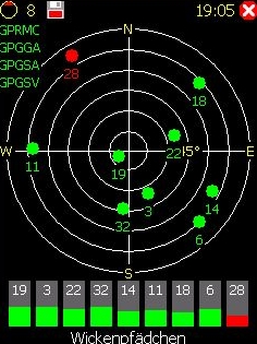
· compass rose
· GPX tracking
· sun rise and set calculation
· export to LOC, GPX, KML
· import from GPX and LOC
What's New in This Release:
· Changed a lot of small things and corrected some errors
FON Access Points for Malaysia FON Access Points for Malaysia - FON offers you a new Points of Interest service (POIs). This allows you to download FONspots directly to your navigation device.
What does that mean? You can download a Points of Interest file directly to your navigation device
RulerPOIs RulerPOIs - RulerPOIs can be used to create named compact POI GPS point files. You can use the GPS on your PocketPC to create a file and view the other files via GPS distance. You can also select 2 GPS points and place them into the ruler to view the metric/imperial distance.
This program requires that you have both the 'BeanDLL
TrackMe TrackMe - Tool that stores GPS positions and uses that information to generate KML files that can be used by Google Earth or Google Maps for displaying realtime or prerecorded tracks.
The data can be stored locally on your PDA or remotely on a server. You can use my server (free of charge) for storing your data
RulerZIPer RulerZIPer allows you to find the distance from your current GPS to a US ZIP code. Start the GPS and when you get a GPS lock then enter the ZIP code. The program converts the ZIP code to GPS coordinates and displays the distance. This service is provided by USZIP
OfficeGPSeds OfficeGPSeds - OfficeGPSeds is a full-featured Pocket Office GPS editor/viewer. When you create a new office file the current GPS is appended to the end of the file. You can view the files and edit them or edit the file and update it with your new GPS location.
This program requires that you have both the 'BeanDLL
Other Software by developer «Julian Bugariu»:
not found
Comments on NaviPOWM:
Comments not found
If you noted an error or download link is broken, please, report it via this page or use comments.
NaviPOWM is compatible with your device Lenovo ET600