Back Country Navigator - is a handy navigator which will help you find way in any location. The application has embedded storage so you can download the needed data and use maps without Internet connection. All you need to do is to activate a satellite navigation to see your location.
Game features:
Fast download
Data of geological surveys
Display of other ways
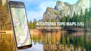
Support of contour maps
Like it? Share with your friends!
Supported operating systems:
Google Android 10.x, Google Android 4.0, Google Android 4.1, Google Android 4.2, Google Android 4.3, Google Android 4.4, Google Android 5.x, Google Android 6.x, Google Android 7.x, Google Android 8.x, Google Android 9.x
Similar Software:
JTrip JTrip - Create your own trip in Thailand. JTrip recommends attractions and directions that you need. Let's get to know Thailand together.
· select places.
· select hotel.
· show map location.
· route path form src to dest.
· taxi, time remaining.
· suggest bus number
In Hand Deals In Hand Deals - In Hand Deals is an easy to use mobile app that provides you with the most effective way to find out what deals are available in different categories or around your location; such as restaurants, fast food, coffee shops, retail stores, automotive, fuel, day spas, beauty salons, theaters and nightclubs.
No need to coupon clip, check in, or score points...
LocationBot Lite LocationBot is an Android app that can change various settings on your phone according to your location. For example, it can switch the phone's WiFi and Bluetooth on when you are in your home or at your favourite coffee shop, or turn the volume down and set vibrate on when you are at work/church/cinema
RMaps RMaps is a navigation tool. You can use RMaps as an online map viewer for some popular maps. And as an offline map viewer for your own maps created on the PC.
· Auto rotate map in driving direction.
· Auto rotate map in the northern direction.
· Compass on the map.
· Auto-follow function.
· Online search.
· Full screen mode
CompassNavi Compass / Navigation Activity, mainly for OpenGPX, but can be used from any application
YGPS Satellites YGPS Satellites - YGPS Satellites is a small mobile application that allows you to easily assess the quality of your GPS signal. The utility displays the location of all the GPS satellites and shows the signal strength for every one of them.
Using the app is pretty straightforward
iMapMyRUN Run GPS Running Jog iMapMyRUN Run GPS Running Jog - iMapMyRUN+ tracks the route, distance, pace, and more in real-time using GPS.
Free new version!
iMapMyRUN+ brings you its mobile app for Android-based devices! Now owners of Android 2
Open GPS Tracker Open Source recording, storing and accessing of your routes: Open GPS TrackerAn application that can track your travels of your Android by storing your GPS locations. Draws the route real-time on either Google or OSM maps
OSMTracker for Android OSMTracker stands for OpenStreetMap Tracker. It allows you to track your journey and mark significant way points. Way points can be marked with a tag using a button, with a quick voice record, a text note or by taking a picture. The various button pages and layouts can be customized to suit your OpenStreetMap activities