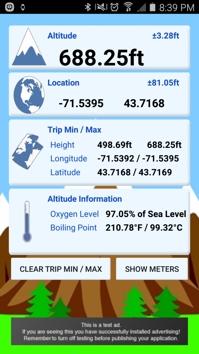
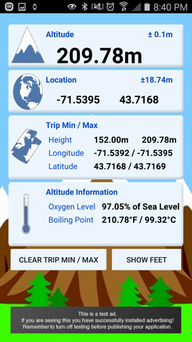
myAltitude - See your Altitude, and details of your trip, including Minimum and Maximum Altitudes, Oxygen levels and more! Full Android Wear support!
Includes improved & tested support for:
Moto 360
ASUS ZenWatch and
Samsung Gear
Like it? Share with your friends!
Supported operating systems:
Google Android 10.x, Google Android 4.0, Google Android 4.1, Google Android 4.2, Google Android 4.3, Google Android 4.4, Google Android 5.x, Google Android 6.x, Google Android 7.x, Google Android 8.x, Google Android 9.x
Similar Software:
CompassPro CompassPro - Best Compass application for Android! Two fantastic compass styles to choose from.
You can have a compass icon always showing on your phone screen! The size and display area can be easily configured.
Note: You need to Calibrate the Sensor Compass first: Rotating your phone around all axes in a continuous movement
Kompas Kompas is a small pocket tool for compass navigation
Ruler (Android) A simple application to turn your Android phone into an emergency measuring device
EcoDrive Free Speedometer EcoDrive Free Speedometer - EcoDrive Free Speedometer - accurate and convenient GPS speedometer.
The app is designed to control the speed, economy, time, direction, etc.
Real-time economy calculations is based on the speed, acceleration and braking, descents and ascents
Surveyor Surveyor - Measure distances with a single click on your Android phone!
All you need to do is point your phone to the object you want to measure, and select the point where it touches ground from the screen.
What's New in This Release:
· Use gyroscope to improve accuracy and smoothness of Augmented Reality result
Point Lite Point Lite Want to know where you are relative to specific places important to you? Or where to go?Point shows it to you in one glance!Add your own points of interest. Mark your current spot before taking a stroll to easily find your way back.Or ask Point to give you a sign when you are near an important spot
Epic Compass Epic Compass - When you are a traveler or lost in somewhere place, you must need a compass. Caompass can be used in outdoor and many activities you can do such as hiking, climbing, flying etc
Naver Maps Naver Maps - Smarter than ever! Experience Naver Map for Android. You can find the shortest way to get to your destination, using public transportation even it is far away. You can also search the information on the area around you easily and check whether you are heading to your destination correctly with GPS and compass
Elevation and Sea Depth Elevation and Sea Depth displays elevation and/or sea depth in direction of phone.In order to use it properly, hold your phone on flat surface and away from ferrous metal objects and electromagnetic fields
GeoLog GeoLog saves the sensors data (gps, accelerometer, magnetometer data, etc.) of your device to a log file and calculates the coverage of the site. The coverage is a ratio of the track covering area to the area of the site (expressed in percents)
Other Software by developer «Rovingsquid»:
not found
Comments on myAltitude:
Comments not found
If you noted an error or download link is broken, please, report it via this page or use comments.
myAltitude is compatible with your device LG G5 H860 TD-LTE


")


