Terracrosser is a free GPS navigation software for Windows Mobile Pocket PC.
· Terracrosser works in Map and Photo modes
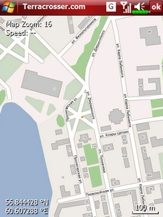
· Terracrosser uses zoomable maps
· Terracrosser is completely compatible with Google Maps service. With included Mapper module you can download maps from the Internet. All maps are automatically calibrated (geo-referenced)
What's New in This Release:
Terracrosser:
· POI system
· enhanced scrolling
· multiple options in settings menu
· maps correction to improve default maps calibration
Mapper:
· limited region to download non-square part of map
Like it? Share with your friends!
If you got an error while installing Themes, Software or Games, please, read FAQ.
Supported operating systems:
Windows Mobile 5.0, Windows Mobile 5.0 Smartphone, Windows Mobile 6 Classic, Windows Mobile 6 Professional, Windows Mobile 6 Standard, Windows Mobile 6.1 Classic, Windows Mobile 6.1 Professional, Windows Mobile 6.1 Standard, Windows Mobile 6.5 Professional, Windows Mobile 6.5 Standard
Similar Software:
Rough Guides Map London Rough Guides Map London... These guides are a series of fantastic interactive maps.
Produced in conjunction with the premier travel publisher Rough Guides.
Discover and explore London using full colour interactive linked maps, in this simple to use PDA version of The Rough Guides London
Trapster Trapster-Your mobile phone or navigation device alerts you as you approach police speed traps.
When you see a trap, report it by pressing a button on your phone, or calling a toll free number. Other user's phones will alert them as they approach the trap. Trapster learns the credibility of traps based on how many users agree
Map of Lyon / France for City Advisor Map of Lyon / France for City Advisor. This map includes: 4 Metro, 4 Tramway, 2 Funiculaire, 1 Rhonexpress and 2 Bus.
Instructions:
1. Download the map (zip file)
2. Extract the files in /CityAdvisor/maps
3. Open CityAdvisor -> Maps icon -> Menu -> Refresh
4
J2ME OGC WMS Client J2ME OGC WMS Client is a program for accessing OGC Web map services from Java enabled mobile phone or PDAs.
It accesses the OGC WMS according to WMS 1.1.0 and 1.1.1 specifications and supports zooming and panning in the Map, WMS sublayers, and a bookmark management system for quick access.
Free for non-commercial use
Map of Wyoming (US State) Map of Wyoming (US State) - A map of the Wyoming by VITO Technology. Good for intercity travels with SmartMap.
SmartMap is a mobile device application which uses vector and raster maps. It is compatible with any NMEA protocol GPS receiver (Compact Flash socket, serial port, BlueTooth or sleeve)
MapMover MapMover - MapMover enables you to get maps (in 256 color BMP format) and pan them with the joypad of your Pocket PC.
MapMover requires that you have both the 'BeanDLL.dll' file ** and ** the runtime files for Visual Basic on your PocketPC computer. Simply unzip the file for your processor and place the DLL file in the 'Windows' folder of your PocketPC computer
Rough Guides Map New York City Rough Guides Map New York City... These guides are a series of fantastic interactive maps.
Produced in conjunction with the premier travel publisher Rough Guides.
Discover and explore New York City using full colour interactive linked maps, in this simple to use PDA version of The Rough Guides New York City
Other Software by developer «Nitisara»:
not found
Comments on Terracrosser:
Comments not found
If you noted an error or download link is broken, please, report it via this page or use comments.


![USA-MI [Michigan] Map for EagleEye PDA Tracking System](https://static.mobyware.org/data/images/def_program_reduced.png "USA-MI [Michigan] Map for EagleEye PDA Tracking System")

")

