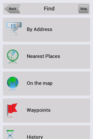
Navitel Navigator for Android - Navitel Navigator is a GPS travel assistant for Android. The app turns your phone into a personal navigation system.
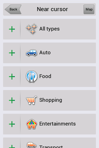
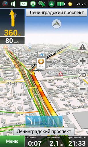
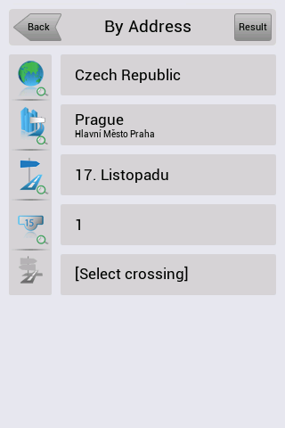
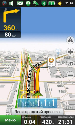
Navitel Navigator comes with detailed maps and other useful features, including traffic jams, speedcams, 3D roads and intersections, instant routing and a comprehensive database with points of interest.
· 30 days trial
What's New in This Release:
· map subscription available;
· vibration of the navigation device in response to use of the keyboard;
· bugs occurring at POI search along the route are fixed;
· traffic jams are rendered quicker in maps.
What's New in 8.0.0.267:
· To Menu - Settings - Navitel.Friends added new option - "Hide irrelevant".
· While installing the minimum values of map detail, buildings are displayed as single-storey.
· Display of textures through the translucent building was fixed.
· Rendering of colors and lighting of 3D models was improved.
· Display of the houses' numbers in 3D mode was fixed.
· Incorrect work of the program on devices Prestigio GeoVision 5500 was fixed.
What's New in 8.0.0.192:
· Option of map scale selection for 3D buildings display was added to the settings.
· As you zoom in more than 3 km, function "Track Up", when following a route, changes to the orientation "North".
· To Menu - My Navitel was added information about version number and size of available update.
· Errors, when drawing some polylines in 3D, were fixed.
· Accuracy of the voice guidance on roundabouts was improved.
· Android 1.5 is no longer supported.
What's New in 8.0.0.0:
· Hardware-accelerated rendering is implemented (OpenGL)
· New 3D maps with number of storeys support and textures
· New 3D models of attractions
· Brand POI
· Traffic jams sensitivity setting
· More detailed description of friends' location on the map is implemented.
· Zoom buttons bugs in "My Route" window were fixed.
· Also other numerous minor fixes, enhancing the stability and reliability of the program, were made
What's New in 7.5.0.2131:
· Automatic SPEEDCAM update from the program menu.
· Personal settings, history, waypoints storing after update installation.
· Dashboard selection on the map while driving on the route.
· Profile switching without having to restart the application.
· Automatic renaming of exported files (routes, waypoints) in order to avoid existing data rewriting.
· Objects naming display is improved during map scrolling.
What's New in 7.5.0.1342:
· Кeyboard for Armenian, Georgian and Azerbaijani languages was added.
· Information of the program's and maps' version was included in menu My Navitel.
· Display of owner's devices on the map attached to the service Navitel.Friends was realized.
· Search by the POI on the route was improved.
What's New in 7.0.0.176:
· View mode and edit mode of "Navitel.Friends" privacy settings are implemented.
· New icons of road infrastructure and weather on the map are added.
· License agreement (Public offer) is updated .
· Multi-touch operation in search result is fixed.
· Bug that caused program hang, during intersections search, was fixed.
· Program zoom is improved on very small and very large scales.
Like it? Share with your friends!
Supported operating systems:
Google Android 1.5, Google Android 1.6, Google Android 10.x, Google Android 2.0, Google Android 2.1, Google Android 2.2, Google Android 2.3, Google Android 3.0, Google Android 3.1, Google Android 3.2, Google Android 4.0, Google Android 4.1, Google Android 4.2, Google Android 4.3, Google Android 4.4, Google Android 5.x, Google Android 6.x, Google Android 7.x, Google Android 8.x, Google Android 9.x
Similar Software:
amAze (Samsung) AmAze is a first of its kind free navigation and local search service. It is free to download and use and it contains wide coverage of maps including aerial photo in Europe, North America, Australia and parts of Asia and Africa
GPS Essentials Turn your phone into a fully-featured GPS receiver!
MapMyFitness+ for Android MapMyFitness+ for Android - MapMyFitness is a fitness assistant that allows you to track your workouts using your phone's built-in GPS.
With the app you can view your route on a map and record your workout details, including duration, distance, pace, speed, elevation and calories burned
GPS Status GPS Status is an application which displays the information received from the phone's GPS receiver. In addition to the basic location information it can extract and display the state and location of each visible GPS satellite which is displayed on a simple sky view. The outer circle represents the horizon while the center corresponds to the zenith right above your head
GpsTicker Gpsticker is a program for outdoor orientation and navigation with GPS, it is best for hiking and biking. Maps are downloaded automatically from OpenStreetMaps, provided the Phone has an active internet connection
AugSatNav Walk AugSatNav is an augmented reality navigation system which overlays walking directions upon a live video feed of the path or road ahead.
With AugSatNav there is no need to follow instructions or interpret maps - you can simply find your way by walking along the route highlighted by a bright white line
Turbo GPS Turbo GPS - The known all-in-one GPS and Sensor manager, now for Android.
Supports waypoints, tracks, sensors, compass, import/export, routes, 3D map and more.
What's New in This Release:
· Less size
· Updated Map when Tracks are drawn
· Fixed bug when Running track (direction arrow)
Tricorder Tricorder - A simple tricorder simulator for Android powered phones, using real sensors to detect magnetic fields, gravity, etc. See the passing gravity wave from a distant collapsar on your phone screen (actual device sensitivity may be insufficient to detect gravity waves). Detect buried powerful magnets! Be a mega-geek! Etc
Share Path Share Path - Although e-maps and GPS can provide accurate navigation, we are confined on the basis of the existing database. Many times we may go to a place which cannot be found on the e-map. For example, go to a club with friends; on a vacation to the countryside near the lake where we have never been to
GPS Tools GPS Tools - is an application for calibration of a satellite module of your smartphone. The utility uses a magnetic compass, makes changes to the route, speed and accuracy of the displayed data. As soon as the calibration is completed you can track your location with maximum accuracy
Other Software by developer «Navitel»:
Navitel Navigator (Russia) for iPhone/iPad Navitel Navigator (Russia) for iPhone/iPad - Navitel Navigator is a GPS travel assistant for iPhone, iPad and iPod touch. The app turns your phone into a personal navigation system
Navitel Navigator for Symbian Navitel Navigator for Symbian - Navitel Navigator is a GPS travel assistant for Symbian. The app turns your phone into a personal navigation system.
Navitel Navigator comes with detailed maps and other useful features, including traffic jams, speedcams, 3D roads and intersections, instant routing and a comprehensive database with points of interest
Navitel Navigator Windows Mobile “Navitel Navigator” is a unique and accurate navigation system. Detailed Russia map. Free traffic jams information service. SPEEDCAMs. The most detailed map of Russia: more than 118 000 cities and towns, 1500 of them contain address search information. The most detailed Moscow and Saint-Petersburg map
Navitel Navigator Android “Navitel Navigator” is a unique and accurate navigation system. Detailed Russia map. Free traffic jams information service. SPEEDCAMs. The most detailed map of Russia: more than 118 000 cities and towns, 1500 of them contain address search information. The most detailed Moscow and Saint-Petersburg map
Navitel Navigator (Kazakhstan) for iPhone/iPad Navitel Navigator (Kazakhstan) for iPhone/iPad - Navitel Navigator is a GPS travel assistant for iPhone, iPad and iPod touch. The app turns your phone into a personal navigation system
Navitel Navigator Symbian “Navitel Navigator” is a unique and accurate navigation system. Detailed Russia map. Free traffic jams information service. SPEEDCAMs. The most detailed map of Russia: more than 118 000 cities and towns, 1500 of them contain address search information. The most detailed Moscow and Saint-Petersburg map
Navitel Navigator (Turkey) for iPhone/iPad Navitel Navigator (Turkey) for iPhone/iPad - Navitel Navigator is a GPS travel assistant for iPhone, iPad and iPod touch. The app turns your phone into a personal navigation system
Navitel Navigator (Commonwealth) for iPhone/iPad Navitel Navigator (Commonwealth) for iPhone/iPad - Navitel Navigator is a GPS travel assistant for iPhone, iPad and iPod touch. The app turns your phone into a personal navigation system
Navitel Navigator iPhone “Navitel Navigator” is a unique and accurate navigation system. Detailed Russia map. Free traffic jams information service. SPEEDCAMs. The most detailed map of Russia: more than 118 000 cities and towns, 1500 of them contain address search information. The most detailed Moscow and Saint-Petersburg map

")


")


 for iPhone/iPad")


 for iPhone/iPad")

 for iPhone/iPad")
 for iPhone/iPad")
