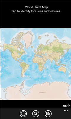
ArcGIS is a great way to discover and use maps. Tap on the map or use your current location to discover information about what you see. Search and find interesting information in the map as well as measure distances and areas. Find community hosted maps from ArcGIS Online, ESRI's online GIS, or use the authoring tools on ArcGIS.com to create your own maps that can be used in ArcGIS. Collect and edit data within a map and share your edits with others.
If you are an existing ESRI customer, this application is part of your ArcGIS system. You can share your corporate maps and extend the reach of your GIS to Windows Phone devices within your enterprise using ArcGIS Server.
Features
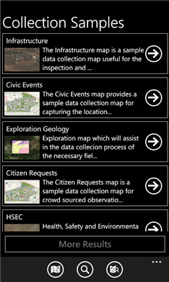
- Use maps authored in ArcGIS.com
- Navigate map galleries
- Access your own GIS data
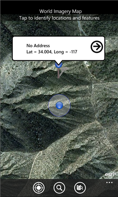
- Display and zoom to current location
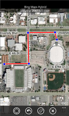
- Perform linear and area measurements
- Retrieve detailed map metadata
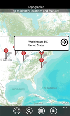
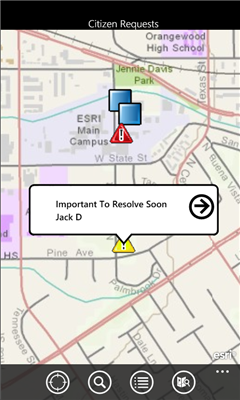
- View feature attribute information
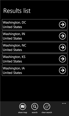
- Perform keyword search and get access to relevant information
- Change the visibility of layers
- Access popular maps faster by adding them to your favorites list
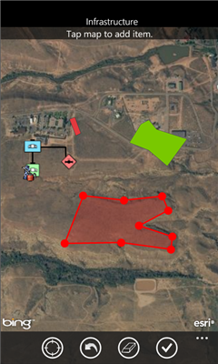
- Use your GPS or tap on the map to collect and update GIS data
- Attach photos to what you collect
Like it? Share with your friends!
If you got an error while installing Themes, Software or Games, please, read FAQ.
Supported operating systems:
Windows 10 Mobile, Windows Phone 7, Windows Phone 8
Similar Software:
Vicinity Vicinity automatically locates you and businesses within 1 mile of you, providing 0 click access to everything in your Vicinity. Selecting a search result presents you with a detailed view, including a zoomable map with walking route from your current location
Mymaps Mymaps - This is an extra odinary app which collaborates bing maps with gmaps or google maps...just browse on bing with the experience of google maps.
This application is a cross between gmaps and bing maps...
lets call it gingmaps :-p
Cheers and please do review
GMaps GMaps - Free Google Maps for Windows Phone 7
Now available the following features:
1. Map navigation with different layers support
2. GPS tracking
3. "What is here"
4. Search for location
We appreciated your feedback
Tube Map Tube Map - Get round on the London tube like never before! Get LIVE train status updates on a map that you can scroll
SketchMaps Free! SketchMaps Free! - SketchMaps is the very first drawable live map which can also be saved to pictures. It's an unique idea and it's first of its kind. It's that simple. Please, view screenshots!
SketchMaps Free is full-featured, but will show ads. You can buy the full version of SketchMaps at any time to remove the ads
En Zaragoza En Zaragoza - Localiza cientos de lugares de interes de Zaragoza rapidamente a traves del mapa.
"En Zaragoza" es una aplicacion gratuita que permite localizar, mediante un mapa de la ciudad de Zaragoza, cientos de lugares de interes. Localiza centros de salud, estaciones Bizi, farmacias, parques, etc
Share Location Share Location - Send a map image to your friends by SMS, Email or Twitter. Automatically find your current location or search for a location and then send it. You can also pick a different location by simple tap and hold the map
GMap Pro GMap Pro - Ultimate Google Maps for Windows Phone 7
In new version we have added China region detection and offset auto correction. We have also improved navigation by adding auto rerouting and current step highlighting.
We appreciate your feedback. Help us make tool you’d like
Metro Paris Simple et efficace, le plan de metro de Paris toujours dans votre poche grace a cette application
Other Software by developer «Esri, Inc»:
not found
Comments on ArcGIS:
Comments not found
If you noted an error or download link is broken, please, report it via this page or use comments.
ArcGIS is compatible with your device Micromax W092 Canvas Win