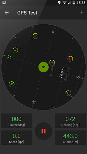
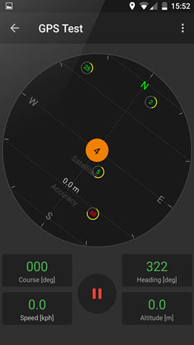
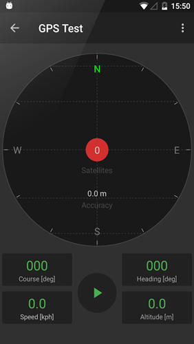
GPS Tools - is an application for calibration of a satellite module of your smartphone. The utility uses a magnetic compass, makes changes to the route, speed and accuracy of the displayed data. As soon as the calibration is completed you can track your location with maximum accuracy.
Game features:
Magnetic compass
Commercial free
Fast calibration
Big number of satellites
Like it? Share with your friends!
Supported operating systems:
Google Android 10.x, Google Android 4.4, Google Android 5.x, Google Android 6.x, Google Android 7.x, Google Android 8.x, Google Android 9.x
Similar Software:
Navitel Navigator Android “Navitel Navigator” is a unique and accurate navigation system. Detailed Russia map. Free traffic jams information service. SPEEDCAMs. The most detailed map of Russia: more than 118 000 cities and towns, 1500 of them contain address search information. The most detailed Moscow and Saint-Petersburg map
LocationBot Lite LocationBot is an Android app that can change various settings on your phone according to your location. For example, it can switch the phone's WiFi and Bluetooth on when you are in your home or at your favourite coffee shop, or turn the volume down and set vibrate on when you are at work/church/cinema
GpsTicker Gpsticker is a program for outdoor orientation and navigation with GPS, it is best for hiking and biking. Maps are downloaded automatically from OpenStreetMaps, provided the Phone has an active internet connection
Fleet Activity Logger Fleet Activity Logger - Why do you need Fleet Activity Logger application?
- Track your fleet to increase your productivity
- View entire fleet on a single map screen
How to start?
1. Install the application on your Android phone.
2. Create your account by providing your email id, phone number of the device, name, country and submit it.
3
Cell Tower Locator This application attempts to find the cellular tower location the mobile is connected to
MapMyHike+ for Android MapMyHike+ for Android - MapMyHike is a mobile assistant designed to allow hikers to track their activities using their phone's built-in GPS.
With the app you can view your route on a map and record your trip details, including duration, distance, pace, speed and elevation.
You can also share the details of your activity with friends via Facebook, Twitter or email
wheredroid wheredroid is a simple application to display your coordinates from the GPS receiver: latitude, longitude, heading, speed, number of satellites used and (it's its peculiarity) altitude and accuracy. It is quite usable as an altimeter and a compass.
What's New in This Release:
· fixes a bug inverting East with West on some displays
What's New in 1.4
InstaMapper (Android) InstaMapper is a free service that allows you to track a person or vehicle online in real time using a GPS-enabled mobile phone.
To use InstaMapper, you create a free account. Registration takes only a minute or two. All it is asked for is a username, password, and a valid email address.
Next, you install a small application on your GPS-enabled phone
TeleNav GPS Navigator Get voice-guided GPS, maps, business listings and real-time traffic updates now!
Art Places Art Places is a software application for the Android mobile operating system.
The application gets our position through the GPS in the mobile device and shows us our current location in the maps application. of maps
Comments on GPS Tools:
Comments not found
If you noted an error or download link is broken, please, report it via this page or use comments.
GPS Tools is compatible with your device Motorola Moto E6 Plus Dual SIM TD-LTE EU 32GB XT2025-2 (Motorola Poker+)

")


")

