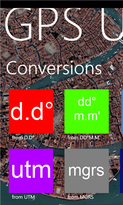
GPS Utility - GPS Utility helps you converts between all major geographical coordinate systems.
Helpful for excursionists, navigators users (TomTom, garmin, etc.), GeoCaching lovers, and Bing maps enthusiasts.
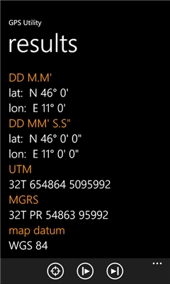
You can convert from and to:
- DMS coordinates (Degrees Minutes Second)
- DM coordinates (Degrees decimal Minutes)
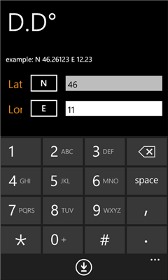
- DD coordinates (decimal Degrees)
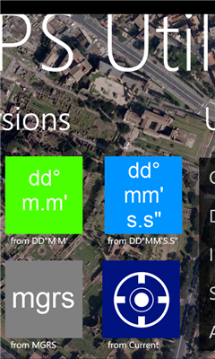
- UTM coordinates (Universal Transverse Mercator)
- MGRS coordinates (Military Grid Reference System)
Plus:
- Get your local coordinate in all systems using internal Windows Phone GPS
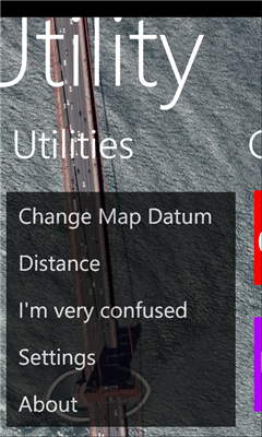
- Get the spherical distance between 2 coordinates
- Built-in Bing Maps view
- References (Wikipedia)
- Real time GPS coordinates
- Km and Miles supported
v1.1:
- add Wikipedia section
- automatic background changer
Like it? Share with your friends!
If you got an error while installing Themes, Software or Games, please, read FAQ.
Supported operating systems:
Windows 10 Mobile, Windows Phone 7, Windows Phone 8
Altitude Difference Collects the altidude difference of a hike in the mountains
MotoCarma MotoCarma uses GPS on the phone to detect speed, acceleration and location to determine how safely and efficiently you are driving. Acceleration and speeding warnings are displayed on the phone's screen and a chime is played to let you know when you need to adjust your driving behavior
Time To Go Time To Go - Time to Go is a simple tool to help you figure out how much time is remaining until you arrive at your destination. Simply put in your current speed and distance remaining (in MPH) and Time to Go will display your remaining time in hours, it's that simple!
Change Log
------------------------------------------------------------------
Version 1.1
Coordinate Checker Check the latitude and longitude for a location on the world using this app. Just indicate a location in the world using your finger and the coordinates will be showed
GPS Distance GPS Distance - GPS Distance vous permet de calculer rapidement et facilement la distance i vol d'aoiseau qu'il y a entre deux coordonnees GPS.
Les coordonnees sont donnees de facon decimales representant la valeur de l'angle en degre et le resultat est donnee en kilometre
Landmeter Landmeter - Call it inclinometer, call it clinometer, call it levels, call it whatever you like ... but you don't have enough of them ... There is still one missing ...
LandMeter is the official inclinometer for all off-roads enthusiasts, 4x4 cars, trucks, jeep, landrover, and trailers
Simple Altimeter Free Simple Altimeter Free - This app answers one simple question: What's my elevation, according to the phone's GPS chip?
Have you ever been hiking, skiing, boarding, or even just driving and wondered what your approximate elevation is? This is the app for you. The best part is that it's free!
Disclaimer: This app is only as accurate as the GPS chip in your phone
Driving Forces Driving Forces is a speedometer and G-Force meter: together at last! Mark your top speed and greatest Gs in 3 dimensions
Speedometer The Speedometer app is about measuring the speed you are moving and then providing you with the maximum speed you achieved over the time period. It's very useful tool when your kids ask you "what
Other Software by developer «Dimension Srl»:
Landmeter Landmeter - Call it inclinometer, call it clinometer, call it levels, call it whatever you like ... but you don't have enough of them ... There is still one missing ...
LandMeter is the official inclinometer for all off-roads enthusiasts, 4x4 cars, trucks, jeep, landrover, and trailers

")