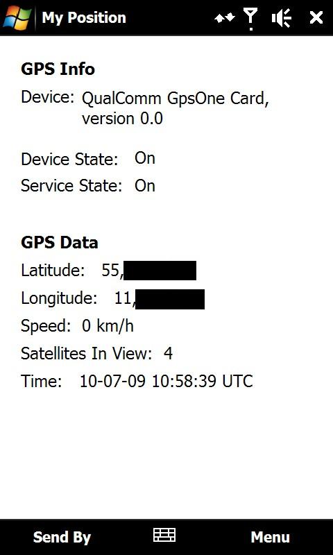
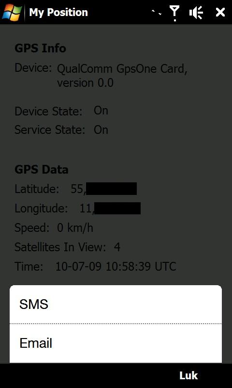
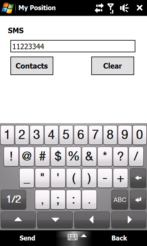
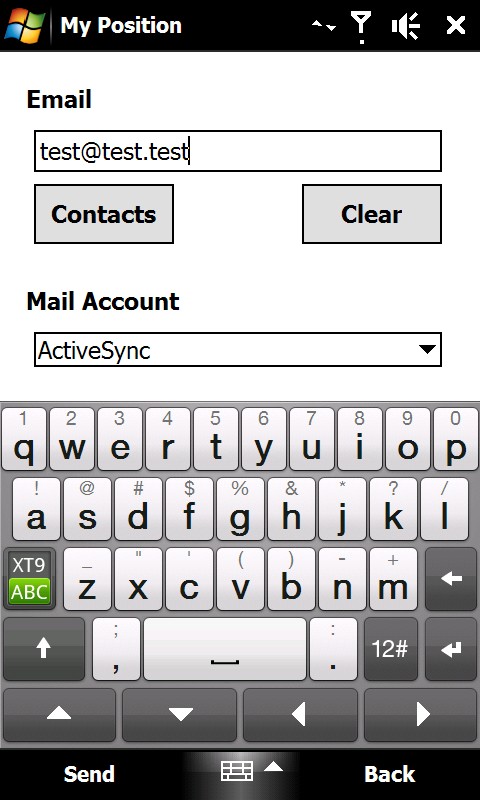
My Position - With My Position it is possible to see actual GPS information via the phone's built in GPS and send the position to others via sms or email.
When sending the position via sms or email it is possible to enter a telephone number or email address. It is also possible to select a contact from the contact list.
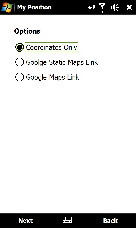
Sending the position is possible in three different ways:
1) As coordinates which can be inserted directly in Google Earth or Google Maps.
2) As a link to Google Static Maps. When the receiver opens the link the phones default web browser connects to the internet and shows the position on a map in 400x400 pixel resolution.
3) As a link to Google Maps. This option is mostly suitable when sending the position via email.
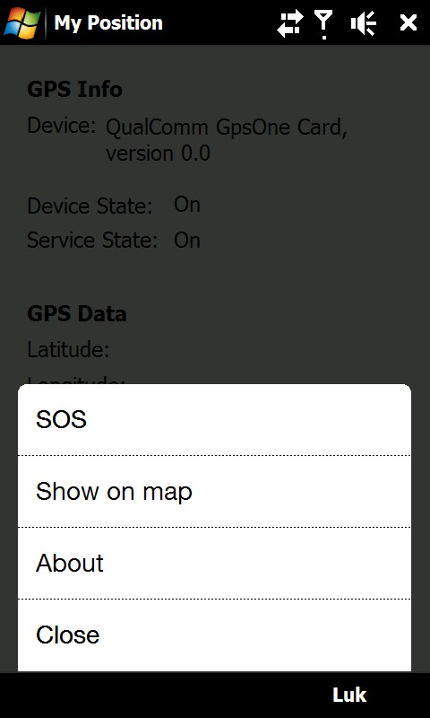
It is also possible to see ones own position on a map where Google Static Map is being used. The phones default web browser will open and connect to the internet and shows the position on a map in 400x400 pixel resolution.
This is a very good function when you are in a big city with many streets.
There is also a sos function which sends the position and a message of help. Again it is possible to send via sms or email.
Like it? Share with your friends!
If you got an error while installing Themes, Software or Games, please, read FAQ.
Supported operating systems:
Windows Mobile 6 Classic, Windows Mobile 6 Professional, Windows Mobile 6.1 Classic, Windows Mobile 6.1 Professional, Windows Mobile 6.5 Professional
Similar Software:
FileGPSeds FileGPSeds - FileGPSeds is a full-featured GPS tagged file viewer. You can browse the folders of the PocketPC for GPS tagged files and view the current distance from your GPS. You can also map the file GPS or all files in a folder on a map from Google.com maps service.
This program requires that you have both the 'BeanDLL
gpsVP gpsVP - GPS navigation software for Windows Mobile devices. It shows vector and raster maps, records and shows tracks, shows multiple navigation parameters, manages and shows waypoints. It aims to be as usable as possible
PoliceGPSeds PoliceGPSeds - PoliceGPSeds can be used to send the police video/picture tips with GPS via Email. When you want to send a tip then you compose the report and tap the 'Camera' button to take the image. An email will be sent to the police email address with the picture attached.
This program requires that you have both the 'BeanDLL
VoiceGPSed VoiceGPSed - VoiceGPSed allows you to create and listen to voice files based on your GPS. When you create a new voice file the GPS location is appended to the end of the file. You can explore the wave files via distance of your current GPS.
This program requires that you have both the 'BeanDLL
GPSPicturer GPSPicture allows you to create GPS stamped JPEG files and displays them in an easy to use explorer interface. When you get a GPS lock the program will display the JPEG files in order of distance to your current GPS. To view the image file simply tap on it. The map service is provided by Google
MovieGooglings MovieGooglings uses the GPS on your PocketPC to find the 50 closest movie rental shops sorted via GPS distance. Tap the button to start the GPS and when you get a lock tap on it to view the list of local stores. You can also dial the store. The GPS maps and store search service is provided by Google
Run.GPS Trainer UV Run.GPS Trainer is the perfect tool for sports like running, skiing and walking. It uses the Global Positioning System (GPS) to record all of your training parameters like speed, distance and altitude.
Run.GPS Trainer UV is the successor of of the award-winning Run.GPS Trainer software and has tons of new features
Fusion GPS Fix Fusion GPS Fix - FusionGPSFix tries to deal with the anemic GPS on the Raphael, and any other post-WM5 device with slow GPS locking.
This app runs after install, and after soft-reset, and immediately starts up the GPS hardware through the WM5+ GPS API. It waits 5 minutes for a GPS lock, or it quits
Gps Notes Gps Notes - GPS diary software.
· Track record of travel, text, graphics, video and other points of interest.
· Gps logging.
· Geotagging.
· Trajectory can be output as KML and KMZ format, you can replay in Google Earth
Navigation BE-ON-ROAD DACH Q2/2011 Navigation BE-ON-ROAD DACH Q2/2011 - The new major version of be-on-road presents new features and is based on new platform which brings high level of reliability, portability and speed on almost any kind of device. The new be-on-road brings high value voice guided door-to-door navigation
Other Software by developer «ULJ»:
Backlight Control A small and simple application to control the backlight

")