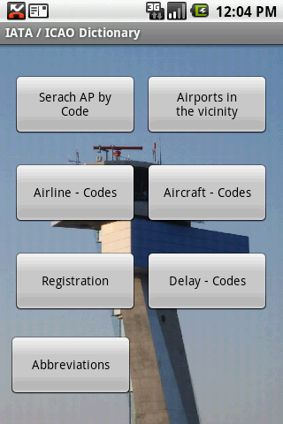
IATA / ICAO Dictionary -This application is an offline database for IATA / ICAO airport, airline, aircraft, delay codes and aircraft registration codes.
The airport database provides:
- Name
- Elevation
- Latitude and Longitude coordinates,
- timezone,
- runway and communication information (not every airport)
- Metar / TAF reports (not every airport)
- google map (not every airport)
- sunrise / set calculation
- find other airport in the vicinity of the selected airport or from your present position (GPS required)
- calculate the distance to the selected airport (GPS required)
The airline database provides:
- Name
- Country
- Callsign
- picture of the airline with airliners.net
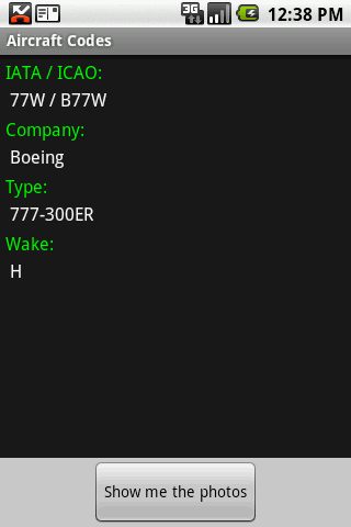
The aircraft database provides:
- Company
- Type
- wake category
- picture of the aircraft with airliners.net
Other functions are:
AC registrations; selection by
- country - registration
- registration - country
Delay codes
general aviation abbreviations
Like it? Share with your friends!
Supported operating systems:
Google Android 1.5, Google Android 1.6, Google Android 10.x, Google Android 2.0, Google Android 2.1, Google Android 2.2, Google Android 2.3, Google Android 3.0, Google Android 3.1, Google Android 3.2, Google Android 4.0, Google Android 4.1, Google Android 4.2, Google Android 4.3, Google Android 4.4, Google Android 5.x, Google Android 6.x, Google Android 7.x, Google Android 8.x, Google Android 9.x
Pune Local Pune Local - This app provides detail local train schedule information about Pune-Lonavala local trains.User just have to select the direction of train and railway station from which user start his journey
My OC Transpo My OC Transpo - Get out and about in Ottawa and the Valley using the OC Transpo Android application.
View bus routes, stop-specific arrival times, find bus stops near you, use Google Maps to locate stops and view routes, add widget, and plan a trip within the Ottawa region using the quick planner
Offi - Public Transport Buddy Everything you need for mastering public transportation! • departure times (live, including delays), • nearby stations (also on a map), • direction queries and
OneTaxiCabs OneTaxiCabs - OneTaxiCabs is a unique app that connects drivers with passengers. Passengers looking for a taxi can login to the app and request for taxi. The app looks for nearby drivers and sends your fare request. After a driver accepts your fare, you get access to the drivers phone number. Passenger can accept or reject the driver who has accepted the request
Sydney Transportation Sydney Transportation - Off-line transport information system which runs on the Google Android, providing timetables for train lines, buses and even ferries in Sydney.
The system is designed to be flexible
Hong Kong Transport Hong Kong Transport - Hong Kong Transport App provides a useful guide for you to go around Hong Kong streets by public transport
Washington Metro This app grants you fast acces to the last Washington map, no internet connection needed once it has been installed. Full zoom controls. Fast, light and simple
Mumbaikar (Android) Mumbaikar.com comes to Android. A cool, compact version of the same blogs, directory, events and incidents to keep you updated on the go. Also featuring a powerful search, geotagged content, get your current location and see things around you, comment, rate, share and do more. Get it and get going
CRUISE CRUISE - Application to navigate on the earth with photos.
‘View’
You can move freely to different part of the earth and catch a glimpse of various cosmopolitan scenes through posted photo.
By going back to the past as if stepping into a time machine, you can take in changing landscapes of a same place in each season and weather
Other Software by developer «Steve Dexter»:
Aviation Weather with Decoder Aviation Weather with Decoder - An easy way to receive metar and TAF reports from NOAA
Snowtam Decoder Snowtam Decoder - You have a snowtam in the metar report, you want to decode. Snowtam Decoder does it for you.
· Decoding of a snowtam in metar format
· Explanation of the items (A ,B , C, ..
Guess the X Guess the X - With this game you can guess a flag, a capital, a land and boundaries.
There are four input methods available to enter the answer: an autocomplete editbox, via a listview, multiple choice and a tap mode.
There are also options to change the color, size and font

")


")


