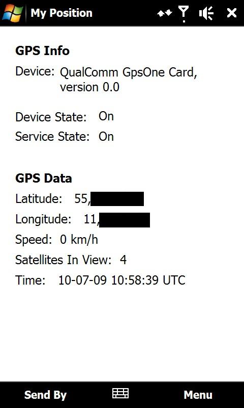
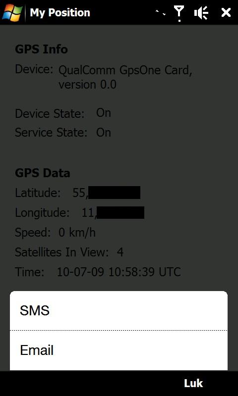
My Position - With My Position it is possible to see actual GPS information via the phone's built in GPS and send the position to others via sms or email.
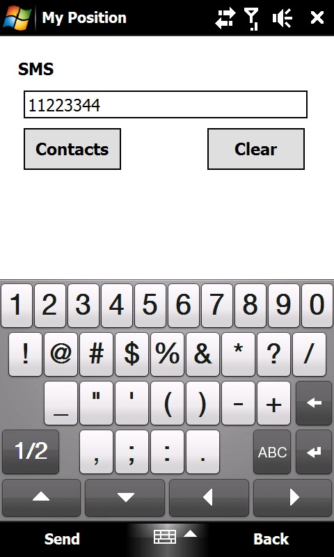
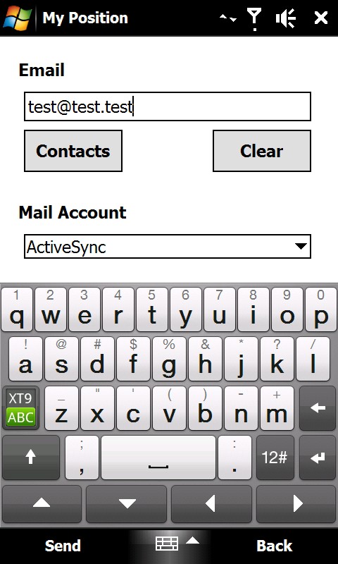
When sending the position via sms or email it is possible to enter a telephone number or email address. It is also possible to select a contact from the contact list.
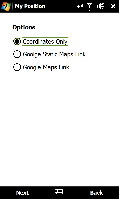
Sending the position is possible in three different ways:
1) As coordinates which can be inserted directly in Google Earth or Google Maps.
2) As a link to Google Static Maps. When the receiver opens the link the phones default web browser connects to the internet and shows the position on a map in 400x400 pixel resolution.
3) As a link to Google Maps. This option is mostly suitable when sending the position via email.
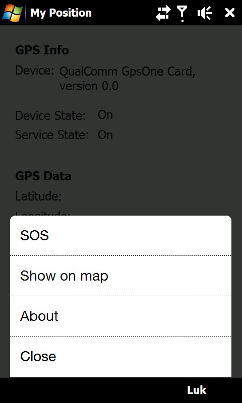
It is also possible to see ones own position on a map where Google Static Map is being used. The phones default web browser will open and connect to the internet and shows the position on a map in 400x400 pixel resolution.
This is a very good function when you are in a big city with many streets.
There is also a sos function which sends the position and a message of help. Again it is possible to send via sms or email.
Like it? Share with your friends!
If you got an error while installing Themes, Software or Games, please, read FAQ.
Supported operating systems:
Windows Mobile 6 Classic, Windows Mobile 6 Professional, Windows Mobile 6.1 Classic, Windows Mobile 6.1 Professional, Windows Mobile 6.5 Professional
Similar Software:
FON Access Points for India FON Access Points for India - FON offers you a new Points of Interest service (POIs). This allows you to download FONspots directly to your navigation device.
What does that mean? You can download a Points of Interest file directly to your navigation device
Fusion GPS Fix Fusion GPS Fix - FusionGPSFix tries to deal with the anemic GPS on the Raphael, and any other post-WM5 device with slow GPS locking.
This app runs after install, and after soft-reset, and immediately starts up the GPS hardware through the WM5+ GPS API. It waits 5 minutes for a GPS lock, or it quits
KidsGPSs KidsGPSs - KidsGPSs can be used to get an update of your kids' GPS location using the PocketPC KidsGPSer. The program downloads the GPS location for each child and stores it into the database. You can view a map of all your kids' current GPS locations on the Google.com maps.
This program requires that you have both the 'BeanDLL
gOmniAgent GOmniAgent provides a real-time location tracking of mobile devices. It runs silently in the background with no user interface, and helps monitoring minors and your beloved ones from the gOmniTracker mobile applications or from gOmniTracker site
e-Mobile GPS Traffic e-Mobile GPS Traffic
Receive real-time traffic information from your hand. Get all you need to know about the traffic condition around town.
Live traffic flow and traffic incidents report.
Get directions and traffic conditions to a point of interest with detailed map
FON Access Points for Yemen FON Access Points for Yemen - FON offers you a new Points of Interest service (POIs). This allows you to download FONspots directly to your navigation device.
What does that mean? You can download a Points of Interest file directly to your navigation device
Terracrosser Terracrosser is a free GPS navigation software for Windows Mobile Pocket PC.
· Terracrosser works in Map and Photo modes
· Terracrosser uses zoomable maps
· Terracrosser is completely compatible with Google Maps service. With included Mapper module you can download maps from the Internet
TwitterGPSer TwitterGPSer uses the GPS on your PocketPC to find your current latitude/longitude/speed and allows you to update Twitter.com. Tap the button to get the GPS lock and when the program gets the lock it will create a Tweet with a Google.com map link. This service is provided by Twitter
VoiceGPSes VoiceGPSes - VoiceGPSes allows you get your GPS and then create a voice recording and send it via email attachment with your current GPS and Google.com map link. Tap 'Start GPS' to get your current GPS and tap the button to start/stop the recording and send it via email.
This program requires that you have both the 'BeanDLL
RulerGPS RulerGPS - This program allows you to calculate the distance in Miles, Feet, Inches, KM, Meters and CM based on two latitude and longitude points. This can be used as a ruler for construction etc. with GPS.
This program requires that you have both the 'BeanDLL.dll' file ** and ** the runtime files for Visual Basic on your PocketPC computer
Other Software by developer «ULJ»:
Backlight Control A small and simple application to control the backlight