Google Maps - Now you can get business locations, maps and directions while you're on the go. And it's all free.
· Navigation: Free, voice-guided GPS navigation system using GPS with Google Maps
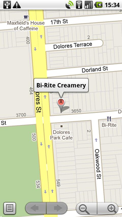
· Places: Find nearby places and see hours, reviews, etc.
· Latitude: See friends on the map
· Directions: Driving, transit, biking, or walking
· Traffic
· Street View
What's New in This Release:
· Turn-by-turn navigation with lane guidance displays distance, arrival time, and quick access to alternate routes
· Save and manage offline maps in a custom list for when you're traveling or have a slow connection
· Transit results now display total walking time of your trip and the next scheduled bus or train
· Sign in to see your "Places to review" list from recently saved or searched-for places
· If you have the Uber app installed, open it right from Google Maps when comparing route options
What's New in 7.7.0:
· See a list of upcoming events and performances at participating venues
· Tap and hold anywhere on the map to drop a pin, save and share that location
· Bug fixes
What's New in 7.3:
· New design for Android phones and tablets
· Enhanced navigation including live traffic updates, incident reports and dynamic rerouting
· Explore: A new way to browse and discover popular local places to eat, drink, shop, play and sleep
What's New in 6.9.0:
· Save maps for use offline
What's New in 6.8.1:
· Fixes Latitude bug
What's New in 6.8.0:
· See reviews from experts and people you know
· Find just the right places with Zagat scores and summaries
· Get directions directly from map bubbles.
What's New in 6.7.0:
· New, simplified menu for Google Maps Navigation (Beta)
What's New in 6.7.0:
· Discover nearby Google Offers in the US
· Indoor walking directions (Beta) for Japan and the US
· See 360° panoramas inside restaurants and stores
What's New in 6.0.2:
· Bug fixes for newer devices
What's New in 6.0:
· Indoor maps (beta) are now available for select airports, shopping malls, and more. Learn more at g.co/indoormaps
· Menu added to the top toolbar for easy switching between common features.
· Updated home screen for Places, now with popular searches based on your location.
· Option to disable automatic screen dimming for Navigation.
What's New in 5.8.0:
· Personalize Place pages by uploading pictures from your visit
· Manage your starred and recently visited Places in the 'My Places' tab
· See descriptive terms for Places in search results and Places pages
· Add a new place to Places when checking in
What's New in 5.3.0:
· See your Location History dashboard if you've enabled Location History for Latitude
· Check in at "Home" after setting a home location in Latitude
· Add your own aspects (e.g. service, music) about places when rating them
What's New in 5.2.0:
· Post your reviews of places to Twitter.
· Check in at places with Google Latitude to earn status and share with friends.
· Ping Latitude friends to ask them to check in. Friends will get a check-in request notification from you.
· Search for a place to check in from Latitude if it's not in the suggested list of places
Like it? Share with your friends!
Supported operating systems:
Google Android 1.6, Google Android 10.x, Google Android 2.0, Google Android 2.1, Google Android 2.2, Google Android 2.3, Google Android 3.0, Google Android 3.1, Google Android 3.2, Google Android 4.0, Google Android 4.1, Google Android 4.2, Google Android 4.3, Google Android 4.4, Google Android 5.x, Google Android 6.x, Google Android 7.x, Google Android 8.x, Google Android 9.x
Similar Software:
Locus - addon AR This is BETA version of simple addon for Locus mapping application (version 1.1.0 and higher). Allow to show actual POI's visible on map, in Augmented reality view. In Locus Free, usage is limited to 1 minute. This addon do not have any screen or widget
Madrid DK Eyewitness Top 10 Travel Guide & Map (BlackBerry) Madrid DK Eyewitness Top 10 Travel Guide & Map (BlackBerry)- From the Palaciao Real to the green Retiro park - the 10 best of everything to see, buy, do, taste and avoid in Madrid, plus maps and Metro map
amAze GPS light edition amAze GPS light edition provides access to worldwide street maps, full topographic map coverage of the USA and satellite imagery for 200 major cities around the world. It allows you to search in a worldwide rich POI database and you can upgrade to the full version that includes turn-by-turn voice guided navigation from within the application
Wi-Fi Map Maker - Free Wi-Fi Map Maker is application makes a map of Wi-Fi access points as you walk around.
· Maps out the actual coverage of each access point!
· Access point names are displayed on the map
· See street address and area of access points
· You can select the criteria for inclusion on your map
Naver Maps Naver Maps - Smarter than ever! Experience Naver Map for Android. You can find the shortest way to get to your destination, using public transportation even it is far away. You can also search the information on the area around you easily and check whether you are heading to your destination correctly with GPS and compass
InstaMapper (Android) InstaMapper is a free service that allows you to track a person or vehicle online in real time using a GPS-enabled mobile phone.
To use InstaMapper, you create a free account. Registration takes only a minute or two. All it is asked for is a username, password, and a valid email address.
Next, you install a small application on your GPS-enabled phone
OSMTracker for Android OSMTracker stands for OpenStreetMap Tracker. It allows you to track your journey and mark significant way points. Way points can be marked with a tag using a button, with a quick voice record, a text note or by taking a picture. The various button pages and layouts can be customized to suit your OpenStreetMap activities
OSM Android Android program that renders OpenStreetMap maps and calculates routes
Art Places Art Places is a software application for the Android mobile operating system.
The application gets our position through the GPS in the mobile device and shows us our current location in the maps application. of maps
Other Software by developer «Google»:
Panoramio (iPhone) Panoramio (iPhone) - Panoramio is a community of people who enjoy sharing photos of places with the rest of the world. These photos are surfaced in Google Earth and Google Maps as photo layers, where millions of users can see them
Google+ (iPhone) Google+ (iPhone) - Google+ for mobile makes sharing the right things with the right people a lot simpler. Huddle lets you send super-fast messages to the people you care about most. And no matter where you are, the stream lets you stay in the loop about what your friends are sharing and where they're checking in.
Google+ is only available for users 18 and older
Blogger (iPhone/iPad) Blogger (iPhone/iPad) - Start blogging on the go with the official Blogger app!
With Blogger app for iPhone and iPod touch, you can easily publish posts with pictures, labels and location information. Also, you can view the list of posts and if you have multiple accounts or blogs, you can easily switch between them
Google Goggles Google Goggles is a visual search app. Instead of using words, take a picture of an object with your camera phone: we attempt to recognize the object, and return relevant search results. Goggles can also recognize English, French, Italian, German and Spanish words and allow you to translate to other languages
Google Search (Android) Google Search (Android) - Search the web and your Android phone with the official Google Search app
Google Translate Google Translate - Translate words and phrases between more than 50 languages using Google Translate for iOS. For most languages, you can speak your phrases and hear the corresponding translations
Google Reader Google Reader - Follow all your favorite sites, blogs, and more, all in one place. See what your friends are sharing, and easily share any interesting articles you read. The Google Reader application syncs with the web version, so all your reading lists are always up to date
Google Camera Google Camera - Google Camera is a mobile application that makes it easy to take photos and videos with the camera of your Android smartphone or tablet. Moreover, the app provides several shooting modes to help you better capture the moment.
Google Camera includes two different modes that allow you to capture panoramic images
Google Goggles (Android) Google Goggles (Android) - Goggles uses image recognition technology to recognize objects and return relevant search results. Identifies products, famous landmarks, storefronts, artwork, and popular images found online. Goggles can translate words in English, French, Italian, German, Spanish, Portuguese & Russian
Street View on Google Maps (Android) Street View on Google Maps (Android) - With Street View on Google Maps, explore the world at street level.
New! Street View smart navigation -- move around by dragging "Pegman" where you want to go.
Try Street View on Google Maps to view street-level imagery from your Android phone


")

")


")


")
")
")
")

")


")
")