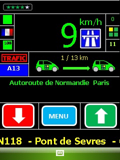
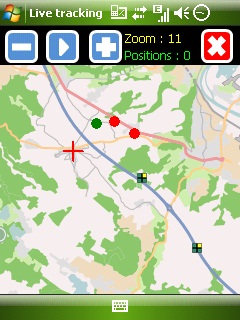
Mobbyway - Based on both internet mobile technologies and GPS, Mobbyway allows you to know easily, at any time, your relatives’ exact position on a map if they have accepted it and if they are connected to the network.
Mobbyway is also a help on the road network with a local alert system of a dangerous zone which is carried out with the network of members. Finally, Mobbyway will reference all the fixed radars in the countries where it is used and Mobbyway will indicate them to you.
Mobbyway was developed to allow:
- you to stay connected with your relatives wherever they are.
- your relatives to follow you visually and in real time.
- you to go back at any time to a place where you have already been on a specific date.
- you to travel safely on the road network thanks to the network members: The Mobbynautes.
- you to have a part in the world cartography OpenStreet Map
Like it? Share with your friends!
If you got an error while installing Themes, Software or Games, please, read FAQ.
Supported operating systems:
Windows Mobile 6 Classic, Windows Mobile 6 Professional, Windows Mobile 6.1 Classic, Windows Mobile 6.1 Professional, Windows Mobile 6.5 Professional
Similar Software:
VirtualGPS Virtual GPS is a free, small utility, which fully emulates GPS module and returns your location (by using cellular towers).
Accuracy of coordinates is about 200m in urban area and up to 5km in countryside. Screenshots are explaining how to use VirtualGPS with navigation software (e.g. "Google Maps")
chtiGPS chtiGPS is intended to the sportsmen and to hikers, for their training (bicycle, rollers, ski...), but also to locate itself by knowing the distance and the direction from the closest cities. Geolocalization finally makes it possible to reassure its close relations at the time of great exits..
RunSat GPS Sports Application - complete with autopause, autolap and upload to runsaturday.com
GPSEmailer GPSEmailer uses the GPS on your PocketPC to find your latitude/longitude/altitude and speed and creates a blank Email template. When the program gets its first lock then it creates an email with your GPS update location and a link to the Google.com mobile online street map
RulerZIPeds RulerZIPeds allows you to enter 2 American ZIP codes and converts the ZIP codes into GPS coordinates. The program then calculates the distance between the points. You can also download a Google.com map of the route. This service is provided by USZIP
MyGPS_PDA MyGPS_PDA - MyGPS_PDA is a light MyGPS version for PocketPC systems. It reads the NMEA sentences coming from a GPS antenna connected to the PocketPC and shows your position on a MyGPS calibrated map. The program can also store on a file the track log together with specific waypoints created by the user
Navigation BE-ON-ROAD USA Q2/2011 Navigation BE-ON-ROAD USA Q2/2011 - The new major version of be-on-road presents new features and is based on new platform which brings high level of reliability, portability and speed on almost any kind of device. The new be-on-road brings high value voice guided door-to-door navigation
FileGPSed FileGPSed - FileGPSed allows browse and view GPS tagged Excel, Word, Note, Voice, Text and Picture/Video files. You can browse the folders of the PocketPC for GPS tagged files and view them via GPS distance from your current location. Tap on the file to open it in the associated application.
This program requires that you have both the 'BeanDLL
Community Megaphone Reader Community Megaphone Reader - This application is part of the author's "30 Days of .NET" initiative to develop 30 mobile applications in 30 days. The source code of the application is included in order to help programmers new to Windows Mobile development write applications in .NET
MapsAligner MapsAligner - MapsAligner allows you to download large maps based on your GPS or with custom latitude and longitude points that you enter. You can use this to compose maps for your GPS applications. The program uses the Google.com maps server for the maps.
This program requires that you have both the 'BeanDLL
Other Software by developer «Mobbyway»:
Mobbyway Mobbyway based on both internet mobile technologies and GPS, Mobbyway allows you to know easily, at any time, your relatives’ exact position on a map if they have accepted it and if they are connected to the network.Mobbyway is also a help on the road network with a local alert system of a dangerous zone which is carried out with the network of members


")
")