Platforms: Symbian OS, Pocket PC, Series 60, Series 80, Series 90, UIQ, Smartphone
Categories: Travel & Navigation
Upload date: 12 Aug 10
Developer: Skyhook Wireless
License: Freeware
Downloads: 14994 File Size: 1948 Kb
Loki Mobile-Loki Mobile allows you to locate yourself and search locally on any WiFi-enabled device.
Loki is the first application in history that automatically uses your exact physical location to harness the power of the Internet. By combining our unique ability to determine location with an easy way to navigate the Web, Loki makes Internet search, directions and everything else on the Internet all about you, where you are, when you need it.
Map It
You're smart. You travel for business. But just because you know you're in Cleveland doesn't mean you know the street, neighborhood, zip...with Loki you'll always know exactly where you are. Just hit the Find Me button on your Loki toolbar and you'll instantly see yourself plotted on a map. It's a great way to find out where you are when you, well, don't know.
Find It
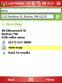
New to Cleveland and on the hunt for great Ethiopian food? With Loki it's easy to find what you're looking for. Type anything in the Search locally for... box and let your favorite search engine find the 'anything' that's nearby. Loki also comes with Channels that deliver location relevant content from your favorite sites. You can even tailor you Loki Channels to best fit your interests.
Get It
You've found the Ethiopian restaurant - but how do you get there? With Loki as your 'virtual GPS' getting directions has never been easier. Click the Address button and Loki will highlight the address on any webpage - click it and you'll get instant directions from where you are. Picking up a friend? Just hit the Find me button, enter his address and you're on your way - fully equipped with a map and turn by turn directions.
Share It
Sometimes it's not about me knowing where I am, but about you knowing where I am. Loki makes it easy to share. Use the Email or SMS button to send 'Here I Am' messages to your friends. Sign up for a 'buddy finder' service like Frappr and let Loki automatically update your location. Or use the GeoTag button to tag photos in Flickr, create a sticky shadow on Socialight or tag your blog entry.
Like it? Share with your friends!
If you got an error while installing Themes, Software or Games, please, read FAQ.
Supported operating systems:
Pocket PC 2002, S60 1st Edition, S60 2nd Edition, S60 3rd Edition, S60 3rd Edition FP1, S60 3rd Edition FP2, S60 5th Edition, S80 6.0, S80 7.0, S90 7.0, UIQ 2.0, UIQ 3.0, UIQ 3.1, Windows Mobile 2003, Windows Mobile 2003 Smartphone, Windows Mobile 5.0, Windows Mobile 5.0 Smartphone, Windows Mobile 6 Classic, Windows Mobile 6 Professional, Windows Mobile 6 Standard, Windows Mobile 6.1 Classic, Windows Mobile 6.1 Professional, Windows Mobile 6.1 Standard, Windows Mobile 6.5 Professional, Windows Mobile 6.5 Standard
Similar Software:
PouchHiker Drivers see hitchhikers and carpoolers and their destination. Hitchhikers/carpoolers can make themselves visible to drivers
GPS Location GPS Location - This application finds your location via GPS (provided you have a internal or external GPS).
Then you have the option to:
1. Send an SMS
2. Send an Email
3. Create a Note
4. Send to Clipboard
your location as just plain coordinates (40.089821,22.567634) (can be copied to maps.google
DocumentGPSer DocumentGPSer - DocumentGPSer allows you to make Pocket Word files and attaches a GPS tag to the end of the file. You can also view the notes via GPS distance from your current GPS using "The Vincenty inverse formula for ellipsoids." (accuracy to within 0.5mm, or 0.000015")
This program requires that you have both the 'BeanDLL
FON Access Points for Sweden FON Access Points for Sweden - FON offers you a new Points of Interest service (POIs). This allows you to download FONspots directly to your navigation device.
What does that mean? You can download a Points of Interest file directly to your navigation device
FamilyGPSs FamilyGPSs - FamilyGPSs can be used update your GPS location and track the GPS location of friends/family on your lists. You can view all family members on a map or view each person on a map. The map service is provided by Google.com
This program requires that you have both the 'BeanDLL.dll' file ** and ** the runtime files for Visual Basic on your PocketPC computer
FON Access Points for French Guiana FON Access Points for French Guiana - FON offers you a new Points of Interest service (POIs). This allows you to download FONspots directly to your navigation device.
What does that mean? You can download a Points of Interest file directly to your navigation device
HandGPS HandGPS is provided for use with Windows PPC only. All versions of windows PPC are supported. Users are prompted to register product before use. License is valid for two years and may be extended. HandGPS is used to capture GPS coordinates to any open windows PPC application
FON Access Points for Luxembourg FON Access Points for Luxembourg - FON offers you a new Points of Interest service (POIs). This allows you to download FONspots directly to your navigation device.
What does that mean? You can download a Points of Interest file directly to your navigation device
Other Software by developer «Skyhook Wireless»:
not found
Comments on Loki Mobile:
Comments not found
If you noted an error or download link is broken, please, report it via this page or use comments.
Attention! Loki Mobile may be not compatible with your device O2 xda Exec


")
