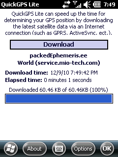
QuickGPS Lite can speed up the time for determining your GPS position by downloading the latest satellite data via an Internet connection (such as GPRS, ActiveSync, etc.).
For quickest connection use:
1. Mod Driver
2. QuickGPS Lite
3. GPS Test
It takes around 10 seconds from cold start to get 9 satellites and have a stable connection.
What's New in This Release:
· Illegal characters in path error, added packedEphemeris server
Like it? Share with your friends!
If you got an error while installing Themes, Software or Games, please, read FAQ.
Supported operating systems:
Windows Mobile 2003, Windows Mobile 5.0, Windows Mobile 6 Classic, Windows Mobile 6 Professional, Windows Mobile 6.1 Classic, Windows Mobile 6.1 Professional, Windows Mobile 6.5 Professional
Similar Software:
Mologogo Mologogo is a free service that will track you and your friends using GPS-enabled mobile phones.
From your phone or the web, Mologogo shows you where you and your friends are at any moment. If you are on the go, Mologogo can alert you when friends are close, search around for points of interest, and keep you updated with local traffic and weather
GPS Location GPS Location - This application finds your location via GPS (provided you have a internal or external GPS).
Then you have the option to:
1. Send an SMS
2. Send an Email
3. Create a Note
4. Send to Clipboard
your location as just plain coordinates (40.089821,22.567634) (can be copied to maps.google
GPSDisplayer GPSDisplayer is and educational tool that displays the NMEA data that comes from your GPS unit in your device. Select the program port for your GPS and tap the start button to view the NMEA logs from your GPS. The program displays the data on viewable list
TravelFTPs TravelFTPs - TravelFTPs can be used when you travel. You can set a FTP server to send a 'picture blog' of your trip. The program creates the HTML page and sends the page and pictures to the FTP server.
This program requires that you have both the 'BeanDLL.dll' file ** and ** the runtime files for Visual Basic on your PocketPC computer
GPS Tuner Essentials Full Version with Iberia Basic Map Content GPS Tuner Essentials Full Version with Iberia Basic Map Content is designed specifically for off-road use: its large buttons, selectable tool window size, multiple Compass views and the built-in Tele Atlas map makes it extremely user-friendly and reliable
Mobitee Lite Mobitee is a mobile application intended for both skilled and beginning golfers with the purpose to diversify the game and make it accessible simultaneously allowing to raise game level
e-Mobile GPS Traffic e-Mobile GPS Traffic
Receive real-time traffic information from your hand. Get all you need to know about the traffic condition around town.
Live traffic flow and traffic incidents report.
Get directions and traffic conditions to a point of interest with detailed map
Navigation BE-ON-ROAD DACH Q2/2011 Navigation BE-ON-ROAD DACH Q2/2011 - The new major version of be-on-road presents new features and is based on new platform which brings high level of reliability, portability and speed on almost any kind of device. The new be-on-road brings high value voice guided door-to-door navigation
FON Access Points for Finland FON Access Points for Finland - FON offers you a new Points of Interest service (POIs). This allows you to download FONspots directly to your navigation device.
What does that mean? You can download a Points of Interest file directly to your navigation device
Navitel Navigator Windows Mobile “Navitel Navigator” is a unique and accurate navigation system. Detailed Russia map. Free traffic jams information service. SPEEDCAMs. The most detailed map of Russia: more than 118 000 cities and towns, 1500 of them contain address search information. The most detailed Moscow and Saint-Petersburg map
Other Software by developer «Vico100»:
not found
Comments on QuickGPS Lite:
siddhu:
jhandu sw not working
Date: 27 Dec 10
If you noted an error or download link is broken, please, report it via this page or use comments.
QuickGPS Lite is compatible with your device O2 xda Exec