Symbian OS | Pocket PC | Smartphone | Android | BlackBerry | Apple iPhone OS | Java | Mobile Gaming | Linux | Palm | Win CE | Tablet  
     

Free Mobile Software, Themes, Games, Apps for PDA and Smartphones

     
Search by Device
My Device

  
Last Viewed Apps
SendPhotos
Unused app remover
The Same Game - Flash Lite
RoboForm (Android)
Try your skill in this beautiful match 3 game. Tiny Butterflies
Search by Category
Business & Profession
Databases
Dictionary & Translator
Entertainment
Finance
Games
Healthcare & Medicine
Internet & Communications
Multimedia & Graphics
Organisation & Productivity
Programming & Development
Reading
Science & Education
System Utilities
Themes & Wallpapers & Skins
Travel & Navigation
Geocaching
GPS
Guides
Maps
Measuring & Compass
Travel Planning
Weather
Worldtime
More
Search by Platform
Android
Apple iPhone OS
iPad
iPhone
iPod Touch
BlackBerry
Java
Linux
Maemo Nokia Internet Tablet
MeeGO
Sharp Zaurus
Mobile Gaming
Nintendo DS
Playstation 3
Playstation Portable
Wii
Xbox 360
Palm OS
Symbian OS
Series 60
Series 80
Series 90
UIQ
Tablet PC
Windows CE.NET
Windows Mobile Pocket PC
Windows Mobile Smartphone


Achivx Partner
 
 
NaviPOWM


NaviPOWM
Version: 0.2.6 updated

Platforms: Pocket PC


Categories: Travel & Navigation

Upload date: 4 Aug 11

Developer: Julian Bugariu

License: Freeware

Downloads: 10095

File Size: 1660 Kb
Download Free NaviPOWM 


Rating: 3.0/5 (Total votes: 22)


NaviPOWM is a car navigation system capable of running on a variety of operating systems. Only OSM based map data is supported. Realtime routing engine is planned in a later version. Geocaching and city guide functionality are also planned.
other:
· more POI types
· more way types
· support more targets at once
· switch between targets by clicking on target display
· coastlines bugfixing

What's New in This Release:

fixed bugs:
· crash under Windows XP when displaying areas with holes
· areas with holes not drawn properly on Windows mobile

implemented feature requests:
· Support for gpsd

What's New in 0.2.5:

fixed bugs:
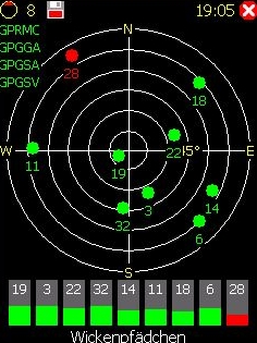
· TrackLog must show real GPSCoor

implemented feature requests:
· No aygshell.dll on PNA systems
· Show oneway arrow on streets
· Visibility of speed-pos box adjustable
· Save received data also as GPX file

other:
· area display (sea) speedup
· reorganized directories
· support for CMake


Like it? Share with your friends!

If you got an error while installing Themes, Software or Games, please, read FAQ.
 

Supported operating systems: Windows Mobile 2003, Windows Mobile 5.0, Windows Mobile 6 Classic, Windows Mobile 6 Professional, Windows Mobile 6.1 Classic, Windows Mobile 6.1 Professional, Windows Mobile 6.5 Professional
 
Similar Software:

Pocket PC Geocaching ToolsPocket PC Geocaching Tools
Pocket PC Geocaching Tools - Many tools in one program to help you while you are geocaching. What's included? * Open GSAK databases directly * HTML view * Field Notes * Hint decoder and decryption * Several coordinate functions * Solver * Transformer (Text to Digits, etc
amAze (LG)amAze (LG)
AmAze is a first of its kind free navigation and local search service. It is free to download and use and it contains wide coverage of maps including aerial photo in Europe, North America, Australia and parts of Asia and Africa
GPSMeter PDAGPSMeter PDA
GPSMeter PDA is program allows you to measure areas of any geometry, distances and to mark fixpoints
PDA NavigationPDA Navigation
PDA Navigation - Simple navigation tool for Pocket PCs with GPS support. · compass rose · GPX tracking · sun rise and set calculation · export to LOC, GPX, KML · import from GPX and LOC What's New in This Release: · Changed a lot of small things and corrected some errors
FON Access Points for Costa RicaFON Access Points for Costa Rica
FON Access Points for Costa Rica - FON offers you a new Points of Interest service (POIs). This allows you to download FONspots directly to your navigation device. What does that mean? You can download a Points of Interest file directly to your navigation device
StoreGooglerStoreGoogler
StoreGoogler uses the GPS on your PocketPC to find the 50 closest local business from 2,238 type of Yellow Pages entry sorted via GPS distance. Tap the button to start the GPS and when you get a lock tap on it to view the list of local businesses. The GPS maps and business search service is provided by Google
GPSPicturerGPSPicturer
GPSPicture allows you to create GPS stamped JPEG files and displays them in an easy to use explorer interface. When you get a GPS lock the program will display the JPEG files in order of distance to your current GPS. To view the image file simply tap on it. The map service is provided by Google
FON Access Points for NicaraguaFON Access Points for Nicaragua
FON Access Points for Nicaragua - FON offers you a new Points of Interest service (POIs). This allows you to download FONspots directly to your navigation device. What does that mean? You can download a Points of Interest file directly to your navigation device
GPSSMSererGPSSMSerer
GPSSMSerer uses the GPS on your PocketPC to find your latitude/longitude/altitude and speed and creates a single blank SMS template. When the program gets its first lock then it creates an SMS with your GPS update location and a link to the Google.com mobile online street map
DrinkGooglerDrinkGoogler
DrinkGoogler uses the GPS on your PocketPC to find the 50 closest local bars sorted via GPS distance. Tap the button to start the GPS and when you get a lock tap on it to view the list of local bars. You can also dial the bar. The GPS maps and business search service is provided by Google
 

Other Software by developer «Julian Bugariu»:

not found
 

Comments on NaviPOWM:

Comments not found

Name:


Comment:


Enter text from image below:

Turn on images!


If you noted an error or download link is broken, please, report it via this page or use comments.
 

NaviPOWM is compatible with your device O2 xda IIs
 
 
© Pantich 2009 - 2025 All rights reserved.