GPSToday-GeoTerrestrial GPSToday now brings an unbeatable combination of location features to your mobile device.
Driving/Walking directions in many countries, with traffic-optimization option.
Log file plotting on map and animated "playback". Also, the geologger will now never clip corners, and will perfectly follow loopy highway ramps. You can now also upload your log-files to the desktop website.(full-featured log-editing on the desktop coming soon)
Location Tracking and sharing (GeoLocation). Track your location history online for your own private use, or share with friends/family. The power-saving ability of GPSToday means you can leave it on indefinitely without worrying about the battery.
Easily and privately (or publicly) share points-of-interest, pictures, messages with like-minded folks (GeoGroups). eg. Track or update swine-flu locations, right from your phone. The possibilities are endless.
'Slideshow' through all your address-book contacts on the map, or through driving directions, or local search results, or all friends' mobile locations
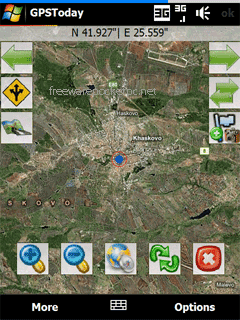
Satellite,Hybrid map views, and many more enhancements for ease of use.
Nearly worldwide support for many features that were previously US only.
Essentially the works, all in a still small package. More features are listed below the screenshots.
This software will not work on OS older than Windows Mobile 5.0 versions, or on any non-touchscreen smartphone. Data plan is recommended for online map features, but not necessary for offline features like geologging or geotagging. An Integrated GPS is advisable (but not mandatory) to fully enjoy the software.
Like it? Share with your friends!
If you got an error while installing Themes, Software or Games, please, read FAQ.
Supported operating systems:
Windows Mobile 5.0, Windows Mobile 6 Classic, Windows Mobile 6 Professional, Windows Mobile 6.1 Classic
Similar Software:
GPS2day GPS2day is a today screen plug-in showing your current GPS coordinates, speed, satellite info, etc...
Languages: English, Czech, Dutch, French, German, Hungarian, Italian, Japanese, Polish, Russian, Spanish.
Currently GPS2day program works as GPS informer. It supports both metric and U.S
Edinburgh Pocket A-Z map Edinburgh Pocket A-Z map - This publication has been designed for a Windows® Mobile-based Pocket PC (version 2002 or later) and The Pocket A-Z Viewer (included)
A-Z Mini London Street Atlas A-Z Mini London Street Atlas From the publishers of London''s best selling paperback street atlas comes this publication designed for a Windows® Mobile-based Pocket PC (version 2002 or later) and Pocket A-Z Viewer (included)
Free Earth Elevation Map for PrettyMap/PrettyEarth Earth Elevation Map for PrettyMap/PrettyEarth - This is a medium-resolution, free Earth elevation map for PrettyMap and PrettyEarth. It contains one elevation sample per 4 km, approximately.
Note: large file (16 MB download, 55 MB after installing).
Note for PrettyEarth users: this map will be installed to Program FilesPrettyMapmaps
CarDirections CarDirections - This program connects you to MapQuest.com, an online car map/direction service. NOTE: You must be connected to the internet to use this program.
This program requires that you have both the 'BeanDLL.dll' file ** and ** the runtime files for Visual Basic on your PocketPC computer
Pilot My-Cast by Garmin Pilot My-Cast® by Garmin makes it easy to page through surface meteorological reports, terminal forecasts, observations and advisories instantly as they become available
Map of Rotterdam / Netherlands for City Advisor Map of Rotterdam / Netherlands for City Advisor - A Rotterdam map of Netherlands for City Advisor.
Instructions:
1. Download the map (zip file)
2. Extract the files in /CityAdvisor/maps
3. Open CityAdvisor -> Maps icon -> Menu -> Refresh
4
amAze (LG) AmAze is a first of its kind free navigation and local search service. It is free to download and use and it contains wide coverage of maps including aerial photo in Europe, North America, Australia and parts of Asia and Africa
gpsVP gpsVP works on virtually any Windows platform including mobile ones. It shows vector and raster maps, records and shows tracks, shows multiple navigation parameters, manages and shows waypoints. It aims to be as usable as possible.
What's New in This Release:
· Geoid correction matrix: Updated values Atlantic & east America's
Comments on GPSToday:
Comments not found
If you noted an error or download link is broken, please, report it via this page or use comments.
GPSToday is compatible with your device O2 XDA Mantle (HTC Sedna 100)

")


")
