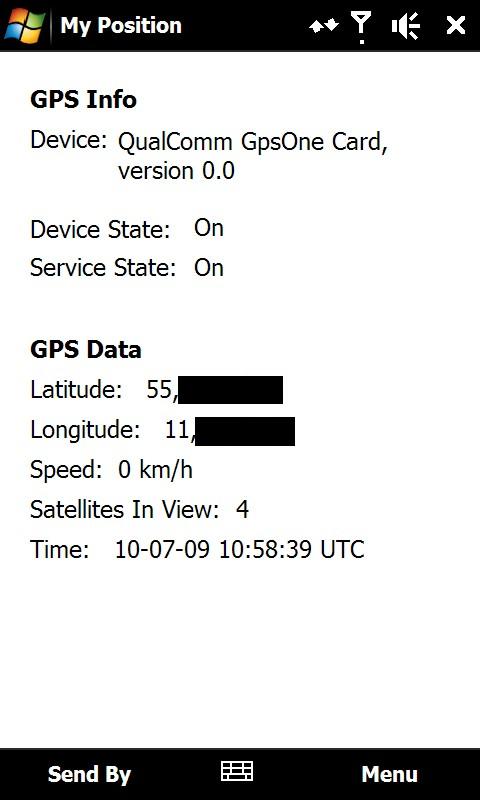
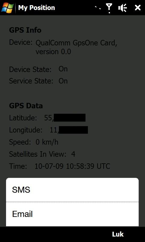
My Position - With My Position it is possible to see actual GPS information via the phone's built in GPS and send the position to others via sms or email.
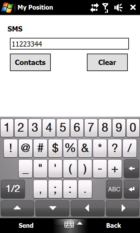
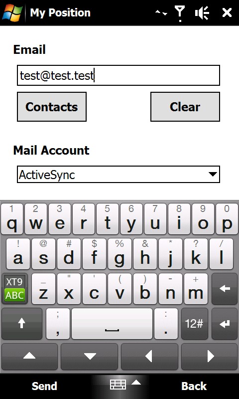
When sending the position via sms or email it is possible to enter a telephone number or email address. It is also possible to select a contact from the contact list.
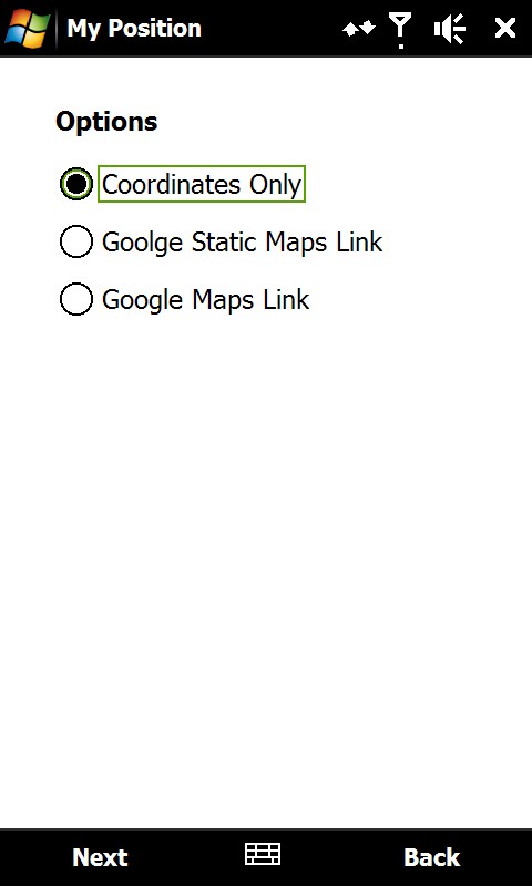
Sending the position is possible in three different ways:
1) As coordinates which can be inserted directly in Google Earth or Google Maps.
2) As a link to Google Static Maps. When the receiver opens the link the phones default web browser connects to the internet and shows the position on a map in 400x400 pixel resolution.
3) As a link to Google Maps. This option is mostly suitable when sending the position via email.
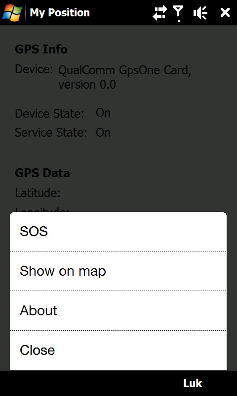
It is also possible to see ones own position on a map where Google Static Map is being used. The phones default web browser will open and connect to the internet and shows the position on a map in 400x400 pixel resolution.
This is a very good function when you are in a big city with many streets.
There is also a sos function which sends the position and a message of help. Again it is possible to send via sms or email.
Like it? Share with your friends!
If you got an error while installing Themes, Software or Games, please, read FAQ.
Supported operating systems:
Windows Mobile 6 Classic, Windows Mobile 6 Professional, Windows Mobile 6.1 Classic, Windows Mobile 6.1 Professional, Windows Mobile 6.5 Professional
Similar Software:
PictureMapperer PictureMapperer - PictureMapperer can be used to tag pictures/videos from your camera with a Google.com map and GPS data. When the program detects a new picture/video in the folder then it downloads a Google.com map and appends it to the end of the image/video with GPS information
FreeCaddie (Windows Mobile) FreeCaddie - Do you have a Windows Mobile phone with Bluetooth GPS support? Then you need FreeCaddie!
FreeCaddie is a completely free golf rangefinder. Our software runs on your phone and uses its GPS capabilities combined with our course file data to tell your distance to the front, center and back of the green
AgMapper AgMapper - Create maps using your Windows Mobile device. Measure lengths and view areas without the desktop PC.
AgMapper makes it easy to map what ever you like and share it with other software packages by using the very common shape file format (.shp) to store your mapping data.
Load images onto your map created using the FREE AgMapper Image Converter
3dtracking 3dtracking has revolutionized the tracking industry through the launch of it's PDA tracking software. Any Windows-based PDA (with access to an internal or external GPS receiver) can be tracked using the 3dtracking PDA software
PMWGPSTracking PMWGPSTracking allows you to plot your trip in a file (. KML).
The trace files can then be viewed and compared with Google Earth.
For each track you can define intermediate time (time stamp).
For each lap, the program calculates the duration, average speed and distance.
The trace files can be sent at regular intervals on an FTP server or an email address
DiaryGPS DiaryGPS - DiaryGPS can be used to make text diary notes based on your GPS. For each day the program creates a subfolder under the current storage folder with the text notes. You can view the notes via distance. Tap on the diary entry to view.
This program requires that you have both the 'BeanDLL
FON Access Points for United Arab Emirates FON Access Points for United Arab Emirates - FON offers you a new Points of Interest service (POIs). This allows you to download FONspots directly to your navigation device.
What does that mean? You can download a Points of Interest file directly to your navigation device
GPSbyGPRS (Pocket PC) GPSbyGPRS is a version of GPSbySMS made for Pocket PCs without GSM module
GPSRulerer GPSRulerer uses GPS to find two points and uses the "The Vincenty inverse formula for ellipsoids." (accuracy to within 0.5mm, or 0.000015"). Select 'Start GPS' to start the GPS and when you get a lock you can view your current GPS. Tap the button to save it and measure your distance. The map service is provided by Google
SirfGPSTweaker SirfGPSTweaker - application for displaying output from NMEA or SIRFBINARY based GPS device.
It has autodetection of data format (so it works both in NMEA or SIRF with on the fly detection). It can display statistics and data panel for cockpit use. Cockpit mode includes history graphs for speed and altitude
Other Software by developer «ULJ»:
Backlight Control A small and simple application to control the backlight

")


")


")


