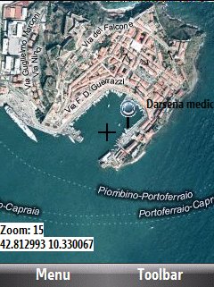
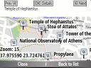
Bluemapia Mobile - View Maps, Search places and geotagged Wikipedia articles, GPS. Mobile Application for bluemapia, the new Web & Mobile Social Mapping for Boaters
- View Maps (OpenStreetMap and other web map servers)
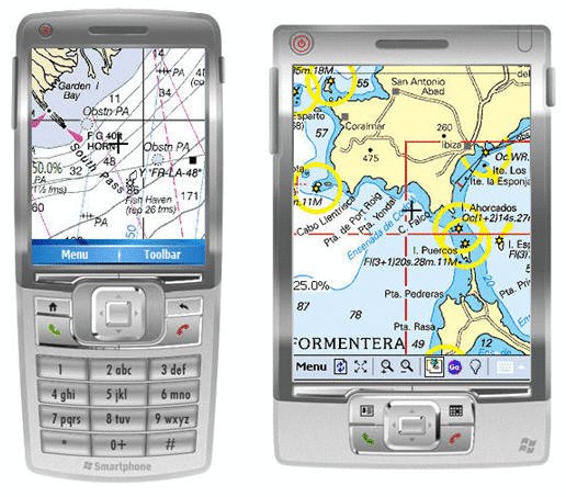
- Support BSB/NOAA Charts and raster, calibrated charts
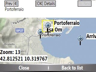
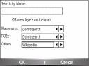
- Search places by name and bluemapia content from the web site
- View geotagged Wikipedia articles on the map
- Use a GPS to display your position on the map and set a terget destination
- Create tracks (gpx file)
- Shoot and upload photos and text to bluemapia for community sharing
Like it? Share with your friends!
If you got an error while installing Themes, Software or Games, please, read FAQ.
Supported operating systems:
Windows Mobile 2003, Windows Mobile 5.0, Windows Mobile 6 Classic, Windows Mobile 6 Professional, Windows Mobile 6.1 Classic, Windows Mobile 6.1 Professional, Windows Mobile 6.5 Professional
Similar Software:
Phonetracker4Free Phonetracker4Free - Received SMS are checked for location statements by Phonetracker4Free and transferred to Google Maps Mobile independently. Google Maps Mobile displays the location on a map or by satellite images, and takes over the routing to the destination if necessary
WMGpsShow Simple utility that shows/hides the GPS icon in Settings -> Connections
amAze (Windows Mobile) AmAze is a first of its kind free navigation and local search service. It is free to download and use and it contains wide coverage of maps including aerial photo in Europe, North America, Australia and parts of Asia and Africa
Locify With Locify you can explore interesting places near you from Wikipedia, seek for geocaches, display map where you are (or you want to go), twitter your location, save interesting places from phone or web sync them and even navigate to them... and much more.
Locify is free application for common mobile phone
FON Access Points for Netherlands FON Access Points for Netherlands - FON offers you a new Points of Interest service (POIs). This allows you to download FONspots directly to your navigation device.
What does that mean? You can download a Points of Interest file directly to your navigation device
TravelCompasses TravelCompasses - TravelCompasses uses the GPS on your PocketPC to find a "Home" position. Then the program displays a compass that rotates to your current GPS. The program also displays your current compass degrees.
This program requires that you have both the 'BeanDLL.dll' file ** and ** the runtime files for Visual Basic on your PocketPC computer
GPS.Friend GPS.Friend - This is user-friendly program,
allows you, with just two touches of your phone:
- get and review your current geographic location
- request someone's phone to give you his/her location
- review on the map your and someone's location.
You needn't know GPS, you needn't learn too much, about this program
WSpeedmeter Car speedometer for your windows mobile
PoliceSyncer PoliceSyncer - PoliceSyncer can be used by a Police officer to create dated GPS POI based note/picture/video logs and also share information on a secure remote FTP server with other police officers. The program uses the GPS on the PocketPC to find the distance of each GPS POI point and you can view or download the map the points on Google.com map service
FON Access Points for Switzerland FON Access Points for Switzerland - FON offers you a new Points of Interest service (POIs). This allows you to download FONspots directly to your navigation device.
What does that mean? You can download a Points of Interest file directly to your navigation device
Other Software by developer «Bluemapia»:
not found
Comments on Bluemapia Mobile:
Comments not found
If you noted an error or download link is broken, please, report it via this page or use comments.
Bluemapia Mobile is compatible with your device ORSiO n725


")


