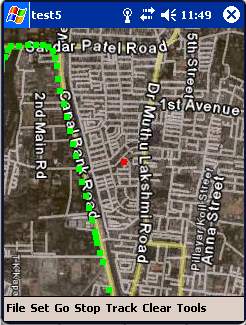
Movmap is a simple freeware GPS tracking program meant for WinCE/PocketPC machines. It can run on PNAs that use WinCE 4.2 .NET Core OS. See the movmap.txt file for details. Source codes for the program are also available.
The application is now called Movmap3D. It can load SRTM 90m elevation data files and display maps in 3D!
Like it? Share with your friends!
If you got an error while installing Themes, Software or Games, please, read FAQ.
Supported operating systems:
Pocket PC 2002, Windows Mobile 2003, Windows Mobile 5.0
Similar Software:
FileGPSer FileGPSer - FileGPSer uses the GPS on your PocketPC to find your current GPS location and allows you to re-name files on your PocketPC with the GPS location tag. You can also explore the files in a folder in distance order based on your current GPS. Tap on the file to view the file in the associated application.
This program requires that you have both the 'BeanDLL
Q-GPS Q-GPS - Q-GPS is a replacement for the built-in software A-GPS of the hw6515. A-GPS improve the speed to login of the GPS by downloading information on the net. Q-GPS make it possible to do the same, both for 2 and for 4 days. It does''nt use the same layer than HP firmware and avoid downloading freeze, usual with bluit-in software
EagleEye PDA Tracking System for HW6500/HW6900 Series EagleEye PDA Tracking System for HW6500/HW6900 Series - We at Targex Corp. have been in the vehicle tracking business for over 10 years, researching and offering products that are advanced and extremely reliable
FON Access Points for Palestinian Territory FON Access Points for Palestinian Territory - FON offers you a new Points of Interest service (POIs). This allows you to download FONspots directly to your navigation device.
What does that mean? You can download a Points of Interest file directly to your navigation device
GPS Tuner Essentials Full Version with Canada Basic Map Content GPS Tuner Essentials Full Version with Canada Basic Map Content is designed specifically for off-road use: its large buttons, selectable tool window size, multiple Compass views and the built-in Tele Atlas map makes it extremely user-friendly and reliable
DateGPSs DateGPSs - DateGPSs uses the GPS network to find the UTC date and time. The program shows the date and time in a 10 entry offset list. You can customize the times via decimal numbers for under 1 hour. The time offsets are saved to a file.
This program requires that you have both the 'BeanDLL.dll' file ** and ** the runtime files for Visual Basic on your PocketPC computer
ExerciseGPSs ExerciseGPSs - ExerciseGPSs uses the GPS on your PocketPC to view on a large display your walking/running/riding speed on a moving graph. You can use this to keep your exercise pace. NOTE: The program does not display/graph 0 speeds.
This program requires that you have both the 'BeanDLL.dll' file ** and ** the runtime files for Visual Basic on your PocketPC computer
Mobile Notes "Where I've been?" feature
Record track lines, points of interest(POI).
Different colors indicate different speed route.
Record text, picture and video style POI.
Record raw gps nmea data for reference and analysis.
Attach pictures to tags of geographical information
SMSGPSing SMSGPSing allows you to send your GPS location readings and a Google.com map link to a person via SMS