Terracrosser is a free GPS navigation software for Windows Mobile Pocket PC.
· Terracrosser works in Map and Photo modes
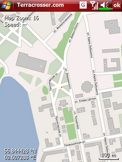
· Terracrosser uses zoomable maps
· Terracrosser is completely compatible with Google Maps service. With included Mapper module you can download maps from the Internet. All maps are automatically calibrated (geo-referenced)
What's New in This Release:
Terracrosser:
· POI system
· enhanced scrolling
· multiple options in settings menu
· maps correction to improve default maps calibration
Mapper:
· limited region to download non-square part of map
Like it? Share with your friends!
If you got an error while installing Themes, Software or Games, please, read FAQ.
Supported operating systems:
Windows Mobile 5.0, Windows Mobile 5.0 Smartphone, Windows Mobile 6 Classic, Windows Mobile 6 Professional, Windows Mobile 6 Standard, Windows Mobile 6.1 Classic, Windows Mobile 6.1 Professional, Windows Mobile 6.1 Standard, Windows Mobile 6.5 Professional, Windows Mobile 6.5 Standard
Similar Software:
TrekBuddy Trekbuddy is a J2ME application to be used with a GPS receiver. It is designed to work with every Java-enabled device. It features capabilities such as: * GPS tracking and simple navigation * bitmap maps (without zoom, you can store bitmap maps with different resolution instead)
Map of New Mexico (US State) Map of New Mexico (US State) - A map of the New Mexico by VITO Technology. Good for intercity travels with SmartMap.
SmartMap is a mobile device application which uses vector and raster maps. It is compatible with any NMEA protocol GPS receiver (Compact Flash socket, serial port, BlueTooth or sleeve)
MetrO Pocket PC Metro finds your way in public transport systems in more than 350 cities around the world (Paris, New York, London, Tokyo, any city with a subway & many more!).
FREE, FAST & ACCURATE
A-Z Mini Birmingham Street Atlas A-Z Mini Birmingham Street Atlas - From the publishers of London''s best selling paperback street atlas comes this publication designed for a Windows® Mobile-based Pocket PC (version 2002 or later) and Pocket A-Z Viewer (included)
Rough Guides Map Paris Rough Guides Map Paris... These guides are a series of fantastic interactive maps.
Produced in conjunction with the premier travel publisher Rough Guides.
Discover and explore Paris using full colour interactive linked maps, in this simple to use PDA version of The Rough Guides Paris
LiteTrack LiteTrack is the right tool to record your route, save off-road paths, retrace a way, get your position on the map with detailed gps data (satellite charts, speed and much more)
LittleWays LittleWays - LittleWays is a simple route calculator for subways, tramways, bus lines and rapid train railways.
Using LittleWays you can provide start and end station and LittleWays will calculate all possible ways and displays them in a list. It's your choice which way you use. After selecting a route it will be displayed as a bold red line
Moscow Map Moscow Map - Full map solution for Pocket PC
View map:Display map,select objects,zoom,pan,...
Search: Search street,location,..by name
Shortest path: Show shortest path and total distance.
GPS: Connect to GPS device by bluetooth,go to location in map
Bristol Pocket A-Z Map Bristol Pocket A-Z Map - This publication has been designed for a Windows® Mobile-based Pocket PC (version 2002 or later) and The Pocket A-Z Viewer
Map of Toulouse (French) / France for City Advisor Map of Toulouse (French) / France for City Advisor - Toulouse / France map in French for City Advisor. It has 2 metro lines.
1. Download the map (zip file)
2. Extract the files in /CityAdvisor/maps
3. Open CityAdvisor -> Maps icon -> Menu -> Refresh
4
Other Software by developer «Nitisara»:
not found
Comments on Terracrosser:
Comments not found
If you noted an error or download link is broken, please, report it via this page or use comments.
Terracrosser is compatible with your device Pharos Traveler 535e / 535PB / 535+ / 535x / 535XB / 535


")


 / France for City Advisor")