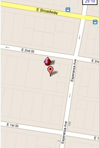
Hunting the Snark - Inspired by Lewis Carrol's poem, The Hunting of the Snark, Hunting the Snark is an action game played on both your GPS-enabled Android device and in the real world. In it, you hunt a Snark (the creature on the map in blue.) If you invade its physical location before the game time has expired, you win. Otherwise, you lose. Also, at random intervals the Snark becomes a Boojum. Your device will vibrate and the creature will turn red, and it will then attack you until a random interval expires, at which time it will become a Snark again. If, as a Boojum, it invades your physical space, you lose.
NOTE: the accuracy of the game is around 3 yards (2.5 meters.) Keep this in mind when you have the map zoomed in close.
Please play responsibly, in areas of low traffic. Adult supervision is recommended.
In the menu, you can pause or stop the game, start a new one, change the screen's orientation, and modify the settings, which include the Snark's speed, the game time, whether the Snark must remain within the region of the map, and the type and zoom-level of the map. Also, you can move the map around with your finger.
This game requires Internet access and an active GPS service, and your device must be facing an open sky. It is also STRONGLY recommended that you turn off other locator services. Though this may be dependent on your particular location and your service provider. The app has been tested on Android 2.2. It may or may not work on other systems.
What's New in This Release:
· Changed character design and animation
· Improved user notifications
· Minor UI improvements
· Replace AdSense with AdMob
Like it? Share with your friends!
Supported operating systems:
Google Android 10.x, Google Android 2.2, Google Android 2.3, Google Android 3.0, Google Android 3.1, Google Android 3.2, Google Android 4.0, Google Android 4.1, Google Android 4.2, Google Android 4.3, Google Android 4.4, Google Android 5.x, Google Android 6.x, Google Android 7.x, Google Android 8.x, Google Android 9.x
TrekBuddy Trekbuddy is a J2ME application to be used with a GPS receiver. It is designed to work with every Java-enabled device. It features capabilities such as: * GPS tracking and simple navigation * bitmap maps (without zoom, you can store bitmap maps with different resolution instead)
GPS Map Camera use GoogleMap GPS Map Camera use GoogleMap - The main feature of the 'GPS Map Camera':
When you take a piture with GPS enabled, it will paste the google map, address and weather to picture. (GPS latitue/longitude also include in the information)
Please enable your network and GPS function before using this application
GPShake Lite With GPShake you can track your GPS location, create GPX files, whenever you want with a shake of your phone! This means battery life saving! A great usage example could be when you want to geotagging your photo made with an external camera
Live Tracker With Live Tracker the location of your Android phone can be tracked in real-time using a web browser. You can send an invitation email to selected contacts containing the link to track your location. Live Tracker provides continuous feedback about the number of web browsers tracking your location
Path Finder Path Finder is a free Android mobile app built at Paxcel Labs that records your GPS positions while you walk or drive and helps you track and record your routes making it easy to remember your way or where you parked your car or bike
MySpeed MySpeed will record your speed and location to a log file and show it on a map.
It can use a database of speed camera locations to alert you when you're near a speed camera.
There is no speed camera database included. You'll need to download the data from a site such as scdb.info, flitspaal.nl, pocketgpsworld.com, maparadar.com, etc
EV Speedo EV Speedo is a GPS based speedometer with gadgets to provide g-force and other GPS information.
A built in map is also provided and any of the gauges provided can be overlayed upon the map, for example use the map to show your location with a speedometer to show your current speed
MarineTraffic.com MarineTraffic.com - Real-time ships positions based on Automatic Identification System (AIS). Watch the positions reported by more than 35000 vessels per day on an interactive Google map.
The application provides worldwide coverage of more than 850 ports and a significant number of open-sea areas.
Port arrivals and departures are recorded in real-time
NAVIGON Eastern Europe for Android NAVIGON Eastern Europe for Android - NAVIGON turns your mobile device into a fully featured GPS navigation system. The software provides advanced functionality for both drivers and pedestrians, including 2D and 3D maps, route planner, speed assistant, voice directions, local search, and more
Other Software by developer «Colin Cohen»:
not found
Comments on Hunting the Snark:
Comments not found
If you noted an error or download link is broken, please, report it via this page or use comments.
Hunting the Snark is compatible with your device Planet Computers Astro Slide 5G Transformer Global Dual SIM TD-LTE 128GB