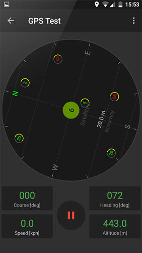
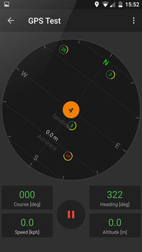
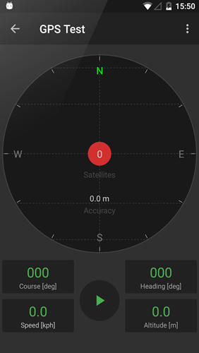
GPS Tools - is an application for calibration of a satellite module of your smartphone. The utility uses a magnetic compass, makes changes to the route, speed and accuracy of the displayed data. As soon as the calibration is completed you can track your location with maximum accuracy.
Game features:
Magnetic compass
Commercial free
Fast calibration
Big number of satellites
Like it? Share with your friends!
Supported operating systems:
Google Android 10.x, Google Android 4.4, Google Android 5.x, Google Android 6.x, Google Android 7.x, Google Android 8.x, Google Android 9.x
Similar Software:
Find Your Android Find Your Android - Do you want to become 007? It's difficult, but you can own some tools like his. Find Your Android is a tool for people who want to locate their cell phone
amAze (Android) AmAze is a first of its kind free navigation and local search service. It is free to download and use and it contains wide coverage of maps including aerial photo in Europe, North America, Australia and parts of Asia and Africa
Geo note Geo note - is an organizing application for Android device users which takes into consideration your current location. When you are in a certain place your smartphone will remind you about coming event or task to complete
MileageTrac Mileage Tracker MileageTrac Let the Genie Out of Your Android! Automatic Mileage Tracking MileageTrac is a powerful application that uses your devices built-in GPS to automatically track and calculate your auto mileage
BeBack Light BeBack Light - A GPS tracking and voice navigation utility economizing the battery charge.Suitable for hunters, fishers or other adventure finders: allows to walk straight to the target point with free hands according to the voice pointers, having your PDA in a pocket with the switched off screen and saving the battery charge on the way
Hansel and Gretel Backtracking GPS Hansel and Gretel Backtracking GPS - A simple and highly effective backtracking GPS that does not require a network connection or maps. Hansel and Gretel will remember any location. When it is time to return just follow the arrow or radar image. If only the fairy tale characters had downloaded this app...
From DS Software, the leader in quality mobile navigation tools
GPS2OpenGTS Free GPS2OpenGTS will send your GPS data to an OpenGTS tracking system.
Latest version now supports UDP.
Also added is a Test function/screen to help with server configuration.
Send a NMEA GPRMC strings with the following data.
(accountID, deviceID, Latitude, Longitude, Speed, Heading and Altitude
Android Photo GeoTag Android Photo GeoTag - Take pictures with your mobile phone and incorporate the data of the geographical location. The application allows you to include in the photographs, data from the GPS receiver, along with a brief note. If you know the coordinates, not having the GPS receiver, you can also handwrite geographic data
Smart Tools Smart Tools is a complete package of 6 app sets. I
EV Speedo EV Speedo is a GPS based speedometer with gadgets to provide g-force and other GPS information.
A built in map is also provided and any of the gauges provided can be overlayed upon the map, for example use the map to show your location with a speedometer to show your current speed
Comments on GPS Tools:
Comments not found
If you noted an error or download link is broken, please, report it via this page or use comments.
GPS Tools is compatible with your device Planet Computers Cosmo Communicator TD-LTE


")


