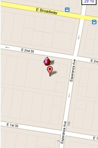
Hunting the Snark - Inspired by Lewis Carrol's poem, The Hunting of the Snark, Hunting the Snark is an action game played on both your GPS-enabled Android device and in the real world. In it, you hunt a Snark (the creature on the map in blue.) If you invade its physical location before the game time has expired, you win. Otherwise, you lose. Also, at random intervals the Snark becomes a Boojum. Your device will vibrate and the creature will turn red, and it will then attack you until a random interval expires, at which time it will become a Snark again. If, as a Boojum, it invades your physical space, you lose.
NOTE: the accuracy of the game is around 3 yards (2.5 meters.) Keep this in mind when you have the map zoomed in close.
Please play responsibly, in areas of low traffic. Adult supervision is recommended.
In the menu, you can pause or stop the game, start a new one, change the screen's orientation, and modify the settings, which include the Snark's speed, the game time, whether the Snark must remain within the region of the map, and the type and zoom-level of the map. Also, you can move the map around with your finger.
This game requires Internet access and an active GPS service, and your device must be facing an open sky. It is also STRONGLY recommended that you turn off other locator services. Though this may be dependent on your particular location and your service provider. The app has been tested on Android 2.2. It may or may not work on other systems.
What's New in This Release:
· Changed character design and animation
· Improved user notifications
· Minor UI improvements
· Replace AdSense with AdMob
Like it? Share with your friends!
Supported operating systems:
Google Android 10.x, Google Android 2.2, Google Android 2.3, Google Android 3.0, Google Android 3.1, Google Android 3.2, Google Android 4.0, Google Android 4.1, Google Android 4.2, Google Android 4.3, Google Android 4.4, Google Android 5.x, Google Android 6.x, Google Android 7.x, Google Android 8.x, Google Android 9.x
Similar Software:
OSMTracker for Android OSMTracker stands for OpenStreetMap Tracker. It allows you to track your journey and mark significant way points. Way points can be marked with a tag using a button, with a quick voice record, a text note or by taking a picture. The various button pages and layouts can be customized to suit your OpenStreetMap activities
JTrip JTrip - Create your own trip in Thailand. JTrip recommends attractions and directions that you need. Let's get to know Thailand together.
· select places.
· select hotel.
· show map location.
· route path form src to dest.
· taxi, time remaining.
· suggest bus number
Redpin The aim of the Redpin project is to create an open source system that allows indoor positioning up to room-level description using mobile phones
TomTom Brazil for Android TomTom Brazil for Android - TomTom Brazil is a turn-by-turn GPS navigator for Android devices. The app includes accurate offline maps, so you can find your way anywhere, even without an internet connection
NavStarter NavStarter is a little app that can be used for the Google Navigation Hack to navigate to an address without first creating a shortcut
Fleet Activity Logger Fleet Activity Logger - Why do you need Fleet Activity Logger application?
- Track your fleet to increase your productivity
- View entire fleet on a single map screen
How to start?
1. Install the application on your Android phone.
2. Create your account by providing your email id, phone number of the device, name, country and submit it.
3
Android Photo GeoTag Android Photo GeoTag - Take pictures with your mobile phone and incorporate the data of the geographical location. The application allows you to include in the photographs, data from the GPS receiver, along with a brief note. If you know the coordinates, not having the GPS receiver, you can also handwrite geographic data
FindShip FindShip - Find any ship all over the world! With FindShip, you can track your vessel' movements realtime on the mapFeatures:• * Nearly 80,000 ships online.• * Covering most ports on the world.• * Detail ship's information. In addition to AIS information, D.W.T/Gross ton/Build year is also provided.• * Powerfull ship/port search engine
Back2It Back2It is not just a car locator.
With one click, you may mark places like:
- parking lots
- favorite restaurants
- museums
- theaters
- public park
...
and 1 click to go back with GPS navigation on Google Map.
Switch to Google Map for route
VGPS (Vietnamese GPS) for Android VGPS was designed to use city street map on your ordinary mobile phone without the need of having GPS receiver or internet connection. VGPS does not require internal or external GPS receiver. However, if you have internal GPS receiver or external bluetooth GPS receiver, VGPS can work with your GPS receiver as well
Other Software by developer «Colin Cohen»:
not found
Comments on Hunting the Snark:
Comments not found
If you noted an error or download link is broken, please, report it via this page or use comments.
Hunting the Snark is compatible with your device Planet Computers Cosmo Communicator TD-LTE


 for Android")