Categories: Internet & Communications, Travel & Navigation
Upload date: 5 Nov 11
Developer: Waze
License: Freeware
Downloads: 4814 File Size: 8774 Kb
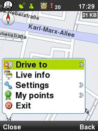
Waze: Community GPS navigation - Waze is a free, 100% user-generated, social navigation app that allows drivers to build and use live maps & real-time traffic updates to improve their daily commute.
In addition to providing turn-by-turn navigation, waze also gives drivers the ability to actively update one other on traffic, police traps, construction, speedcams and more, reflecting a live description of the road at any given moment and because it's user-generated, the more people who use it, the better (and more fun) it gets!
Here is what users are saying about us:
* Im in love already! I don't usually get this excited about things, but I am about waze.
* Coolest navigation app I've seen in a while, hope more people sign up in my area!!
* Waze is an amazing collaborative GPS mapping application!
***
Constantly-updated road map
Real-time traffic updates
Automatic rerouting
Live reports from users on the road
Turn-by turn directions
Road tweets - Twitter integration
Picture sharing from the road
Like it? Share with your friends!
Supported operating systems:
Google Android 1.0, Google Android 1.5, Google Android 1.6, Google Android 10.x, Google Android 2.0, Google Android 2.1, Google Android 2.2, Google Android 2.3, Google Android 3.0, Google Android 3.1, Google Android 3.2, Google Android 4.0, Google Android 4.1, Google Android 4.2, Google Android 4.3, Google Android 4.4, Google Android 5.x, Google Android 6.x, Google Android 7.x, Google Android 8.x, Google Android 9.x
Similar Software:
ZoeMob Family Locator ZoeMob Family Locator - ZoeMob Family Locator is the ultimate app for families. With over 5 million registered users, it´s the next generation of the family safety services.
With ZoeMob you can receive alerts if your kids arrive at school or home, if they are over the speed limit (school bus) and if they are sending or receiving bullying and sexting messages
Mobilex GPS Logger Mobilex GPS Logger - Overview ========================== The Android GPS Logger application captures GPS updates, and saves latitude and longitude coordinate fixes to text files on micro SD card. Supported Features inlcude: ============================== Google Maps. Satellite, Traffic and Street Views
Tricorder Tricorder - A simple tricorder simulator for Android powered phones, using real sensors to detect magnetic fields, gravity, etc. See the passing gravity wave from a distant collapsar on your phone screen (actual device sensitivity may be insufficient to detect gravity waves). Detect buried powerful magnets! Be a mega-geek! Etc
AntipodalPoint AntipodalPoint retrieves you position from the network provider or GPS and calculates and shows you antipodal point - the place exact opposite of you on Earth.
AntipodalPoint Pro enables you to browse the entire world and find antipodal points
CompassNavi Compass / Navigation Activity, mainly for OpenGPX, but can be used from any application
OSMTracker for Android OSMTracker stands for OpenStreetMap Tracker. It allows you to track your journey and mark significant way points. Way points can be marked with a tag using a button, with a quick voice record, a text note or by taking a picture. The various button pages and layouts can be customized to suit your OpenStreetMap activities
GPS Assistant GPS Assistant - GPS Assistant is a simple and intuitive app which shows location data from the GPS receiver. You can check your coordinates (latitude and longitude) and altitude. Additionally, it includes a speedometer.
What's New in This Release:
· Changed ad network
What's New in 1
Magellano Navigator GPS Magellano Navigator GPS - Magellan will lead you to your destination using the GPS of the smartphone and the engine of Google Maps (registered trademark from the rightful owner) or other application of road maps. You can set the destination by typing in the box or by speaking after activating the voice mode
GPS Coordinates Converter GPS Coordinates Converter - With this app you can convert GPS coordinates from "degrees, minutes, decimal seconds" to "decimal degrees".
What's New in This Release:
· Locate your phone and show the coordinates
What's New in 2
MarineTraffic.com MarineTraffic.com - Real-time ships positions based on Automatic Identification System (AIS). Watch the positions reported by more than 35000 vessels per day on an interactive Google map.
The application provides worldwide coverage of more than 850 ports and a significant number of open-sea areas.
Port arrivals and departures are recorded in real-time
Other Software by developer «Waze»:
Waze Waze is a free, 100% user-generated, social navigation application that allows drivers to build and use live maps & real-time traffic updates to improve their daily commute
waze Waze - Waze is a free, 100% user-generated, social navigation application that allows drivers to build and use live maps & real-time traffic updates to improve their daily commute
Waze Waze is a free, 100% user-generated, social navigation application that allows drivers to build and use live maps & real-time traffic updates to improve their daily commute
Waze (iPhone/iPad) Waze is a free, 100% user-generated, social navigation application that allows drivers to build and use live maps & real-time traffic updates to improve their daily commute
Waze Waze is a free, 100% user-generated, social navigation application that allows drivers to build and use live maps & real-time traffic updates to improve their daily commute


")
