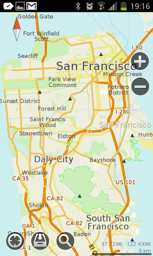
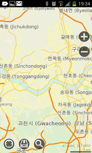
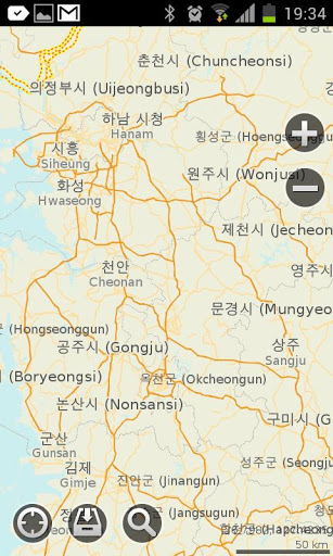
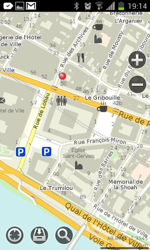
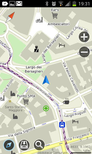
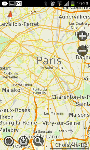
MapsWithMe Pro for Android - MapsWithMe allows you to access maps of all the countries in the world while on the go. The maps are based on OpenStreetMap data and work completely offline, without requiring an internet connection.
With MapsWithMe installed on your iOS device, you can find out your current location using GPS, search for points of interest, bookmark favorite spots, and more. MapsWithMe Pro for Android features:
· All countries, all cities covered
· High level of detail
· Offline search, auto-suggestion feature
· Thousands of POI
· Bookmarks
· GPS positioning and compass
· Map rotation and auto-follow mode
· Vector maps
· Innovative map data compression method
· English, Russian, Spanish, German, Czech, Dutch, Japanese, Korean supported
What's New in This Release:
· Fixed bug on Samsung Galaxy S4 GT-I9500
What's New in 2.5.0:
· Paths/lines/tracks import from KML. Finally you can display and use the lines from other apps in MapsWithMe. Import KML file to MapsWithMe and view the projected route on the map. Further improvements are coming soon.
· Map data updated
· Bug fixes
What's New in 2.4.6:
· Map updates notification. You do not need to check whether new map details are available or not any more. Now the app informs you which maps need to be updated
· Travel guides availability notification. To help you make your travel more enjoyable, we provide reliable country information. Once you've downloaded the map, free travel guide GuideWithMe app can be offered for your destination
· Android 4.3 support
· Map data updated
· Bug fixes
What's New in 2.4.4:
· New option is available: get and copy precise coordinates of any point on the map. Coordinates info is displayed on the POI information screen
· Fresh OpenStreetMap data
· Bug fixes
What's New in 2.3.5:
· We made maps faster!
· Added Poland and Ukraine translations: the option of searching by keywords in native language is enabled for you.
· Optimized for new devices' screens
· Changed UI color theme to white
· Fixed installation issue on some Android devices
What's New in 2.3.4:
· optimized the map brightness and contrast
· changed the map fonts
· fixed the bugs
What's New in 2.3.3:
· Meet a brand new feature - location sharing! It enables you to send a pin to any place on the map via e-mail or sms.
· Traditional Chinese, Korean, Japanese, Dutch, Ukrainian languages added
· API for external apps via geo url scheme added
· Map data updated
· Smoother map handling
What's New in 2.3.2:
· IMPORT/EXPORT OF BOOKMARKS. Share your favorite places with friends via email or add bookmarks from other maps to MapsWithMe. KML/KMZ files are supported.
· "My position" arrow problem fixed
· Map data updated
· Smoother map handling
What's New in 2.3.0:
· Bookmarks feature! Now you are able to mark and save your favorite locations, POI and destinations. The option of creating a group of bookmarks is added
· Improved search: more detailed categories; an option to choose the location where to search is available
· Compass and GPS issues fixed
· Map data updated
What's New in 2.2.1:
· There are lots of improvements and bug fixes in the new version.
Like it? Share with your friends!
Supported operating systems:
Google Android 10.x, Google Android 2.1, Google Android 2.2, Google Android 2.3, Google Android 3.0, Google Android 3.1, Google Android 3.2, Google Android 4.0, Google Android 4.1, Google Android 4.2, Google Android 4.3, Google Android 4.4, Google Android 5.x, Google Android 6.x, Google Android 7.x, Google Android 8.x, Google Android 9.x
Similar Software:
Google Maps (Android) Google Maps - Now you can get business locations, maps and directions while you're on the go. And it's all free.
· Navigation: Free, voice-guided GPS navigation system using GPS with Google Maps
· Places: Find nearby places and see hours, reviews, etc
OS Map OS Map is a tool to turn your Android phone into a handy Ordnance Survey map, with your GPS position pinpointed on it!
· Nearly all OS Map scales available (including 250,000 and 50,000).
· Touch-scrolling - simply use your finger to drag the map around.
· Fast resume from standby and fast position updates
InstaMapper (Android) InstaMapper is a free service that allows you to track a person or vehicle online in real time using a GPS-enabled mobile phone.
To use InstaMapper, you create a free account. Registration takes only a minute or two. All it is asked for is a username, password, and a valid email address.
Next, you install a small application on your GPS-enabled phone
TrekBuddy Trekbuddy is a J2ME application to be used with a GPS receiver. It is designed to work with every Java-enabled device. It features capabilities such as: * GPS tracking and simple navigation * bitmap maps (without zoom, you can store bitmap maps with different resolution instead)
Locus - addon AR This is BETA version of simple addon for Locus mapping application (version 1.1.0 and higher). Allow to show actual POI's visible on map, in Augmented reality view. In Locus Free, usage is limited to 1 minute. This addon do not have any screen or widget
London DK Eyewitness Top 10 Travel Guide & Map (BlackBerry) London DK Eyewitness Top 10 Travel Guide & Map (BlackBerry)- From the top 10 ways to experience Royal London to the top 10 shops, pubs and hotels - this guide features the insider knowledge that every visitor needs, plus London maps and metro maps.
Capture the essence of London, from shopping in Harrods to the Changing of the Guard at Buckingham Palace
AugSatNav Walk AugSatNav is an augmented reality navigation system which overlays walking directions upon a live video feed of the path or road ahead.
With AugSatNav there is no need to follow instructions or interpret maps - you can simply find your way by walking along the route highlighted by a bright white line
Maps In My Pocket (MIMP) Maps In My Pocket - The main goal of this application is to allow its users to view maps, locate themselves, follow KML or GPX formatted tracks and getting directions from place to place.
What's New in This Release:
· New Icon
What's New in 1.4.3:
· Long press and long pinch concurrency on info bubble solved
ShareYourDrive ShareYourDrive Transportation and cars especially are contaminating. Imagine with a few clicks, you can know who can give you a ride. The time real geolocalisation to save environment. Don't be afraid about security. Historic helps to know who was with you, when and where. Moreover you can give a rate to the persons you meet
JTrip JTrip - Create your own trip in Thailand. JTrip recommends attractions and directions that you need. Let's get to know Thailand together.
· select places.
· select hotel.
· show map location.
· route path form src to dest.
· taxi, time remaining.
· suggest bus number
Other Software by developer «MapsWithMe»:
MapsWithMe Pro for iPhone/iPad MapsWithMe Pro for iPhone/iPad - MapsWithMe allows you to access maps of all the countries in the world while on the go. The maps are based on OpenStreetMap data and work completely offline, without requiring an internet connection
MAPS.ME for iPhone/iPad 3. MAPS.ME for iPhone/iPad 3. - MapsWithMe allows you to access maps of all the countries in the world while on the go. The maps are based on OpenStreetMap data and work completely offline, without requiring an internet connection
MAPS.ME for Android MAPS.ME for Android - MapsWithMe allows you to access maps of all the countries in the world while on the go. The maps are based on OpenStreetMap data and work completely offline, without requiring an internet connection
MapsWithMe Lite for iPhone/iPad MapsWithMe Lite for iPhone/iPad - MapsWithMe allows you to access maps of all the countries in the world while on the go. The maps are based on OpenStreetMap data and work completely offline, without requiring an internet connection
MAPS.ME Lite for iPhone/iPad 3. MAPS.ME Lite for iPhone/iPad 3. - MapsWithMe allows you to access maps of all the countries in the world while on the go. The maps are based on OpenStreetMap data and work completely offline, without requiring an internet connection


")

")


")

")


