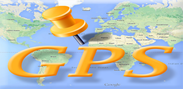
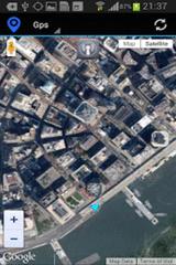
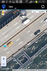
Gps Maps - Gps with Google Map, live current position. Very simple to use. It is the most easy way to know your exactly coordinates. Only 1.2 KB
Like it? Share with your friends!
Supported operating systems:
Google Android 10.x, Google Android 2.3, Google Android 3.0, Google Android 3.1, Google Android 3.2, Google Android 4.0, Google Android 4.1, Google Android 4.2, Google Android 4.3, Google Android 4.4, Google Android 5.x, Google Android 6.x, Google Android 7.x, Google Android 8.x, Google Android 9.x
uWho Find Me uWho Find Me will send a text message with your current location to help people find you.Simply have your friend or family member send you a text with your uWho Find Me Access code as the body of the text and your current location will be sent back.
Notes:
Application runs on phone boot up
Locate My Team Locate My Team - Why do you need Locate My Team application?
1. Locate My Team tracks, monitors and manages an individual or group of people for operational and safety security reasons.
How to start?
1. Install the application on your Android phone.
2. Create your account by providing your email id, phone number of the device, name, country and submit it.
3
Nearby Get & Go Get Set Go is an easy to use app which helps you to find ATM, Banks, Gas Stations, Restaurants, Bar, Cafe, Hospitals, Hotels, Taxi, Movie Theatres, Beauty Salon, Wi-Fi spots or virtually anything near you
Car Service Finder This is free android app and it have Car dealer, Car rental, Car repair and Car wash place details. you can search any place any time any where without any registration. You can share your location to your friends family and others
My Fleet Geofence My Fleet Geofence - Why do you need My Fleet Geofence application?
1. With My Fleet Geofence, you can create a specific "safe zone" or "unauthorized zone" on a map and get an E-mail Alert if the phone leaves the area.
2. Receive an instant alert in case of breach of specific zone.
How to start?
1. Install the application on your Android phone.
2
ParkLeitSystem ParkLeitSystem is a car-park-routing system. It shows you, according to your GPS position, the nearest city with a car-park-routing system and gives you a list with all available car-parkings and shows how many free places there are. With a click on the parking it switches to google maps and shows you the position of the parking
GpsTicker Gpsticker is a program for outdoor orientation and navigation with GPS, it is best for hiking and biking. Maps are downloaded automatically from OpenStreetMaps, provided the Phone has an active internet connection
Digital Dashboard GPS Digital Dashboard GPS - Features included
- Save your track info,Record gpx file(it will be saved in "sdcard/DigitalDashboardGPS/gpx/")..
- Switch between car speedometer and bike cyclometer.
- Switch between mph or km/h mode.
- Display satellites status.
- Speed chart.
- Map integration,get your location.
……
Facebook:https://www.facebook
Other Software by developer «Kayipkayik@gmail.com»:
not found
Comments on Gps Maps:
Comments not found
If you noted an error or download link is broken, please, report it via this page or use comments.
Gps Maps is compatible with your device Planet Computers Gemini PDA LTE


")


