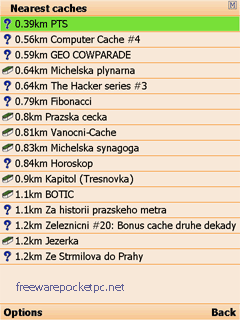
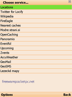
With Locify you can explore interesting places near you from Wikipedia, seek for geocaches, display map where you are (or you want to go), twitter your location, save interesting places from phone or web sync them and even navigate to them... and much more.
Locify is free application for common mobile phone. It can use phone's internal GPS or connected bluetooth GPS and is fairly usable even without any GPS device.
What's New in This Release:
· Map and navigation fix on certain phones
Like it? Share with your friends!
If you got an error while installing Themes, Software or Games, please, read FAQ.
Supported operating systems:
Java ME, Java Nokia 240x320, Java SE 240x320, Pocket PC 2002, RIM BlackBerry OS 1.0, RIM BlackBerry OS 2.0, RIM BlackBerry OS 3.x, RIM BlackBerry OS 4.0, RIM BlackBerry OS 4.1, RIM BlackBerry OS 4.2, RIM BlackBerry OS 4.3, RIM BlackBerry OS 4.5, RIM BlackBerry OS 4.6, RIM BlackBerry OS 4.7, RIM BlackBerry OS 5.0, RIM BlackBerry OS 6.0, Windows Mobile 2003, Windows Mobile 2003 Smartphone, Windows Mobile 5.0, Windows Mobile 5.0 Smartphone, Windows Mobile 6 Classic, Windows Mobile 6 Professional, Windows Mobile 6 Standard, Windows Mobile 6.1 Classic, Windows Mobile 6.1 Professional, Windows Mobile 6.1 Standard, Windows Mobile 6.5 Professional, Windows Mobile 6.5 Standard
Similar Software:
FON Access Points for British Virgin Islands FON Access Points for British Virgin Islands - FON offers you a new Points of Interest service (POIs). This allows you to download FONspots directly to your navigation device.
What does that mean? You can download a Points of Interest file directly to your navigation device
GPS Tuner Essentials Full Version with British Isles Basic Map Content GPS Tuner Essentials Full Version with British Isles Basic Map Content is designed specifically for off-road use: its large buttons, selectable tool window size, multiple Compass views and the built-in Tele Atlas map makes it extremely user-friendly and reliable
mdNavMobile mdNavMobile is a waypoint-based GPS navigation solution for the Windows Mobile platform. It can guide you from waypoint to waypoint while keeping you informed of all relevant navigation data. All NMEA-data from a GPS is automatically logged to file so you can 'replay' a trip with variable speed
YourGPSPosition YourGPSPosition - This simple app will check your position and show your coordinates and your position on a Bing map.
Disclaimer:
This application is for entertainment purposes only and not intended for use as any means of navigation.
The developer of YourGPSPosition is not responsible for any damages as a result of the use of YourGPSPosition by you or a third party
Movmap GPS Tracker (Movmap3D) Movmap GPS Tracker (Movmap3D) is a simple freeware GPS tracking program meant for WinCE/PocketPC machines. It can run on PNAs that use WinCE 4.2 .NET Core OS. See the movmap.txt file for details. Source codes for the program are also available.
The application is now called Movmap3D
FON Access Points for Austria FON Access Points for Austria - FON offers you a new Points of Interest service (POIs). This allows you to download FONspots directly to your navigation device.
What does that mean? You can download a Points of Interest file directly to your navigation device
Mobile Tracking System Mobile Tracking System is a new project from Fightersoft Multimedia that provides real time tracking and messaging services.
How does it work?
The client version of MTS is a smartphone application that can get the identification data of the current cell in use by the mobile phone
PoliceSpeeders PoliceSpeeders - PoliceSpeeders can be used by a police officer for an informal police speed trap. Enter the distance between the two points in settings and metric/imperial and tap the button or joypad when a car hits the start line and then again at the end line. The program calculates the estimated speeds into a log file
FON Access Points for New Zealand FON Access Points for New Zealand - FON offers you a new Points of Interest service (POIs). This allows you to download FONspots directly to your navigation device.
What does that mean? You can download a Points of Interest file directly to your navigation device
ppc PhotoGeoTag ppc PhotoGeoTag - Take pictures with your mobile phone and incorporate the data of the geographical location. The application allows you to include in the photographs, data from the GPS receiver, along with a brief note. If you know the coordinates, not having the GPS receiver, you can also handwrite geographic data
Other Software by developer «Locify»:
not found
Comments on Locify:
B SAMBASIVARAO:
kothagudem
Date: 8 Mar 11
If you noted an error or download link is broken, please, report it via this page or use comments.