Supported operating systems:
Windows Mobile 5.0, Windows Mobile 6 Classic, Windows Mobile 6 Professional, Windows Mobile 6.1 Classic, Windows Mobile 6.1 Professional
Similar Software:
DateGPSs DateGPSs - DateGPSs uses the GPS network to find the UTC date and time. The program shows the date and time in a 10 entry offset list. You can customize the times via decimal numbers for under 1 hour. The time offsets are saved to a file.
This program requires that you have both the 'BeanDLL.dll' file ** and ** the runtime files for Visual Basic on your PocketPC computer
TravelIntersections TravelIntersections uses the GPS on your PocketPC to find your current latitude/ longitude/ speed and altitude and looks up the GPS profile for it on the GeoNames.org website. Tap the button to start the GPS and when you get the lock tap the button again to view the GPS profile. This service is provided by GeoNames
Location Tracker SDK Location Tracker SDK - Includes client software capable of reading from bluetooth enabled GPS receiver as well as a .NET assembly that will receive lattitude and longitude information wireless for plotting in your mapping solution of choice
Gps Runner Track An application for Windows Mobile devices with GPS to keep tracks of your runs
FamilyGPSs FamilyGPSs - FamilyGPSs can be used update your GPS location and track the GPS location of friends/family on your lists. You can view all family members on a map or view each person on a map. The map service is provided by Google.com
This program requires that you have both the 'BeanDLL.dll' file ** and ** the runtime files for Visual Basic on your PocketPC computer
AIS2OZI AIS2OZI - AIS2OZI tracks ship positions. It is a logger/decoder/plotter for PocketPC.
Ship positions are plotted directly in OziExplorer Download AIS2OZI (Make backup of Shiplist.txt when reinstalling.)
Decodes AIVDM sentences of types 1, 2, 3 and 5, i.e. position reports for class A shipborne equipment plus vessel information
TravelGPSer TravelGPSer - TravelGPSer uses the GPS on your PocketPC to graphically view your GPS movement. You can adjust the slider for to view larger distances on the map. This uses "The Vincenty inverse formula for ellipsoids" (accuracy to within 0.5mm, or 0.000015").
This program requires that you have both the 'BeanDLL
CyberTracker 3 CyberTracker 3 - Capture data in the field using our unique icon-based user interface and a GPS for georeferencing. Analysis of the results can be done either in CyberTracker or exported to a third party program. Requires PocketPC 2002/2003/WM5+ or Palm 3 and higher
NavIt NavIt is a car navigation system with routing engine.
It's modular design is capable of using vector maps of various formats for routing and rendering of the displayed map. It's even possible to use multiple maps at a time.
Modular, touch screen friendly car navigation system with GPS tracking, realtime routing engine and support for various vector map formats
GPS Diagnostics 1.0 GPS Diagnostics 1.0 - These are the problems which users typically face when they're trying to get their GPS device to work:
1. Users' Windows Mobile 5.0+ devices frequently have incorrect GPS Intermediate Driver settings.
2. Users are unaware that Bluetooth is turned off, or do not know how to configure a virtual serial port for their GPS device.
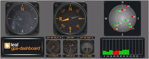
Built using GPS
Comments on GPS Dashboard:
Comments not found
If you noted an error or download link is broken, please, report it via this page or use comments.
GPS Dashboard is compatible with your device Qtek pm10a