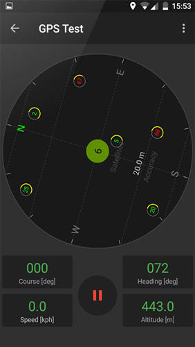
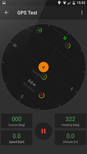
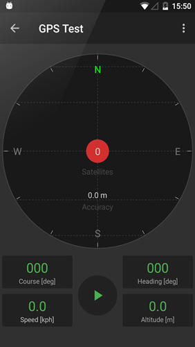
GPS Tools - is an application for calibration of a satellite module of your smartphone. The utility uses a magnetic compass, makes changes to the route, speed and accuracy of the displayed data. As soon as the calibration is completed you can track your location with maximum accuracy.
Game features:
Magnetic compass
Commercial free
Fast calibration
Big number of satellites
Like it? Share with your friends!
Supported operating systems:
Google Android 10.x, Google Android 4.4, Google Android 5.x, Google Android 6.x, Google Android 7.x, Google Android 8.x, Google Android 9.x
Similar Software:
GPS Widget GPS Widget - This widget simply shows your current location in numbers. Latitude and Longitude are received from the GPS location provider or from the network location provider if GPS is not available.
The altitude is queried from open MapQuest API which yields in a more accurate result than receiving the altitude by GPS
Android Photo GeoTag Android Photo GeoTag - Take pictures with your mobile phone and incorporate the data of the geographical location. The application allows you to include in the photographs, data from the GPS receiver, along with a brief note. If you know the coordinates, not having the GPS receiver, you can also handwrite geographic data
DEWA (Android) DEWA - Welcome to the Mobile World of DEWA
GPS2OpenGTS Free GPS2OpenGTS will send your GPS data to an OpenGTS tracking system.
Latest version now supports UDP.
Also added is a Test function/screen to help with server configuration.
Send a NMEA GPRMC strings with the following data.
(accountID, deviceID, Latitude, Longitude, Speed, Heading and Altitude
Geofence Tracker Why do you need Geofence Tracker application?
1. With Geofence Tracker, you can create a specific "safe zone" or "unauthorized zone" on a map and get an E-mail Alert if the phone leaves the area
MileageLedger 2.0 MileageLedger 2.0 - New features include resume trip, filtered reports, auto data export, data export via e-mail or SD card, improved GUI, increased reliability & accuracy, fault tolerance, & trip categories
Mileage Ledger is a GPS powered mileage logging application designed for Android enabled smart phones
ParkLeitSystem ParkLeitSystem is a car-park-routing system. It shows you, according to your GPS position, the nearest city with a car-park-routing system and gives you a list with all available car-parkings and shows how many free places there are. With a click on the parking it switches to google maps and shows you the position of the parking
GPS Status & Toolbox GPS Status & Toolbox - Be a GEEK: Get the most out of your phone. Raw GPS data at your fingertips.
Display your GPS and sensor data: position and signal strength of satellites, accuracy, speed, acceleration, bearing.
Tools included: compass with magnetic and true north, leveling tool, mark or share your location and navigate back later
Location Finder Place Search Location Finder Place Search - This Free place finder application automatically detect your current location and shows best places around you. This app will show you all available ATM, Bus Stands, Service centers, Airport, Food Services etc. around the current location. Download this free app on your smartphone and just simplified your place search
Track Location Track Location is an Android app which uses GPS or your network to display your location anywhere in the world. You can see the latitude and longitude of your current position and save the coordinates
Comments on GPS Tools:
Comments not found
If you noted an error or download link is broken, please, report it via this page or use comments.
GPS Tools is compatible with your device RIM BlackBerry KEYone Bronze Edition BBB100-7 Dual SIM TD-LTE 64GB (TCL Mercury)

")


")


