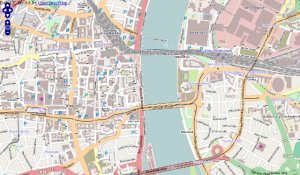
OpenMap - makes use of the GPS and allows you to browse your surroundings.
Like it? Share with your friends!
Supported operating systems:
RIM BlackBerry OS 4.6, RIM BlackBerry OS 4.7, RIM BlackBerry OS 5.0, RIM BlackBerry OS 6.0
Similar Software:
NavFunPro NavFunPro is the most universal Google-Maps tool that gives you all the goodies of Google Maps and Google Earth. You can connect your Bluetooth GPS or use the mobile's built in GPS. Then NavFunPro turns your mobile into an all-terrain navigation/gps tool. All your tracks are uploaded to internet. You can check them out at www.trackthisout.com/tm
Super Duper Survey Super Duper Survey is an easy to use application to take and report surveys. It's designed as a self contained, offline application perfect for street surveys
MetrO (BlackBerry) Métro is your free guide to public transport systems worldwide (about 400 cities covered now)
Travelling Volkswagen An application designed for travelers who like to see the world driving his car. Through the menu, you can access a selection of routes passing through various Spanish regions, France, Portugal and neighboring Andorra
TopoExplorer for Touch Screen Devices ONLY TopoExplorer for Touch Screen Devices ONLY
Features | Free Download
With TopoExplorer you will discover your surroundings on topographic maps even in remote areas assisted by GPS and without the need of the wireless network connection
Plaspy PLASPY is an application developed to enable location and a satellite tracking device or person regardless of the geographical area in which you are. It is a Global Information System Web-based Google Maps and the coordinates of a GPS device with an accuracy of 6 to 15 meters
GPSed Pro GPSed Pro- is a service for trip tracking from mobile. In real time tracks are traced on Google maps and stored in an online archive. With a simple geotagging feature it is possible to pin photos to a map precisely at a place they were taken
Lyon Metro for BlackBerry Find information about the Metro Railway system in Lyon. You can find Lyon Metro map, Lines, Stations and City info with ease. Once installed this App can provide you useful information stored locally on your device. Using GPS the route from current place to nearest station is generated
amAze (BlackBerry) AmAze is a first of its kind free navigation and local search service. It is free to download and use and it contains wide coverage of maps including aerial photo in Europe, North America, Australia and parts of Asia and Africa


")


")

