Rough Guides Map Barcelona... These guides are a series of fantastic interactive maps.
Produced in conjunction with the premier travel publisher Rough Guides.
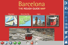
Discover and explore Barcelona using full colour interactive linked maps, in this simple to use PDA version of The Rough Guides Barcelona.
Find all the top tourist spots and key attractions with ease, information on the city and its sights can be quickly displayed with links to photographs and map locations. All in a superb easy to use interface.
If you''re travelling to Barcelona, be sure you don''t leave home without this guide on your PDA.
The Rough Guide city maps includes:
Fully scrollable and interactive maps of the city.
Tap any location to display information and available links.
Intuitive navigation bar meaning you are never more than one click away from the information you require.
Map links allow you to directly link to other maps, photographs, or detailed views.
Categorised Find feature allowing you to quickly find any street, place of interest or station.
Categorised Information feature providing a wealth of information on the city, places of interest, etc.
1-Click Home feature, keeping the Home map always at hand.
Zoom function on all maps.
Special Offer Only $20.00
Hi Res & landscape displays supported.
Like it? Share with your friends!
If you got an error while installing Themes, Software or Games, please, read FAQ.
Supported operating systems:
Pocket PC 2002, Windows Mobile 2003, Windows Mobile 5.0, Windows Mobile 6 Classic, Windows Mobile 6 Professional, Windows Mobile 6.1 Classic, Windows Mobile 6.1 Professional, Windows Mobile 6.5 Professional
Similar Software:
City Advisor City Advisor is a Public Transport Navigation Platform for Windows Mobile, providing generic path searching services for cities.
Note: Use the Map Creator to create public transportation maps for use with City Advisor
Oxford Pocket A-Z map Oxford Pocket A-Z map - This publication has been designed for a Pocket PC running Windows® Mobile-based Pocket PC (version 2002 or later) and the Pocket A-Z Viewer (included). The map covers an area of central Oxford, extending to Summertown, Blackbird Leys, Kennington and New Botley
Spb Traveler Spb Traveler is a mobile travel assistant application that helps to keep track of trips, stay on top of meetings even when abroad
Sanoodi Sanoodi is one of the world's leading community platforms for runners, joggers, walkers, cyclists and people who enjoy any of the 30 different outdoor activities that we support. People from all over the world are sharing their adventures via our website or SMap our free to use range of applications for GPS equipped mobile phones. Sanoodi
PDA TileManager With PDA TileManager you can batch download OpenStreetMap maptiles.
Features:
Runs on Windows Mobile Devices with .NET CF 2.0 or above.
Read GPX track with trackpoints and waypoints
Direct support for Run
amAze (Samsung) AmAze is a first of its kind free navigation and local search service. It is free to download and use and it contains wide coverage of maps including aerial photo in Europe, North America, Australia and parts of Asia and Africa
Sms My Position Sms My Position - How many times have you spend ages trying to explain somebody where to meet up, and finally not finding them? With this application you can just say: I''''ll send you an SMS with my location and we meet there SMS my Position is a very simple application that allows you to SMS your position in 3 clicks
Great Britain Pocket A-Z Map 2009 Great Britain Pocket A-Z Map 2009 - This publication has been designed for a Windows® Mobile-based Pocket PC (version 2002 or later) and The Pocket A-Z Viewer. Covering the same area as the Great Britain Mini Road atlas, this publication consists of coloured road mapping of Great Britain which shows motorways, primary routes and main roads
gpsVP gpsVP works on virtually any Windows platform including mobile ones. It shows vector and raster maps, records and shows tracks, shows multiple navigation parameters, manages and shows waypoints. It aims to be as usable as possible.
What's New in This Release:
· Geoid correction matrix: Updated values Atlantic & east America's
Other Software by developer «Visual IT»:
Tube 2 London Touristic (UIQ3) Tube 2 London Touristic (UIQ3) - This map package for Tube 2 is the ideal map for the tourist or business traveller who needs to get around London using the Tube system and would like to know just exactly where they are. The map geographically locates all the central stations, making it much more informative than the official topological map
Tube 2 London Geo (Palm OS) Tube 2 London Geo (Palm OS) - This superb map package for Tube 2 is the ideal map for anyone who needs to get around London using the underground system and would like to know just exactly where they are.
The map geographically accurately locates the central London stations, overlaid onto a street map. Now you can easily see how these stations fit into the real world
Tube London City Streets (2009 Edition) Tube London City Streets
This Tube package consists of a fully scrollable detailed map of the London Underground system and 9 linked GPS enabled A-Z street maps.
Plan journeys on the London Underground system, list details of the quickest routes and see a superb animated display of your journey tracking around the system map
Tube Hamburg (Palm OS) Tube Hamburg (Palm OS) - An award winning and highly acclaimed Palm OS application that guides you around the metro (S-Bahn / U-Bahn) system of Hamburg. An essential addition to your Palm device for locals and tourists alike.
Tube's features include:
A detailed clear colour (or grey scale) map of the transport system fully scrollable.
Quick find station utility
Tube Nottingham Streets Tube Nottingham Streets - A complete street map of central Nottingham for your Palm device using superb map tiles from the famous A-Z map company.
These maps plug directly into our new Tube engine and are a convenient replacement for your paperback A-Z. Never get lost in Nottingham again
Tube 2 Barcelona Pro (UIQ3) Tube 2 Barcelona Pro (UIQ3) - This map package for Tube 2 consists of a fully scrollable detailed map of the Barcelona metro & rail system and linked street maps of central Barcelona.
Plan journeys on the metro system, list details of the quickest routes and see a superb animated display of your journey tracking around the system map
Tube 2 Washington Pro (UIQ) Tube 2 Washington Pro (UIQ) - This map package for Tube 2 consists of a fully scrollable detailed map of the Washington D.C. metro system and linked high quality street maps of central Washington D.C.
Plan journeys on the metro system, list details of the quickest routes and see a superb animated display of your journey tracking around the system map
Rome Metro 10 for iPad Rome Metro 10 -The Zuti Rome Metro application is a superb geographically based map and route planner for the Metro, Tram, Urban and Regional rail systems. Unlike old fashioned schematic style maps this product contains a geographically accurate central area showing major streets, parks and places of interest etc, allowing the user to easily get their bearings
London Visitors A-Z London Visitors A-Z - The London Visitors Map of central London is designed especially for the tourist. The principal feature of the mapping is the highlighting of places of interest, buildings open to the public, theatres, cinemas, selected shops and stores, main shopping streets, main line and underground railway stations and other locations of interest to the visitor
Tube Brussels (Palm OS) Tube Brussels (Palm OS) - An award winning and highly acclaimed Palm OS application that guides you around the metro & tram system of Brussels. An essential addition to your Palm device for locals and tourists alike.
Tube's features include:
A detailed clear colour (or grey scale) map of the transport system fully scrollable.
Quick find station utility


 Hi Res & landscape displays supported.


")


")
")
")
")

")
")


")