Map of New Mexico (US State) Map of New Mexico (US State) - A map of the New Mexico by VITO Technology. Good for intercity travels with SmartMap.
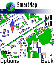
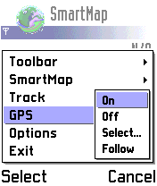
SmartMap is a mobile device application which uses vector and raster maps. It is compatible with any NMEA protocol GPS receiver (Compact Flash socket, serial port, BlueTooth or sleeve)
Map of Tunisia Map of Tunisia - A map of Tunisia. Good for intercity travels with SmartMap.
Layers include:
Towns
Settlements
Airports
Roads
Railroads
Rivers
Inland water
Administrative borders
International borders
Trees
Map scale is 1:1 million.
Good for use with any version of SmartMap. SmartMap can be purchased here
Travel Cuyahoga Valley National Park - illustrated travel guide and maps Travel Cuyahoga Valley National Park - illustrated travel guide and maps- is a comprehensive travel guide illustrated with maps and photographs. Indulge Yourself with a personal tour guide on Your PDA. FREE General Information chapter and a map in the trial version.
Features
Fully illustrated.
Geology, Flora, Fauna and more.
Interesting facts
Map of New Jersey (US State) Map of New Jersey (US State) - A map of the New Jersey by VITO Technology. Good for intercity travels with SmartMap and VITO SmartNavigator.
SmartMap is a mobile device application which uses vector and raster maps. It is compatible with any NMEA protocol GPS receiver (Compact Flash socket, serial port, BlueTooth or sleeve)
Travel Zion National Park - illustrated travel guide and maps Travel Zion National Park - illustrated travel guide and maps is a comprehensive travel guide illustrated with maps and photographs. Indulge Yourself with a personal tour guide on Your PDA. FREE General Information chapter and a map in the trial version.
Features
Fully illustrated.
Geology, Flora, Fauna and more.
Interesting facts.
Maps
Travel Ireland - illustrated guide and maps Travel Ireland - illustrated guide and maps-
An illustrated guide and maps. Indulge Yourself with a personal tour guide on Your PDA. FREE General Information chapter and a map in the trial version.
Features
Fully illustrated.
Historical overviews.
Interesting facts.
City Attractions.
Landmark maps, Street maps, and more
Map of Saudi Arabia Bundle of Saudi Arabia maps consisting of 14 territories. Each map is accompanied by a short text description. Good for intercity travels with VITO SmartMap and VITO SmartNavigator
Travel Seattle - illustrated travel guide and maps Travel Seattle - illustrated travel guide and maps-
An illustrated city guide and maps. Indulge Yourself with a personal tour guide on Your PDA. FREE General Information chapter and a map in the trial version.
Features
Fully illustrated.
Landmarks and Street map, Area map, and more.
Historical overviews.
Interesting facts.
City Attractions
Travel London - illustrated travel guide and maps Travel London - illustrated travel guide and maps- illustrated city guide and maps. Indulge Yourself with a personal tour guide on Your PDA. FREE General Information chapter and a map in the trial version.
Features
Fully illustrated.
Historical overviews.
Interesting facts.
City Attractions
Travel London Travel London – Indulge Yourself with a personal tour guide on Your PDA.
Features:
Fully illustrated.
Historical overviews.
Interesting facts.
City attractions and landmarks are discussed in concise and clear language.
Street maps, Subway maps, and more.
Museums addresses, telephones, hours and admission information
Map of Tunisia Map of Tunisia - A map of Tunisia. Good for intercity travels with SmartMap.
Layers include:
Towns
Settlements
Airports
Roads
Railroads
Rivers
Inland water
Administrative borders
International borders
Trees
Map scale is 1:1 million.
Good for use with any version of SmartMap. SmartMap can be purchased here
Map of Washington (US State) Map of Washington (US State) - A map of the Washington by VITO Technology. Good for intercity travels with SmartMap.
SmartMap is a mobile device application which uses vector and raster maps. It is compatible with any NMEA protocol GPS receiver (Compact Flash socket, serial port, BlueTooth or sleeve)
Map of Uruguay Map of Uruguay - A map of Uruguay. Good for intercity travels with SmartMap.
Layers include:
Towns
Settlements
Airports
Roads
Railroads
Rivers
Inland water
Administrative borders
International borders
Trees
Map scale is 1:1 million.
Good for use with any version of SmartMap. SmartMap can be purchased here
Map of Pennsylvania (US State) Map of Pennsylvania (US State) - A map of the Pennsylvania by VITO Technology. Good for intercity travels with SmartMap.
SmartMap is a mobile device application which uses vector and raster maps. It is compatible with any NMEA protocol GPS receiver (Compact Flash socket, serial port, BlueTooth or sleeve)
Map of South Africa Map of South Africa - A map of South Africa, divided into 9 smaller territories for the ease of use.
NORTHERN
NORTH WEST
GAUTENG
MPUMALANGA
FREE STATE
KWAZULU-NATAL
EASTERN CAPE
NORTHERN CAPE
WESTERN CAPE
Good for intercity travels with SmartMap
Map of Tennessee (US State) Map of Tennessee (US State) - A map of the Tennessee by VITO Technology. Good for intercity travels with SmartMap.
SmartMap is a mobile device application which uses vector and raster maps. It is compatible with any NMEA protocol GPS receiver (Compact Flash socket, serial port, BlueTooth or sleeve)
Map of West Virginia (US State) Map of West Virginia (US State) - A map of the West Virginia by VITO Technology. Good for intercity travels with SmartMap.
SmartMap is a mobile device application which uses vector and raster maps. It is compatible with any NMEA protocol GPS receiver (Compact Flash socket, serial port, BlueTooth or sleeve)
Map of New Zealand Map of New Zealand - A map of New Zealand.
Good for intercity travels with SmartMap.
Layers include:
Towns
Settlements
Airports
Roads
Railroads
Rivers
Inland water
Administrative borders
International borders
Trees
Map scale is 1:1 million.
Good for use with any version of SmartMap
Map of Nicaragua Map of Nicaragua - A map of the Nicaragua by VITO Technology. Good for intercity travels with SmartMap.
SmartMap is a mobile device application which uses vector and raster maps. It is compatible with any NMEA protocol GPS receiver (Compact Flash socket, serial port, BlueTooth or sleeve)


")


")


")

")

")
")

