Categories: Internet & Communications, Travel & Navigation
Upload date: 10 Aug 10
Developer: Ulf Arndt
License: Freeware
Downloads: 3651 File Size: 42 Kb
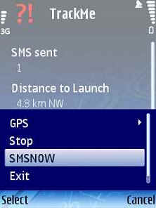
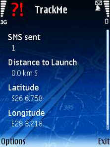
TrackMe (S60)-An application that sends your location at a regular interval via SMS to another cellphone. If it receives a SMS query in a certain format (e.g. from RTMS), will send your location to the predefined number.
Like it? Share with your friends!
If you got an error while installing Themes, Software or Games, please, read FAQ.
FON Access Points for Philippines FON Access Points for Philippines - FON offers you a new Points of Interest service (POIs). This allows you to download FONspots directly to your navigation device.
What does that mean? You can download a Points of Interest file directly to your navigation device
FON Access Points for Malta FON Access Points for Malta - FON offers you a new Points of Interest service (POIs). This allows you to download FONspots directly to your navigation device.
What does that mean? You can download a Points of Interest file directly to your navigation device
FON Access Points for Cameroon FON Access Points for Cameroon - FON offers you a new Points of Interest service (POIs). This allows you to download FONspots directly to your navigation device.
What does that mean? You can download a Points of Interest file directly to your navigation device
Efficasoft GPS Utilities Efficasoft GPS Utilities- The best-selling Windows Mobile Smartphone GPS software is now available on Symbian + even greater features!
Digital compass, speedometer with alarm, real-time map navigation..
FON Access Points for Lithuania FON Access Points for Lithuania - FON offers you a new Points of Interest service (POIs). This allows you to download FONspots directly to your navigation device.
What does that mean? You can download a Points of Interest file directly to your navigation device
Street Smart AskLaila StreetSmart is a local search mobile client using location based service, with listings, mo
FON Access Points for French Guiana FON Access Points for French Guiana - FON offers you a new Points of Interest service (POIs). This allows you to download FONspots directly to your navigation device.
What does that mean? You can download a Points of Interest file directly to your navigation device
GETrack GETrack - Now you can record tracking data from your bluetooth GPS receiver and send the track via bluetooth to your PC for direct use with "Google Earth". For business, holidays and fun.
There's no need for any conversion software on the PC side. The tracking data is ready to be used with "Google Earth"
Nokia Nearby Nokia Nearby - Don't have maps on your mobile phone as it may not be supported? Have always wanted to have a service to know more about places around you? Now you can do that....even on phones those don't support Maps or don't have GPS
FON Access Points for Romania FON Access Points for Romania - FON offers you a new Points of Interest service (POIs). This allows you to download FONspots directly to your navigation device.
What does that mean? You can download a Points of Interest file directly to your navigation device
Other Software by developer «Ulf Arndt»:
PRS GPS PRS GPS - Uses a built-in GPS of a Nokia Phone and JAVA J2ME based Location based service to SMS your Pilot Status to the Pilot Recovery System. Can be used for the Winelands Paragliding comp. The JAVA J2ME Midlet feeds via SMS the Pilot Recovery status webpage
RTMS RTMS - This JAVA Midlet sends a SMS to a mobile phone that runs the TrackMe code.
It sends an SMS to TrackMe, TrackMe then sends a SMS with the location data to the predefined number.
The predefined number gets set by the enduser when TrackMe gets started.
The code needs a trackmesms.txt file in the Images folder of the cellphone
Pilot Recovery System Pilot Recovery System - A simple J2ME JAVA Midlet that can be used with the Pilot Recovery System. Can be used for the Winelands Paragliding comp. The JAVA J2ME Midlet feeds via SMS the Pilot Recovery status webpage
TrackMeTweet TrackMeTweet - uses the built-in GPS, or a Bluetooth GPS (recommended for cellphone battery life) to send regular tweets of your location to Twitter.
The Tweet info contains your identifier, distance from take-off in km, coordinates in degrees and decimal minutes, altitude in meters above sea level, speed in km/h, direction you are heading at that specific moment

")
")