GETrack - Now you can record tracking data from your bluetooth GPS receiver and send the track via bluetooth to your PC for direct use with "Google Earth". For business, holidays and fun.
There's no need for any conversion software on the PC side. The tracking data is ready to be used with "Google Earth". These files can then be sent by email to your friends or put them on your website.
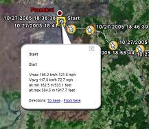
On the PC side you only need a bluetooth dongle and the ability to receive files from your phone.
You can choose a logging interval from 1,3,5,10,20,30,60 and 300 seconds which covers driving speeds by car and bike and is also suitable for hiking tours.
You can choose to send a file in plain Google Earth format, extended Google Earth format including automatic waypoints including altitude, driving speed and time/date , GPX, IGC and CSV (Microsoft Excel or OpenOffice) format.
Compatible with S60 3rd Edition devices.
You need "Goole Earth" Version 3.0 or better, a NMEA compatible bluetooth GPS receiver and you must be able to receive files via bluetooth from your phone.
Like it? Share with your friends!
If you got an error while installing Themes, Software or Games, please, read FAQ.
SmartComGPS SmartComGPS is an advanced GPS mapping/tracking/navigation software for Symbian smartphones.
You can use a new version of SmartComGPS 1.5 with a new function of map rotation. This upgrade is free to all our customers, but it is required to obtain a new serial number here: http://www.wild-mobile.ru/eng/updatelicense
Speereo Voice Translator: English-Russian (s60v3) Speereo Voice Translator: English-Russian (s60v3) is an ideal companion for traveling on business or leisure and also is an excellent aid for business communication. Running on Windows Mobile and Symbian based mobile devices it contains of over 4000 phrases in each of 16+ languages and many other useful features
Speereo Voice Translator: English-Finnish Speereo Voice Translator: English-Finnish- is an ideal companion for traveling on business or leisure and also is an excellent aid for business communication. Running on Windows Mobile and Symbian based mobile devices it contains of over 4000 phrases in each of 16+ languages and many other useful features
Travel Grand Teton National Park - illustrated travel guide and maps Travel Grand Teton National Park - illustrated travel guide and maps- is a comprehensive travel guide illustrated with maps and photographs. Indulge Yourself with a personal tour guide on Your PDA. FREE General Information chapter and a map in the trial version.
Features
Fully illustrated.
Geology, Flora, Fauna and more.
Interesting facts
J2ME OGC WMS Client J2ME OGC WMS Client is a program for accessing OGC Web map services from Java enabled mobile phone or PDAs.
It accesses the OGC WMS according to WMS 1.1.0 and 1.1.1 specifications and supports zooming and panning in the Map, WMS sublayers, and a bookmark management system for quick access.
Free for non-commercial use
EchoEcho EchoEcho is an easy way to ask and answer the question "Where are you?" With a few simple clicks. You can find your friends anywhere in the world and see their locations on a map. EchoEcho works on Symbian s60 on all mobile smartphone platforms so you can share location with your friends even if they don't have S60 phones
Buddy Way With the new GPS based mobile phone tracking software called Buddy Way you can:
* Track & save your trips
* Share them with friends
* View your trips in 3D in Google Earth
* Show friends your location
Buddy Way is a FREE location based services, similar to the Nokia Sports Tracker and allows you to track yourself in a real time and show your location on a map
Barcelona DK Eyewitness Top 10 Travel Guide & Map Barcelona DK Eyewitness Top 10 Travel Guide & Map-From Gaudi''s mind-boggling buildings to the Gothic Quarter, your holiday to Barcelona starts the moment you open the guide, plus Barcelona maps and metro maps.
Discover unmissable museums and galleries, walks and itineraries, fascinating modernist buildings and best tapas to suit every budget and much more
A-Z London Street Map A-Z London Street Map - This is a revolutionary map application for Symbian mobile phones. Using the familiar London A-Z maps in all their detail and reliability, it looks just like the paper book. It is very easy to use, and very fast. In fact, this could be the fastest raster map application ever created for a Symbian smartphone
S60 Screensaver Maker Pro S60 Screensaver Maker Pro - Using this PC application you can create custom screensavers for Nokia S60 2nd Edition devices from a GIF file.
The created screensaver will be automatically packaged into a SIS installer and is ready to be installed on a S60 2nd Edition device. The screensaver turns the backlight on (not on 3230,6260,6600,6620,6670,7610) when it starts
Series 60 Screensaver Source Code Series 60 Screensaver Source Code - Sourcecode of a Series 60 2nd Edition screensaver plugin. The demoversion only contains the binary SIS installer. Start writing your own screensaver plugins using C++ based on this source code right now. The sourcecode is compatible with the Series 60 SDK 2.0 for Symbian OS
GETrack GETrack - Now you can record tracking data from your bluetooth GPS receiver and send the track via bluetooth to your PC for direct use with "Google Earth". For business, holidays and fun.
There's no need for any conversion software on the PC side. The tracking data is ready to be used with "Google Earth"
TweakME TweakME is used for modifying the security settings of Java midlets on the Nokia 6600 phone.
With TweakME you can set all permissions for a midlet regardless if it's signed or not
POIXpress POIXpress - Modern location aware applications running on S60 3rd Edition devices like smart2go(TM) aka Nokia Maps use a shared database of POIs (called landmarks).
With POIXpress you can import POI databases in ASC and OV2 format and export landmarks in ASC,GPX and KML format
GETrack for UIQ3 GETrack for UIQ3 - Now you can record tracking data from your bluetooth GPS receiver and send the track via bluetooth to your PC for direct use with "Google Earth". For business, holidays and fun.
There's no need for any conversion software on the PC side. The tracking data is ready to be used with "Google Earth"


")


