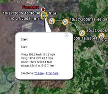
GETrack - Now you can record tracking data from your bluetooth GPS receiver and send the track via bluetooth to your PC for direct use with "Google Earth". For business, holidays and fun.
There's no need for any conversion software on the PC side. The tracking data is ready to be used with "Google Earth". These files can then be sent by email to your friends or put them on your website.
On the PC side you only need a bluetooth dongle and the ability to receive files from your phone.
You can choose a logging interval from 1,3,5,10,20,30,60 and 300 seconds which covers driving speeds by car and bike and is also suitable for hiking tours.
You can choose to send a file in plain Google Earth format, extended Google Earth format including automatic waypoints including altitude, driving speed and time/date , GPX, IGC and CSV (Microsoft Excel or OpenOffice) format.
Compatible with S60 3rd Edition devices.
You need "Goole Earth" Version 3.0 or better, a NMEA compatible bluetooth GPS receiver and you must be able to receive files via bluetooth from your phone.
Like it? Share with your friends!
If you got an error while installing Themes, Software or Games, please, read FAQ.
FON Access Points for Turkey FON Access Points for Turkey - FON offers you a new Points of Interest service (POIs). This allows you to download FONspots directly to your navigation device.
What does that mean? You can download a Points of Interest file directly to your navigation device
Trapster Trapster – When you see a trap, report it by pressing a button on your phone, or calling a toll free number. Other user's phones will alert them as they approach the trap. Trapster learns the credibility of traps based on how many users agree. It also learns the credibility of each user, over time
FON Access Points for Ethiopia FON Access Points for Ethiopia - FON offers you a new Points of Interest service (POIs). This allows you to download FONspots directly to your navigation device.
What does that mean? You can download a Points of Interest file directly to your navigation device
RaceChrono (S60) RaceChrono (S60) is a GPS based lap timing software for Nokia Series 60 smart phones. It can be used to measure lap times on almost any vehicle and track. It can be used to measure laptimes for example for motorbikes, bicycles, cars, water jets and quadbikes.
The main feature is of course the Live Timer, which shows your lap- and sector-times in real-time
SMap SMap allows you to record and manage your running, hiking, cycling, MTB or sailing routes and easily upload them onto the Sanoodi website live via GPRS or later when you connect your mobile to your desktop computer.
· Two screens: a Pace Screen and a route Summary Screen
FON Access Points for Morocco FON Access Points for Morocco - FON offers you a new Points of Interest service (POIs). This allows you to download FONspots directly to your navigation device.
What does that mean? You can download a Points of Interest file directly to your navigation device
Aspicore GSM Tracker 3 Aspicore GSM Tracker 3 - Purpose
The product is intended for fleet tracking, field force automation or personal location tracking.
Would you like to..
FON Access Points for Colombia FON Access Points for Colombia - FON offers you a new Points of Interest service (POIs). This allows you to download FONspots directly to your navigation device.
What does that mean? You can download a Points of Interest file directly to your navigation device
Navizon for Symbian 3rd edition Navizon is the perfect urban companion for your handheld. It allows you to find cool places around you (such as bars, restaurants etc...), see where your friends are and find your own directions
Users with a GPS device can use Navizon worldwide. And Navizon will allow you to get a GPS fix where you couldn't before (indoors, urban canyons etc..
Nokia Nearby beta Nokia Nearby beta - Don't have maps on your mobile phone as it may not be supported? Have always wanted to have a service to know more about places around you? Now you can do that....even on phones those don't support Maps or don't have GPS
Other Software by developer «Quentin»:
TweakME TweakME is used for modifying the security settings of Java midlets on the Nokia 6600 phone.
With TweakME you can set all permissions for a midlet regardless if it's signed or not
GETrack GETrack - Now you can record tracking data from your bluetooth GPS receiver and send the track via bluetooth to your PC for direct use with "Google Earth". For business, holidays and fun.
There's no need for any conversion software on the PC side. The tracking data is ready to be used with "Google Earth"
Series 60 Screensaver Source Code Series 60 Screensaver Source Code - Sourcecode of a Series 60 2nd Edition screensaver plugin. The demoversion only contains the binary SIS installer. Start writing your own screensaver plugins using C++ based on this source code right now. The sourcecode is compatible with the Series 60 SDK 2.0 for Symbian OS
GETrack for UIQ3 GETrack for UIQ3 - Now you can record tracking data from your bluetooth GPS receiver and send the track via bluetooth to your PC for direct use with "Google Earth". For business, holidays and fun.
There's no need for any conversion software on the PC side. The tracking data is ready to be used with "Google Earth"
POIXpress POIXpress - Modern location aware applications running on S60 3rd Edition devices like smart2go(TM) aka Nokia Maps use a shared database of POIs (called landmarks).
With POIXpress you can import POI databases in ASC and OV2 format and export landmarks in ASC,GPX and KML format
S60 Screensaver Maker Pro S60 Screensaver Maker Pro - Using this PC application you can create custom screensavers for Nokia S60 2nd Edition devices from a GIF file.
The created screensaver will be automatically packaged into a SIS installer and is ready to be installed on a S60 2nd Edition device. The screensaver turns the backlight on (not on 3230,6260,6600,6620,6670,7610) when it starts


")


