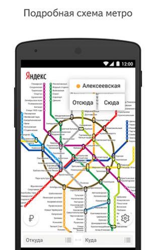
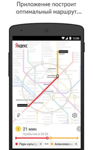
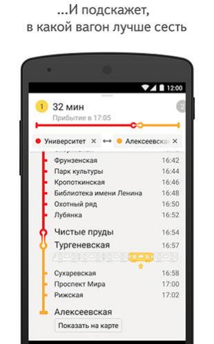
Yandex. Metro - is a useful application for those who often goes by subway. The application will make exact calculation of time, offer the best route and give the switch points. Select the destination and departure stations according to the scheme and easily plan your subway trips.
Game features:
Time calculation including switch points
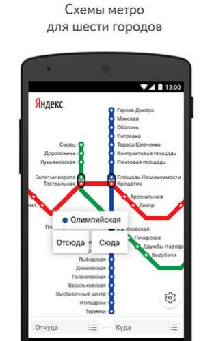
Up-to-date schemes
Work in offline mode
Scheme for each route
Loading video...
Like it? Share with your friends!
Supported operating systems:
Google Android 10.x, Google Android 4.0, Google Android 4.1, Google Android 4.2, Google Android 4.3, Google Android 4.4, Google Android 5.x, Google Android 6.x, Google Android 7.x, Google Android 8.x, Google Android 9.x
Similar Software:
Latitude Launcher Latitude isn't enabled in the UK, and some other countries, on the T-Mobile G1, however it is enabled on many other phones e.g. Nokia N95. This is frustrating, a Google phone without Google Latitude.
Latitude Launcher can enable Latitude for you if you have 'Rooted' your phone
Wi-Fi Map Maker - Free Wi-Fi Map Maker is application makes a map of Wi-Fi access points as you walk around.
· Maps out the actual coverage of each access point!
· Access point names are displayed on the map
· See street address and area of access points
· You can select the criteria for inclusion on your map
TripComputer TripComputer is a personal off-road GPS navigation utility software for Android phones, that has been created for active people, who love travel by hike or bike.
The application does not use Internet connection or Google Maps for navigation or track recording, but you can share your data to others, or store your data on server
Cell Phone Coverage Map Cell Phone Coverage Map - Test your mobile service for yourself and compare results to other carriers using RootMetrics. Coverage information in the market today is incomplete and gathered infrequently - often no more than once a year - resulting in soft advertising claims of network reliability. RootMetrics is different
Osmand: Maps and Navigation Osmand: Maps and Navigation - is a navigation utility. Support of electronic maps gives you a chance to get new updates all the time. The map has marks which will help tourists. Embedded satellite navigation allows you to make the shortest route fast
MapMakr MapMakr If you’re an aid worker responding to a humanitarian crisis, up to date, accurate, and easy to read maps are vital. Knowing whether a bridge has collapsed, a road is passable and where you can land planes bringing in aid is really important
TrekBuddy Trekbuddy is a J2ME application to be used with a GPS receiver. It is designed to work with every Java-enabled device. It features capabilities such as: * GPS tracking and simple navigation * bitmap maps (without zoom, you can store bitmap maps with different resolution instead)
Android Location Android Location is your free, location-aware, mobile social network.
Meet real world friends. Reveal your location, befriend, and chat with people around you.
Using location-based technologies, Android Location lets you see where your friends are and what they are up to, in real time. Meet people around you. Discover who visits your favorite places
ViewRanger GPS ViewRanger is a unique mapping, navigation, tracking, and information tool for mobile phones that provides fully featured outdoor gps and trail navigation through a natural and intuitive display. ViewRanger transforms a Nokia or other Symbian S60 smartphone into a fully featured trail navigation system
Locus - addon AR This is BETA version of simple addon for Locus mapping application (version 1.1.0 and higher). Allow to show actual POI's visible on map, in Augmented reality view. In Locus Free, usage is limited to 1 minute. This addon do not have any screen or widget
Comments on Yandex. Metro:
Comments not found
If you noted an error or download link is broken, please, report it via this page or use comments.
Yandex. Metro is compatible with your device Samsung SM-G887F/DS Galaxy A9 Pro 2018 Duos Global TD-LTE 128GB (Samsung G887)
")