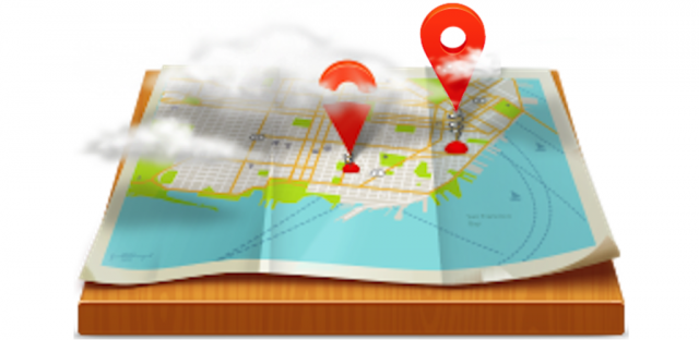
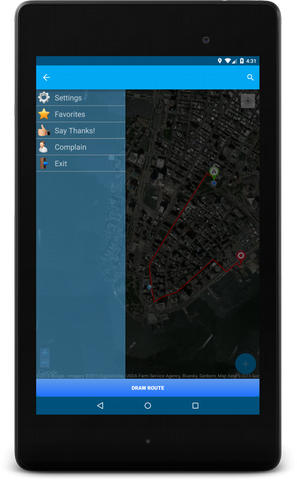
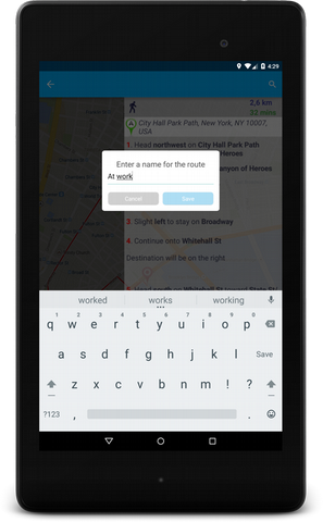
Best Route GPS Navigator - Are you planning walk, go to the store or to work? "Best Route" will show the best way for you to save your nerves and time. Because time is money!
Like it? Share with your friends!
Supported operating systems:
Google Android 10.x, Google Android 2.3, Google Android 3.0, Google Android 3.1, Google Android 3.2, Google Android 4.0, Google Android 4.1, Google Android 4.2, Google Android 4.3, Google Android 4.4, Google Android 5.x, Google Android 6.x, Google Android 7.x, Google Android 8.x, Google Android 9.x
Similar Software:
GPS Coordinates Converter GPS Coordinates Converter - With this app you can convert GPS coordinates from "degrees, minutes, decimal seconds" to "decimal degrees".
What's New in This Release:
· Locate your phone and show the coordinates
What's New in 2
CoPilot Live Europe (Android) CoPilot Live Europe (Android) - CoPilot Live is full-featured voice-guided GPS navigation with Western and Eastern Europe street maps stored on your phone. Includes 3D guidance, lane assist, speed limit warnings, safety camera alerts, planning mode.
Download maps via WiFi after purchase. Unlimited use after 10 days once Google order verified
OSMTracker for Android OSMTracker stands for OpenStreetMap Tracker. It allows you to track your journey and mark significant way points. Way points can be marked with a tag using a button, with a quick voice record, a text note or by taking a picture. The various button pages and layouts can be customized to suit your OpenStreetMap activities
Where's My Location? Where’s My Location? gives an edge in finding the most wonderful places surrounding you with a beautiful user interface. In details, such an application will provide you with all the available places near you with detailed information.
Also Where’s My Location? acts as a great navigation tool by which you can find your way in a strange city or location
Pocket Caddy Pocket Caddy - #1 Golf GPS app: 3D flyover of holes, yardage to greens, shot recording, stats, scorecard, hazard carry or lay up position. Positioning is shot to hole, not cart to hole. Free PC Analytics inc. 3D Google Earth replay with stats, and Free DIY Course Mapping software both available from www.satsportsna
GpsTicker Gpsticker is a program for outdoor orientation and navigation with GPS, it is best for hiking and biking. Maps are downloaded automatically from OpenStreetMaps, provided the Phone has an active internet connection
TwoNav for Android TwoNav for Android - A dual navigation system (On-Road/Off-Road) to perform most of your outdoor activities (hiking, biking, skiing, geocaching, ...). TwoNav can also guide you when driving. A single solution for all your orientation needs
amAze (Sony Ericsson) AmAze is a first of its kind free navigation and local search service. It is free to download and use and it contains wide coverage of maps including aerial photo in Europe, North America, Australia and parts of Asia and Africa
AntipodalPoint AntipodalPoint retrieves you position from the network provider or GPS and calculates and shows you antipodal point - the place exact opposite of you on Earth.
AntipodalPoint Pro enables you to browse the entire world and find antipodal points
DondeEsta - ultimate SMS mobile tracking system! DondeEsta - ultimate SMS mobile tracking system! - LOCATE YOUR FAMILY SIMPLE SENDING SMS
Install the application in the mobile to be located (i.e. your kid's mobile)
Mobile tracking for family safety.
Locate your children.
Locate elderly.
Locate for your own safety.
Easily alert your family when you are in a trouble!
DondeEstaTM brings peace of mind
Other Software by developer «Devosoftmir»:
not found
Comments on Best Route GPS Navigator:
Comments not found
If you noted an error or download link is broken, please, report it via this page or use comments.
Best Route GPS Navigator is compatible with your device Samsung SM-T835N0 Galaxy Tab S4 10.5 2018 TD-LTE 256GB (Samsung T830)

")


")


")

