MicroSky v3 c BT Api MicroSky is a planetarium for mobile/cell devices with Java-support and a connection to the Internet (preferably GPRS or UMTS). It is a very small J2ME-Midlet client/server application which retrieves its starcharts from the skyserver
PinPointer PinPointer lets you create personalized location tagged Points of Interest, Pinpointers (POI) and add your own description. You can then share them with friends & family as well as store safely or future use.
Remember and share your experiences/places with your friends, family and other people
Speereo Voice Translator: English-Portuguese (s60v3) Speereo Voice Translator: English-Portuguese (s60v3)- is an ideal companion for traveling on business or leisure and also is an excellent aid for business communication. Running on Windows Mobile and Symbian based mobile devices it contains of over 4000 phrases in each of 16+ languages and many other useful features
Map of UK Map of UK -
A map of the UK by VITO Technologies. Good for intercity travels with SmartMap.
Layers include:
Towns
Settlements
Airports
Roads
Railroads
Rivers
Inland water
Administrative borders
International borders
Trees
Map scale is 1:1 million.
Good for use with any version of SmartMap
Travel Mammoth Cave National Park - illustrated travel guide and maps Travel Mammoth Cave National Park - illustrated travel guide and maps is a comprehensive travel guide illustrated with maps and photographs. Indulge Yourself with a personal tour guide on Your PDA. FREE General Information chapter and a map in the trial version.
Features
Fully illustrated.
Geology, Flora, Fauna and more.
Interesting facts
Map of Wisconsis (US State) Map of Wisconsis (US State) - A map of the Wisconsis by VITO Technology. Good for intercity travels with SmartMap.
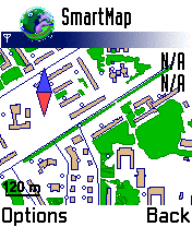
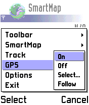
SmartMap is a mobile device application which uses vector and raster maps. It is compatible with any NMEA protocol GPS receiver (Compact Flash socket, serial port, BlueTooth or sleeve)
Travel Dresden, Germany Travel Dresden, Germany - illustrated city guide, phrasebook, and maps. Indulge Yourself with a personal tour guide on Your PDA.
Features
Fully illustrated.
Historical overviews.
Interesting facts.
Street Maps, Metro Map, and more.
Museums hours and ticket infor.
The guide is loaded into the device memory.
No network access needed
TripAdvisor TripAdvisor - Wherever you are on the planet, TripAdvisor can find you the best hotels, food, and things to do. You can even book a cheap flight on the go! TripAdvisor is the world's most trusted travel site
Tube Portland (Series 60) Tube Portland (Series 60) - Our highly acclaimed Tube application that guides you around the rail system of Portland is now available for your Series 60 Symbian powered phone. An essential addition to your phone for locals and tourists alike.
· A detailed clear colour map of the Portland rail system fully scrollable.
· Quick find station utility
Travel Madrid, Spain - FREE General chapter, basic phrasebook, and a map Travel Madrid, Spain - FREE General chapter, basic phrasebook, and a map - illustrated city guide, phrasebook, and maps. Indulge Yourself with a personal tour guide on Your PDA. FREE General chapter, basic phrasebook, and a map in the trial version.
Features
Fully illustrated.
Historical overviews.
Interesting facts
Other Software by developer «VITO Technology»:
VITO ButtonMapper ButtonMapper is a system application that allows creating custom commands for hardware buttons of your PocketPC
Map of South Dakota (US State) Map of South Dakota (US State) - A map of the South Dakota by VITO Technology. Good for intercity travels with SmartMap.
SmartMap is a mobile device application which uses vector and raster maps. It is compatible with any NMEA protocol GPS receiver (Compact Flash socket, serial port, BlueTooth or sleeve)
Map of Switzerland Map of Switzerland - A map of Switzerland. Good for intercity travels with SmartMap.
Layers include:
Towns
Settlements
Airports
Roads
Railroads
Rivers
Inland water
Administrative borders
International borders
Trees
Map scale is 1:1 million.
Good for use with any version of SmartMap
QuickSMS QuickSMS Love sending SMS? There's a great deal just for you! Quick SMS is a powerful SMS tool including SMS-Chat and ZoomBoard.
SMS-Chat allows you to organize SMS correspondence into threaded SMS conversations.
ZoomBoard is a soft onscreen keyboard for quick and accurate finger typing
Map of Romania Map of Romania - A map of Romania. Good for intercity travels with SmartMap.
Layers include:
Towns
Settlements
Airports
Roads
Railroads
Rivers
Inland water
Administrative borders
International borders
Trees
Map scale is 1:1 million.
Good for use with any version of SmartMap. SmartMap can be purchased here
Map of Pennsylvania (US State) Map of Pennsylvania (US State) - A map of the Pennsylvania by VITO Technology. Good for intercity travels with SmartMap.
SmartMap is a mobile device application which uses vector and raster maps. It is compatible with any NMEA protocol GPS receiver (Compact Flash socket, serial port, BlueTooth or sleeve)
Map of Spain Map of Spain - A map of Spain, divided into 8 smaller territories for the ease of use. Good for intercity travels with SmartMap.
Layers include:
Towns
Settlements
Airports
Roads
Railroads
Rivers
Inland water
Administrative borders
International borders
Trees
Map scale is 1:1 million
VITO QuickContact UIQ QuickContact is a simple yet powerful contact manager adapted for ONE HAND operation. Extremely useful for those who never use the flip. The main feature of QuickContact is a character-specific search method. Based on alphabetic filtering of names in the list it helps to operate hundreds of your contacts in a flash, much faster then a built-in Contacts can provide
VITO Voice2Go Voice2Go is a voice control application for Pocket PC that allows you to manage your Pocket PC with voice commands! Starting and quitting applications, calling contacts, opening system settings, pressing any screen buttons with your voice and launching macros
Map of New Zealand Map of New Zealand - A map of New Zealand.
Good for intercity travels with SmartMap.
Layers include:
Towns
Settlements
Airports
Roads
Railroads
Rivers
Inland water
Administrative borders
International borders
Trees
Map scale is 1:1 million.
Good for use with any version of SmartMap


")


")


")


")


")


